Enable Location

We need your location to show you interesting places around you

Discover nearby places

Find interesting locations and hidden gems around you

Precise directions

Get accurate directions and distances to places

Your location is never shared with other users. It's only used when you tap the location button.

Tate County

Log in to your account

Start exploring — it's free

Trusted by 62,430 travelers worldwide

Continue with Google
Continue with Apple
or

We will send you a code to connect

By continuing, you accept our Terms and Conditions and our Privacy Policy

Check your inbox

We've sent a pincode in your inbox. Please enter the code below.

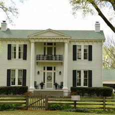
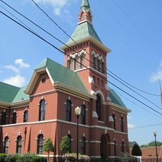
Tate County, County administration center in Senatobia, Mississippi, United States.

Tate County is an administrative division in northwestern Mississippi, with Senatobia functioning as its governmental center. The region encompasses a mix of rural communities, agricultural lands, and smaller towns spread across the area.

The county was established in 1873, named after Thomas Simpson Tate, an early settler of the area. Its administrative structure developed over time to serve the needs of the farming communities within its bounds.

Northwest Community College in Senatobia educates over seven thousand students annually, making it a central educational institution for the region.

Visitors can access county buildings in Senatobia to view public records and speak with local officials. Weekday business hours are the best time for administrative matters.

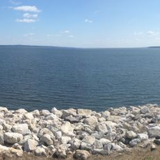
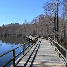
Arkabutla Lake sits along the eastern edge and is an artificial lake originally created for flood control purposes. Today it serves residents and visitors as a place for fishing and outdoor recreation.

The community of curious travelers

AroundUs brings together thousands of curated places, local tips, and hidden gems, enriched daily by 60,000 contributors worldwide.

Start exploring
Location
Inception
1873
Capital city
Senatobia
Shares border with
DeSoto County, Panola County, Marshall County, Lafayette County, Tunica County
GPS coordinates
34.65000,-89.94000
Latest update
December 7, 2025 19:25
Around this place
Graceland
United States of America

Graceland

44.8 km
Chucalissa Indian Village
United States of America

Chucalissa Indian Village

49.1 km
Sardis Lake
United States of America

Sardis Lake

29.9 km
Arkabutla Lake
United States of America

Arkabutla Lake

20.8 km
T. O. Fuller State Park
United States of America

T. O. Fuller State Park

49.1 km
Wall Doxey State Park
United States of America

Wall Doxey State Park

43.4 km
Magnolia Grove Monastery
United States of America

Magnolia Grove Monastery

32.7 km
Walter Place
United States of America

Walter Place

46.3 km
BankPlus Amphitheater at Snowden Grove
United States of America

BankPlus Amphitheater at Snowden Grove

33.5 km
Tunica Museum
United States of America

Tunica Museum

40.1 km
Batesville Mounds
United States of America

Batesville Mounds

33.7 km
John M. Fleming Home Place
United States of America

John M. Fleming Home Place

45.1 km
Germantown Redoubt
United States of America

Germantown Redoubt

49 km
Dunvegan
United States of America

Dunvegan

46.6 km
Holy Innocents' Episcopal Church
United States of America

Holy Innocents' Episcopal Church

15.1 km
Taylor-Falls House
United States of America

Taylor-Falls House

15.2 km
Southwest Holly Springs Historic District
United States of America

Southwest Holly Springs Historic District

46.5 km
Civil War Earthworks at Tallahatchie Crossing
United States of America

Civil War Earthworks at Tallahatchie Crossing

42.7 km
Tate County Courthouse
United States of America

Tate County Courthouse

4.4 km
Myers-Hicks Place
United States of America

Myers-Hicks Place

30.5 km
Felix LaBauve House
United States of America

Felix LaBauve House

19.4 km
Downtown Senatobia Historic District
United States of America

Downtown Senatobia Historic District

4.2 km
Lee House
United States of America

Lee House

37.6 km
Cotton Warehouse Classic Cars
United States of America

Cotton Warehouse Classic Cars

38.2 km
Como Commercial Historic District
United States of America

Como Commercial Historic District

15.5 km
Batesville Historic District
United States of America

Batesville Historic District

37.2 km
Wall Doxey State Park Historic District
United States of America

Wall Doxey State Park Historic District

43.9 km
Byhalia Historic District
United States of America

Byhalia Historic District

33.4 km
Show the full map
Administrative divisions
« Tate County - County administration center in Senatobia, Mississippi, United States » is provided by Around Us (aroundus.com). Images and texts are derived from Wikimedia project under a Creative Commons license. You are allowed to copy, distribute, and modify copies of this page, under the conditions set by the license, as long as this note is clearly visible.

Discover hidden gems everywhere you go!

From secret cafés to breathtaking viewpoints, skip the crowded tourist spots and find places that match your style. Our app makes it easy with voice search, smart filtering, route optimization, and insider tips from travelers worldwide. Download now for the complete mobile experience.

Around Us App Screenshot

A unique approach to discovering new places

Le Figaro

All the places worth exploring

France Info

A tailor-made excursion in just a few clicks

20 Minutes

Around Us
Travel Guide & Maps
Download

Send to your phone

QR Code
1

Open the camera app on your mobile.

2

Point at the QR code with your camera. A notification will appear.

3

Tap the notification to open the link.