Bullitt County

Log in to your account

AroundUs is a community-driven map of interesting places, built by curious explorers like you. It grows with every review, story, and photo you share.
Connect to save your favorite spots, contribute locations, and create personalized routes.
By continuing, you accept our Terms and Conditions and our Privacy Policy
Add to collection
Map
Suggest a change
Share

Bullitt County, County administrative division in Kentucky, United States.

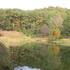
Bullitt County is an administrative area in north central Kentucky that combines developed neighborhoods with natural open spaces. The region includes multiple communities and transitions from more urban areas to rural farmland.

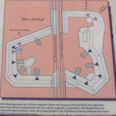
The county was established in 1796 and named after Alexander Scott Bullitt, the first Lieutenant Governor of Kentucky. Its creation reflected the westward expansion of settlement in the region during that era.

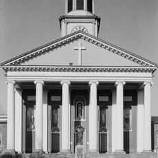
The county maintains strong local traditions through seasonal festivals, agricultural fairs, and community gatherings that bring residents together throughout the year.

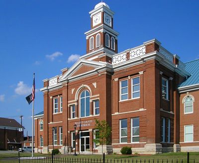
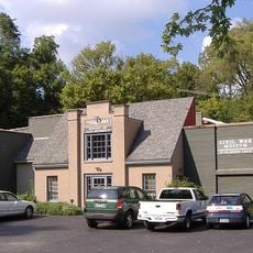
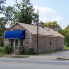
Shepherdsville serves as the county seat and main hub for administrative services and local government offices. Visitors can easily locate resources and information by contacting local facilities in this central location.

A significant portion of the county's western section is occupied by Fort Knox, the major military installation that houses the United States' gold reserves. This military presence shapes the landscape and access to parts of the area.

Location: Kentucky

Inception: December 13, 1796

Capital city: Shepherdsville

Shares border with: Jefferson County, Hardin County, Nelson County, Spencer County

Website: http://bullittcounty.ky.gov

GPS coordinates: 37.97000,-85.70000

Latest update: December 7, 2025 09:27

Photos
Around this place
Show the full map
Louisville Male High School
United States of America

Louisville Male High School

24 km
T3
United States of America

T3

25.3 km
Kentucky Flyer
United States of America

Kentucky Flyer

25.3 km
Basilica of St. Joseph Proto-Cathedral
United States of America

Basilica of St. Joseph Proto-Cathedral

26.7 km
Fort Duffield
United States of America

Fort Duffield

21.4 km
Civil War Museum
United States of America

Civil War Museum

27.4 km
Little Loomhouse
United States of America

Little Loomhouse

21.8 km
Rooster Run
United States of America

Rooster Run

16.1 km
Riverside, The Farnsley-Moremen Landing
United States of America

Riverside, The Farnsley-Moremen Landing

22.4 km
Wickland
United States of America

Wickland

27.9 km
Bardstown Historic District
United States of America

Bardstown Historic District

27.1 km
The Gauntlet
United States of America

The Gauntlet

25.3 km
Ben Johnson House
United States of America

Ben Johnson House

26.3 km
Knobs State Forest
United States of America

Knobs State Forest

10.1 km
Oscar Getz Museum of Whiskey History
United States of America

Oscar Getz Museum of Whiskey History

26.8 km
Cobblestone Path
United States of America

Cobblestone Path

27.4 km
Bardstown Historical Museum
United States of America

Bardstown Historical Museum

26.8 km
Confederate Monument of Bardstown
United States of America

Confederate Monument of Bardstown

26.5 km
James M. Lloyd House
United States of America

James M. Lloyd House

16.5 km
Fort DeWolf
United States of America

Fort DeWolf

2.2 km
Bank of the Commonwealth
United States of America

Bank of the Commonwealth

2.4 km
Pennsylvania Run Presbyterian Church
United States of America

Pennsylvania Run Presbyterian Church

18.5 km
Henry J. Barnes House
United States of America

Henry J. Barnes House

16.4 km
South Louisville Reformed Church
United States of America

South Louisville Reformed Church

24.2 km
Riverside, the Farnsley-Moremen Landing
United States of America

Riverside, the Farnsley-Moremen Landing

22.3 km
Levin Bates House
United States of America

Levin Bates House

21.8 km
Solomon Neill Brooks House
United States of America

Solomon Neill Brooks House

9.4 km
Waybur Theatre
United States of America

Waybur Theatre

23.7 km
Show the full map
Reviews

Visited this place? Tap the stars to rate it and share your experience / photos with the community! Try now! You can cancel it anytime.

« Bullitt County - County administrative division in Kentucky, United States » is provided by Around Us (aroundus.com). Images and texts are derived from Wikimedia project under a Creative Commons license. You are allowed to copy, distribute, and modify copies of this page, under the conditions set by the license, as long as this note is clearly visible.

Discover hidden gems everywhere you go!

From secret cafés to breathtaking viewpoints, skip the crowded tourist spots and find places that match your style. Our app makes it easy with voice search, smart filtering, route optimization, and insider tips from travelers worldwide. Download now for the complete mobile experience.

Around Us App Screenshot

A unique approach to discovering new places

Le Figaro

All the places worth exploring

France Info

A tailor-made excursion in just a few clicks

20 Minutes