·

Enable Location

We need your location to show you interesting places around you

Discover nearby places

Find interesting locations and hidden gems around you

Precise directions

Get accurate directions and distances to places

Your location is never shared with other users. It's only used when you tap the location button.

Warren County

Log in to your account

Start exploring — it's free

Trusted by 62,690 travelers worldwide

Continue with Google
Continue with Apple
or

We will send you a code to connect

By continuing, you accept our Terms and Conditions and our Privacy Policy

Check your inbox

We've sent a pincode in your inbox. Please enter the code below.

Warren County, Administrative county in western Indiana, United States

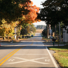
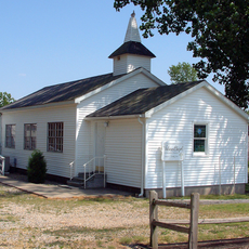
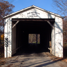
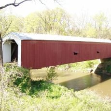
Warren County is an administrative county in western Indiana located between the Wabash River and the Illinois border. The landscape consists mainly of agricultural land, natural preserves, and rural communities.

The county was established in 1827 as Indiana's 55th administrative division. Williamsport became its administrative center just a couple of years later.

Farming shapes daily life and community traditions throughout the county. Visitors notice agricultural activities woven into the landscape and local practices.

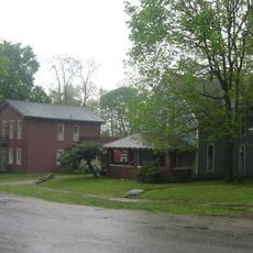
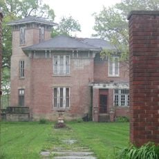
The county is sparsely populated and traveling between attractions requires a personal vehicle. The county seat of Williamsport offers the main services and facilities for visitors.

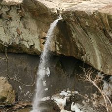
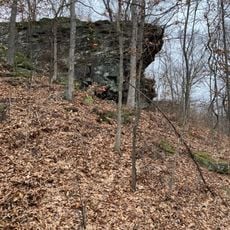
Williamsport Falls in the county seat is Indiana's highest free-falling waterfall. Water cascades over limestone formations, creating a surprising natural feature in this otherwise flat rural landscape.

The community of curious travelers

AroundUs brings together thousands of curated places, local tips, and hidden gems, enriched daily by 60,000 contributors worldwide.

Start exploring
Location
Inception
January 19, 1827
Capital city
Williamsport
Shares border with
Benton County, Tippecanoe County, Fountain County, Vermillion County, Vermilion County
GPS coordinates
40.35000,-87.36000
Latest update
December 7, 2025 19:26
Around this place
Williamsport Falls
United States of America

Williamsport Falls

9.1 km
Portland Arch Nature Preserve
United States of America

Portland Arch Nature Preserve

14.8 km
Glen Hall, Indiana
United States of America

Glen Hall, Indiana

27.1 km
Danville National Cemetery
United States of America

Danville National Cemetery

31.1 km
Oxford Presbyterian Church
United States of America

Oxford Presbyterian Church

21 km
Farmers Institute
United States of America

Farmers Institute

31.4 km
Fountain County Courthouse
United States of America

Fountain County Courthouse

24 km
Carnegie Library of Covington
United States of America

Carnegie Library of Covington

23.5 km
Williamsport-Washington Township Public Library
United States of America

Williamsport-Washington Township Public Library

8.8 km
Warren County Courthouse
United States of America

Warren County Courthouse

8.9 km
Attica Downtown Historic District
United States of America

Attica Downtown Historic District

11.2 km
David S. Heath House
United States of America

David S. Heath House

21 km
Attica Main Street Historic District
United States of America

Attica Main Street Historic District

11.6 km
Williams Chapel
United States of America

Williams Chapel

17.3 km
Marshall M. Milford House
United States of America

Marshall M. Milford House

11.7 km
Fountain County Clerk's Building
United States of America

Fountain County Clerk's Building

23.7 km
Brady Street Historic District
United States of America

Brady Street Historic District

11.5 km
West Lebanon-Pike Township Public Library
United States of America

West Lebanon-Pike Township Public Library

8.9 km
Covington Courthouse Square Historic District
United States of America

Covington Courthouse Square Historic District

23.9 km
Van Reed Farmstead
United States of America

Van Reed Farmstead

4.9 km
Covington Residential Historic District
United States of America

Covington Residential Historic District

23.6 km
William C.B. Sewell House
United States of America

William C.B. Sewell House

23.8 km
Kent and Hitchens Houses
United States of America

Kent and Hitchens Houses

9.7 km
Andrew Brier House
United States of America

Andrew Brier House

1.4 km
Old East Historic District
United States of America

Old East Historic District

11.5 km
Rob Roy Covered Bridge
United States of America

Rob Roy Covered Bridge

15.3 km
Cades Mill Bridge
United States of America

Cades Mill Bridge

32.1 km
Black Rock Barrens Nature Preserve
United States of America

Black Rock Barrens Nature Preserve

22.1 km
Show the full map
Administrative divisions
« Warren County - Administrative county in western Indiana, United States » is provided by Around Us (aroundus.com). Images and texts are derived from Wikimedia project under a Creative Commons license. You are allowed to copy, distribute, and modify copies of this page, under the conditions set by the license, as long as this note is clearly visible.

Discover hidden gems everywhere you go!

From secret cafés to breathtaking viewpoints, skip the crowded tourist spots and find places that match your style. Our app makes it easy with voice search, smart filtering, route optimization, and insider tips from travelers worldwide. Download now for the complete mobile experience.

Around Us App Screenshot

A unique approach to discovering new places

Le Figaro

All the places worth exploring

France Info

A tailor-made excursion in just a few clicks

20 Minutes

Around Us
Travel Guide & Maps
Download

Send to your phone

QR Code
1

Open the camera app on your mobile.

2

Point at the QR code with your camera. A notification will appear.

3

Tap the notification to open the link.