·

Enable Location

We need your location to show you interesting places around you

Discover nearby places

Find interesting locations and hidden gems around you

Precise directions

Get accurate directions and distances to places

Your location is never shared with other users. It's only used when you tap the location button.

Glen Hall, Indiana

Log in to your account

Start exploring — it's free

Trusted by 62,690 travelers worldwide

Continue with Google
Continue with Apple
or

We will send you a code to connect

By continuing, you accept our Terms and Conditions and our Privacy Policy

Check your inbox

We've sent a pincode in your inbox. Please enter the code below.

Glen Hall, Indiana

Glen Hall, Indiana, Former settlement in Tippecanoe County, Indiana, United States.

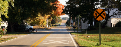
Glen Hall is a former settlement in Tippecanoe County, located in the northern part of Indiana near the community of West Point. The site sits at about 190 meters elevation in a rural area shaped by the pattern of small Midwestern communities.

A post office was established in 1866 and served the settlement as an important communication center until it closed in 1904. This span of operation shows how the place functioned as a local hub during that era.

The settlement represents the development patterns of small communities in Indiana, reflecting the lifestyle of early Midwestern settlers.

The location sits in the Eastern Time Zone in a rural area of northern Indiana accessible by car. Visitors should know this is a former settlement with minimal physical structures or facilities remaining at the site.

The unincorporated status of Glen Hall results in the absence of municipal governance, making it dependent on Tippecanoe County administration.

The community of curious travelers

AroundUs brings together thousands of curated places, local tips, and hidden gems, enriched daily by 60,000 contributors worldwide.

Start exploring
Elevation above the sea
190 m
GPS coordinates
40.35417,-87.04083
Latest update
December 14, 2025 11:01
Around this place
Ross–Ade Stadium
United States of America

Ross–Ade Stadium

13.7 km
Fort Ouiatenon
United States of America

Fort Ouiatenon

8.7 km
Samara
United States of America

Samara

14.1 km
Elliott Hall of Music
United States of America

Elliott Hall of Music

13.5 km
Purdue Memorial Union
United States of America

Purdue Memorial Union

13.5 km
Engineering Fountain
United States of America

Engineering Fountain

13.6 km
Tippecanoe County Courthouse
United States of America

Tippecanoe County Courthouse

14.4 km
Slayter Center of Performing Arts
United States of America

Slayter Center of Performing Arts

13.2 km
Purdue University Horticulture Gardens
United States of America

Purdue University Horticulture Gardens

13.2 km
Temple Israel
United States of America

Temple Israel

14.7 km
Judge Cyrus Ball House
United States of America

Judge Cyrus Ball House

14.7 km
Downtown Lafayette Historic District
United States of America

Downtown Lafayette Historic District

14.5 km
Former Alpha Tau Omega Fraternity House
United States of America

Former Alpha Tau Omega Fraternity House

13.2 km
LaFayette Fountain
United States of America

LaFayette Fountain

14.4 km
Long Center for the Performing Arts
United States of America

Long Center for the Performing Arts

14.6 km
Farmers Institute
United States of America

Farmers Institute

5.5 km
Jesse Andrew House
United States of America

Jesse Andrew House

13.6 km
The Varsity
United States of America

The Varsity

13.6 km
Morton School
United States of America

Morton School

13.9 km
Hills and Dales Historic District
United States of America

Hills and Dales Historic District

14.1 km
Trinity United Methodist Church
United States of America

Trinity United Methodist Church

14.7 km
Highland Park Neighborhood Historic District
United States of America

Highland Park Neighborhood Historic District

14.1 km
Falley Home
United States of America

Falley Home

14.4 km
Ellsworth Historic District
United States of America

Ellsworth Historic District

14.6 km
Stidham United Methodist Church
United States of America

Stidham United Methodist Church

8.8 km
Chauncey-Stadium Avenues Historic District
United States of America

Chauncey-Stadium Avenues Historic District

14.3 km
Indian Trail Road–Belle River Bridge
United States of America

Indian Trail Road–Belle River Bridge

9.8 km
Harwood Tree Improvement and Regeneration Center
United States of America

Harwood Tree Improvement and Regeneration Center

13.2 km
Show the full map
« Glen Hall, Indiana - Former settlement in Tippecanoe County, Indiana, United States » is provided by Around Us (aroundus.com). Images and texts are derived from Wikimedia project under a Creative Commons license. You are allowed to copy, distribute, and modify copies of this page, under the conditions set by the license, as long as this note is clearly visible.

Discover hidden gems everywhere you go!

From secret cafés to breathtaking viewpoints, skip the crowded tourist spots and find places that match your style. Our app makes it easy with voice search, smart filtering, route optimization, and insider tips from travelers worldwide. Download now for the complete mobile experience.

Around Us App Screenshot

A unique approach to discovering new places

Le Figaro

All the places worth exploring

France Info

A tailor-made excursion in just a few clicks

20 Minutes

Around Us
Travel Guide & Maps
Download

Send to your phone

QR Code
1

Open the camera app on your mobile.

2

Point at the QR code with your camera. A notification will appear.

3

Tap the notification to open the link.