Starke County

Log in to your account

AroundUs is a community-driven map of interesting places, built by curious explorers like you. It grows with every review, story, and photo you share.
Connect to save your favorite spots, contribute locations, and create personalized routes.
By continuing, you accept our Terms and Conditions and our Privacy Policy
Add to collection
Map
Suggest a change
Share

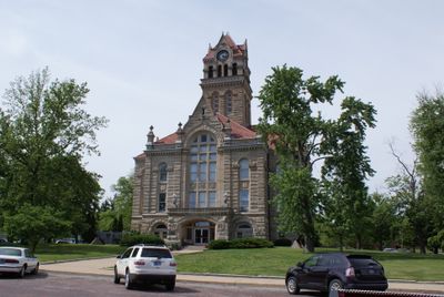
Starke County, Administrative county in Indiana, United States.
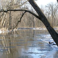
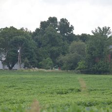
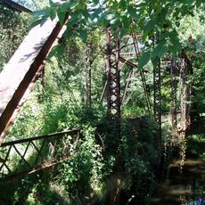
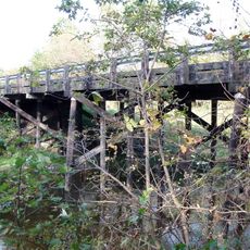
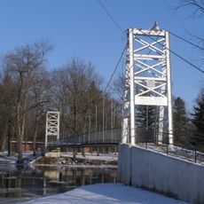
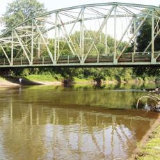
The Kankakee River forms the northwestern boundary of Starke County, which spans across 312 square miles of rolling hills and agricultural lands.

General John Stark, who led New Hampshire troops at the Battle of Bunker Hill in 1775, inspired the naming of Starke County in 1835.

The Potawatomi Native American nation inhabited the region before their forced removal in 1838 through a relocation process that led to many deaths.

The county maintains a network of major transportation routes, including U.S. Routes 30, 35, and 421, along with several state roads connecting communities.

Residents north of the Kankakee River petitioned to join LaPorte County in 1842 due to geographical isolation from the rest of Starke County.

Location: Indiana

Inception: 1850

Capital city: Knox

Shares border with: LaPorte County, Pulaski County, St. Joseph County, Porter County, Jasper County, Marshall County, Fulton County

Website: http://co.starke.in.us

GPS coordinates: 41.28000,-86.65000

Latest update: March 4, 2025 19:27

Around this place
Show the full map
Tippecanoe River State Park
United States of America

Tippecanoe River State Park

18.4 km
Marion Ridgeway Polygonal Barn
United States of America

Marion Ridgeway Polygonal Barn

34.8 km
Pinhook Methodist Church and Cemetery
United States of America

Pinhook Methodist Church and Cemetery

36 km
Chief Menominee Memorial Site
United States of America

Chief Menominee Memorial Site

24.2 km
Plymouth Downtown Historic District
United States of America

Plymouth Downtown Historic District

29.3 km
Starke County Courthouse
United States of America

Starke County Courthouse

3.1 km
Everel S. Smith House
United States of America

Everel S. Smith House

35.9 km
Marshall County Courthouse
United States of America

Marshall County Courthouse

29.2 km
Collier Lodge Site
United States of America

Collier Lodge Site

35.3 km
Tepicon Hall
United States of America

Tepicon Hall

15.3 km
Hoham-Klinghammer-Weckerle House and Brewery Site
United States of America

Hoham-Klinghammer-Weckerle House and Brewery Site

27.6 km
East Shore Historic District
United States of America

East Shore Historic District

23.3 km
Dr. George W. Thompson House
United States of America

Dr. George W. Thompson House

25.5 km
Pulaski County Courthouse
United States of America

Pulaski County Courthouse

25.8 km
Starke County Bridge No. 39
United States of America

Starke County Bridge No. 39

3.2 km
Monterey Bandstand
United States of America

Monterey Bandstand

19.5 km
Plymouth Northside Historic District
United States of America

Plymouth Northside Historic District

29.2 km
Pulaski County Home
United States of America

Pulaski County Home

26.2 km
Norris Farm-Maxinkuckee Orchard
United States of America

Norris Farm-Maxinkuckee Orchard

25.3 km
Plymouth Southside Historic District
United States of America

Plymouth Southside Historic District

29.2 km
Forest Place Historic District
United States of America

Forest Place Historic District

20.6 km
Woodbank
United States of America

Woodbank

23.7 km
LaPorte County Historical Society Museum
United States of America

LaPorte County Historical Society Museum

34.6 km
Hoosier Valley Railroad Museum
United States of America

Hoosier Valley Railroad Museum

12.3 km
Dog Face Bridge
United States of America

Dog Face Bridge

22.1 km
Starke County Bridge 700E
United States of America

Starke County Bridge 700E

7.4 km
Memorial Bridge
United States of America

Memorial Bridge

25.7 km
Kankakee River IN 49 Bridge
United States of America

Kankakee River IN 49 Bridge

32.2 km
Show the full map

Reviews

Visited this place? Tap the stars to rate it and share your experience / photos with the community! Try now! You can cancel it anytime.

Administrative divisions
« Starke County - Administrative county in Indiana, United States » is provided by Around Us (aroundus.com). Images and texts are derived from Wikimedia project under a Creative Commons license. You are allowed to copy, distribute, and modify copies of this page, under the conditions set by the license, as long as this note is clearly visible.

Discover hidden gems everywhere you go!

From secret cafés to breathtaking viewpoints, skip the crowded tourist spots and find places that match your style. Our app makes it easy with voice search, smart filtering, route optimization, and insider tips from travelers worldwide. Download now for the complete mobile experience.

Around Us App Screenshot

A unique approach to discovering new places

Le Figaro

All the places worth exploring

France Info

A tailor-made excursion in just a few clicks

20 Minutes