Enable Location

We need your location to show you interesting places around you

Discover nearby places

Find interesting locations and hidden gems around you

Precise directions

Get accurate directions and distances to places

Your location is never shared with other users. It's only used when you tap the location button.

Whitley County

Log in to your account

Start exploring — it's free

Trusted by 62,119 travelers worldwide

Continue with Google
Continue with Apple
or

We will send you a code to connect

By continuing, you accept our Terms and Conditions and our Privacy Policy

Check your inbox

We've sent a pincode in your inbox. Please enter the code below.

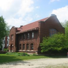
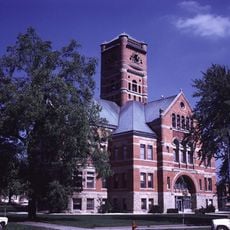
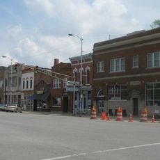
Whitley County, Administrative county in northeastern Indiana, US.

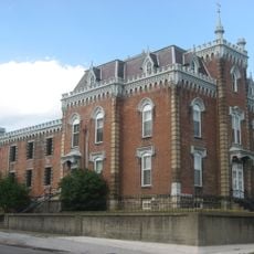
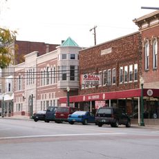
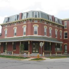
Whitley County is an administrative area in northeastern Indiana comprising multiple towns and communities spread across the region. Columbia City serves as the county seat and the primary population center.

The Indiana State Legislature established this county on February 7, 1835, creating a new administrative unit for the region. It has since served as a local governance center for surrounding communities.

The Columbia City/Whitley County Joint Planning Department maintains zoning regulations and building standards that reflect the community values and development priorities.

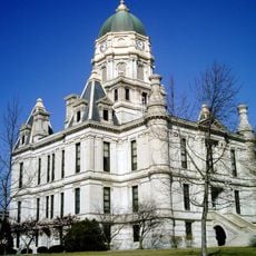
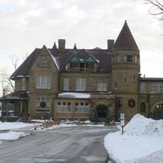
Administrative services and official records are available at the Government Center located at 220 West Van Buren Street in Columbia City. The Health Department maintains multiple locations throughout the county for public health services and food safety inspections.

The Whitley County Health Department coordinates multiple locations for community health nursing services and manages food establishment inspections throughout the territory.

The community of curious travelers

AroundUs brings together thousands of curated places, local tips, and hidden gems, enriched daily by 60,000 contributors worldwide.

Start exploring
Location
Inception
February 7, 1835
Capital city
Columbia City
Shares border with
Noble County, Allen County, Huntington County, Wabash County, Kosciusko County
GPS coordinates
41.14000,-85.50000
Latest update
December 7, 2025 20:46
Around this place
John D. Haynes House
United States of America

John D. Haynes House

27.1 km
Lindenwood Cemetery
United States of America

Lindenwood Cemetery

28.1 km
Justin Zimmer House
United States of America

Justin Zimmer House

29.1 km
Billy Sunday Historic Home
United States of America

Billy Sunday Historic Home

28.4 km
Winona Lake Historic District
United States of America

Winona Lake Historic District

28.5 km
Noble County Sheriff's House and Jail
United States of America

Noble County Sheriff's House and Jail

29.1 km
Vermilyea Inn Historic District
United States of America

Vermilyea Inn Historic District

20.8 km
Thomas R. Marshall House
United States of America

Thomas R. Marshall House

2.3 km
Pierceton Historic District
United States of America

Pierceton Historic District

18.4 km
North Manchester Covered Bridge
United States of America

North Manchester Covered Bridge

27.4 km
Whitley County Courthouse
United States of America

Whitley County Courthouse

2 km
Dr. Christopher Souder House
United States of America

Dr. Christopher Souder House

11.5 km
Columbia City Historic District
United States of America

Columbia City Historic District

2.2 km
Lentz House
United States of America

Lentz House

27.4 km
Old North Manchester Public Library
United States of America

Old North Manchester Public Library

27.7 km
Wildwood Park Historic District
United States of America

Wildwood Park Historic District

27.4 km
Albion Courthouse Square Historic District
United States of America

Albion Courthouse Square Historic District

29.3 km
Robert Orr Polygonal Barn
United States of America

Robert Orr Polygonal Barn

21.8 km
Horney Robinson House
United States of America

Horney Robinson House

26.7 km
Dixie
United States of America

Dixie

26 km
Manchester College Historic District
United States of America

Manchester College Historic District

26.3 km
Robert M. Feustel House
United States of America

Robert M. Feustel House

27 km
Noftzger-Adams House
United States of America

Noftzger-Adams House

27.4 km
Hawley Heights Historic District
United States of America

Hawley Heights Historic District

27.9 km
North Manchester Historic District
United States of America

North Manchester Historic District

27.6 km
Thomas R. Marshall School
United States of America

Thomas R. Marshall School

26.7 km
Noble County Courthouse
United States of America

Noble County Courthouse

29.2 km
John H. Bass Mansion
United States of America

John H. Bass Mansion

27.8 km
Show the full map
Administrative divisions
« Whitley County - Administrative county in northeastern Indiana, US » is provided by Around Us (aroundus.com). Images and texts are derived from Wikimedia project under a Creative Commons license. You are allowed to copy, distribute, and modify copies of this page, under the conditions set by the license, as long as this note is clearly visible.

Discover hidden gems everywhere you go!

From secret cafés to breathtaking viewpoints, skip the crowded tourist spots and find places that match your style. Our app makes it easy with voice search, smart filtering, route optimization, and insider tips from travelers worldwide. Download now for the complete mobile experience.

Around Us App Screenshot

A unique approach to discovering new places

Le Figaro

All the places worth exploring

France Info

A tailor-made excursion in just a few clicks

20 Minutes

Around Us
Travel Guide & Maps
Download

Send to your phone

QR Code
1

Open the camera app on your mobile.

2

Point at the QR code with your camera. A notification will appear.

3

Tap the notification to open the link.