McCreary County

Log in to your account

AroundUs is a community-driven map of interesting places, built by curious explorers like you. It grows with every review, story, and photo you share.
Connect to save your favorite spots, contribute locations, and create personalized routes.
Continue with Google
Continue with Apple
Continue with X
Continue with Facebook
Continue with email
By continuing, you accept our Terms and Conditions and our Privacy Policy
Create an account
Add to collection
Map
Suggest a change
Share

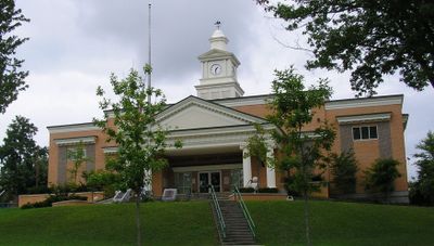
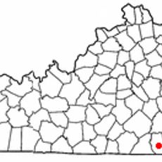
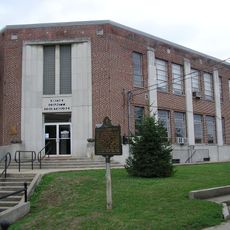
McCreary County, Administrative county in southeastern Kentucky, United States

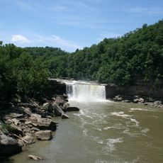
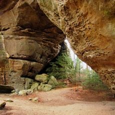
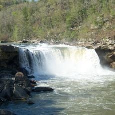
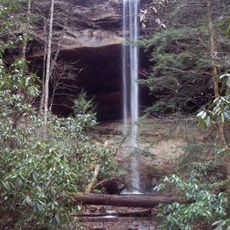
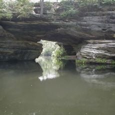
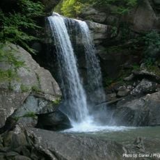
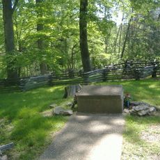
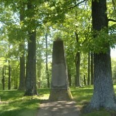
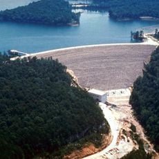
McCreary County is an administrative division in southeastern Kentucky that spreads across a forested landscape with natural stone arches and the Big South Fork National River running through it. The terrain is dominated by dense woodlands, and recreation areas follow along the river and its surrounding valleys.

The county was created in 1912 as Kentucky's last newly formed county, carved from parts of three neighboring counties. This late establishment makes it one of the state's newest administrative divisions.

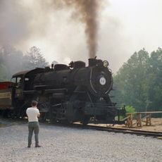
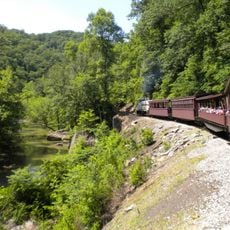
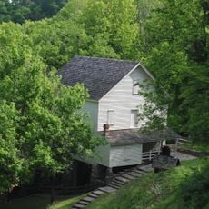
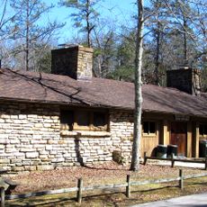
Coal mining shaped life here for generations, and you can see this heritage reflected at places like the Barthell Coal Mining Camp and Blue Heron Mining Community. Residents keep these stories alive through the communities and landmarks that mark this chapter of their past.

This area is popular for outdoor activities like hiking and boating, with trails and water access scattered throughout the forests and along the river. Visitors should know that the terrain is hilly and sturdy footwear is important for exploring.

The county has no incorporated cities within its boundaries, making county government the sole local authority throughout the entire area. This makes it an unusual case among Kentucky's administrative structure.

Location: Kentucky

Inception: March 12, 1912

Capital city: Whitley City

Shares border with: Pulaski County, Laurel County, Whitley County, Scott County, Wayne County, Campbell County

Website: http://mccrearycounty.com

GPS coordinates: 36.74000,-84.48000

Latest update: December 20, 2025 15:28

Photos
Around this place
Cumberland Falls
United States of America

Cumberland Falls

16.3 km
Big South Fork National River and Recreation Area
United States of America

Big South Fork National River and Recreation Area

34.3 km
Cumberland Falls State Resort Park
United States of America

Cumberland Falls State Resort Park

17.3 km
Tombstone Junction
United States of America

Tombstone Junction

15.2 km
Yahoo Falls
United States of America

Yahoo Falls

4.2 km
Pickett Civilian Conservation Corps Memorial State Park
United States of America

Pickett Civilian Conservation Corps Memorial State Park

35.2 km
United States of America

Dog Slaughter Falls

20 km
Big South Fork Scenic Railway
United States of America

Big South Fork Scenic Railway

4.6 km
Eagle Falls
United States of America

Eagle Falls

16.8 km
Mill Springs National Cemetery
United States of America

Mill Springs National Cemetery

43.2 km
McCreary County Museum
United States of America

McCreary County Museum

4.6 km
Mill Springs Mill
United States of America

Mill Springs Mill

34.3 km
Confederate Mass Grave Monument in Somerset
United States of America

Confederate Mass Grave Monument in Somerset

42 km
General Felix K. Zollicoffer Monument
United States of America

General Felix K. Zollicoffer Monument

42 km
Cumberland Inn Museum
United States of America

Cumberland Inn Museum

28 km
Old Wayne County High School
United States of America

Old Wayne County High School

35.3 km
Burnside Methodist Church
United States of America

Burnside Methodist Church

29.5 km
Burnside Masonic Lodge
United States of America

Burnside Masonic Lodge

29.5 km
Fairchild House
United States of America

Fairchild House

34.6 km
Lane Theater
United States of America

Lane Theater

28.4 km
Somerset Downtown Commercial District
United States of America

Somerset Downtown Commercial District

40.7 km
Stearns Administrative and Commercial District
United States of America

Stearns Administrative and Commercial District

4.6 km
Monticello Historic Commercial District
United States of America

Monticello Historic Commercial District

34.4 km
Withers House
United States of America

Withers House

40.9 km
Mill Springs Battlefield Visitor Center and Museum
United States of America

Mill Springs Battlefield Visitor Center and Museum

43.1 km
Pickett State Rustic Park Historic District
United States of America

Pickett State Rustic Park Historic District

35.6 km
Laurel River Lake
United States of America

Laurel River Lake

34 km
Pickett State Park Fire Tower
United States of America

Pickett State Park Fire Tower

37.2 km
Show the full map
Reviews

Visited this place? Tap the stars to rate it and share your experience / photos with the community! Try now! You can cancel it anytime.

« McCreary County - Administrative county in southeastern Kentucky, United States » is provided by Around Us (aroundus.com). Images and texts are derived from Wikimedia project under a Creative Commons license. You are allowed to copy, distribute, and modify copies of this page, under the conditions set by the license, as long as this note is clearly visible.

Discover hidden gems everywhere you go!

From secret cafés to breathtaking viewpoints, skip the crowded tourist spots and find places that match your style. Our app makes it easy with voice search, smart filtering, route optimization, and insider tips from travelers worldwide. Download now for the complete mobile experience.

Around Us App Screenshot

A unique approach to discovering new places

Le Figaro

All the places worth exploring

France Info

A tailor-made excursion in just a few clicks

20 Minutes