·

Enable Location

We need your location to show you interesting places around you

Discover nearby places

Find interesting locations and hidden gems around you

Precise directions

Get accurate directions and distances to places

Your location is never shared with other users. It's only used when you tap the location button.

Monroe County

Log in to your account

Start exploring — it's free

Trusted by 62,749 travelers worldwide

Continue with Google
Continue with Apple
or

We will send you a code to connect

By continuing, you accept our Terms and Conditions and our Privacy Policy

Check your inbox

We've sent a pincode in your inbox. Please enter the code below.

Monroe County, Administrative county in eastern Tennessee, US

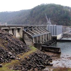
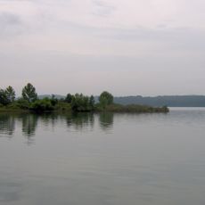
Monroe County is an administrative division in eastern Tennessee that encompasses multiple towns and natural waterways. The area includes communities like Madisonville and Sweetwater along the Little Tennessee River.

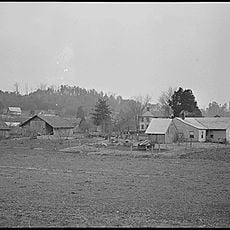
The county was established in 1819 and named after a U.S. president. It developed from areas that were previously inhabited by Cherokee nations.

Monthly County Commission meetings at the Monroe County Courthouse facilitate community discussions about infrastructure, public safety, and local development initiatives.

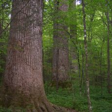
The area is shaped by mountains and rivers that influence travel through the landscape. Visitors should prepare for varying weather and hilly terrain when exploring.

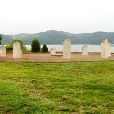
The Unicoi Mountains mark the southeastern border with North Carolina, while Bald River Falls flows within the Cherokee National Forest boundaries.

The community of curious travelers

AroundUs brings together thousands of curated places, local tips, and hidden gems, enriched daily by 60,000 contributors worldwide.

Start exploring
Location
Inception
November 13, 1819
Capital city
Madisonville
Shares border with
Loudon County, Blount County, Graham County, Cherokee County, Polk County, McMinn County
GPS coordinates
35.45000,-84.25000
Latest update
December 20, 2025 12:42
Around this place
Craighead Caverns
United States of America

Craighead Caverns

19 km
Fort Loudoun
United States of America

Fort Loudoun

16.8 km
Joyce Kilmer Memorial Forest
United States of America

Joyce Kilmer Memorial Forest

26.3 km
Chota
United States of America

Chota

15.9 km
Tellico Blockhouse
United States of America

Tellico Blockhouse

17.2 km
United States of America

Chilhowee

24.8 km
Joyce Kilmer-Slickrock Wilderness
United States of America

Joyce Kilmer-Slickrock Wilderness

26.3 km
Calderwood Dam
United States of America

Calderwood Dam

25 km
Morganton, Tennessee
United States of America

Morganton, Tennessee

21.6 km
Chilhowee Dam
United States of America

Chilhowee Dam

21 km
Citico Creek Wilderness
United States of America

Citico Creek Wilderness

18.9 km
Tomotley
United States of America

Tomotley

14.6 km
Icehouse Bottom
United States of America

Icehouse Bottom

16.5 km
United States of America

Bald River Gorge Wilderness

17.4 km
Calderwood
United States of America

Calderwood

24.4 km
United States of America

Hiwassee/Ocoee Scenic River State Park

33.9 km
United States of America

Gee Creek Wilderness

31.5 km
United States of America

Snowbird Mountain Lodge

28.3 km
Tapoco Lodge Historic District
United States of America

Tapoco Lodge Historic District

28.3 km
United States of America

Fort Loudoun State Park

16.3 km
Craigs Chapel AME Zion Church
United States of America

Craigs Chapel AME Zion Church

23.3 km
United States of America

First Presbyterian Church

25.7 km
Monroe County Courthouse
United States of America

Monroe County Courthouse

12.8 km
Sequoyah Birthplace Museum
United States of America

Sequoyah Birthplace Museum

14.7 km
John M. Rorex House
United States of America

John M. Rorex House

26.7 km
Look Rock Observation Tower
United States of America

Look Rock Observation Tower

34.4 km
John McCroskey House
United States of America

John McCroskey House

20.1 km
United States of America

White Cliff

19.7 km
Show the full map
Administrative divisions
« Monroe County - Administrative county in eastern Tennessee, US » is provided by Around Us (aroundus.com). Images and texts are derived from Wikimedia project under a Creative Commons license. You are allowed to copy, distribute, and modify copies of this page, under the conditions set by the license, as long as this note is clearly visible.

Discover hidden gems everywhere you go!

From secret cafés to breathtaking viewpoints, skip the crowded tourist spots and find places that match your style. Our app makes it easy with voice search, smart filtering, route optimization, and insider tips from travelers worldwide. Download now for the complete mobile experience.

Around Us App Screenshot

A unique approach to discovering new places

Le Figaro

All the places worth exploring

France Info

A tailor-made excursion in just a few clicks

20 Minutes

Around Us
Travel Guide & Maps
Download

Send to your phone

QR Code
1

Open the camera app on your mobile.

2

Point at the QR code with your camera. A notification will appear.

3

Tap the notification to open the link.