·

Enable Location

We need your location to show you interesting places around you

Discover nearby places

Find interesting locations and hidden gems around you

Precise directions

Get accurate directions and distances to places

Your location is never shared with other users. It's only used when you tap the location button.

Log in to your account

Start exploring — it's free

Trusted by 62,751 travelers worldwide

Continue with Google
Continue with Apple
or

We will send you a code to connect

By continuing, you accept our Terms and Conditions and our Privacy Policy

Check your inbox

We've sent a pincode in your inbox. Please enter the code below.

Chilhowee

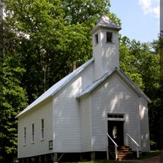
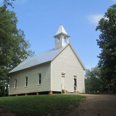
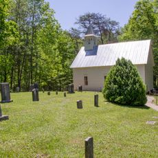
Chilhowee, Archaeological site in Blount and Monroe Counties, Tennessee, United States.

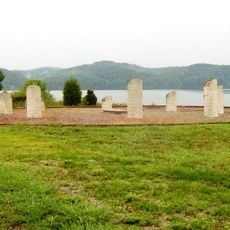
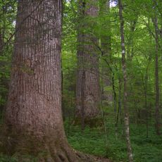
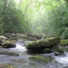
Chilhowee was a large settlement area along the Little Tennessee River with remains from many different time periods. The site spreads across several miles and shows traces of houses, work areas, and burial grounds left by successive groups.

People settled here in ancient times and continued living in this valley for many centuries as different cultures arrived and stayed. In the 1500s a Spanish explorer named Juan Pardo reached this place and met the Creek people who were living there.

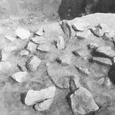
This place served as a meeting point where different peoples lived and traded over many centuries. The pottery and tools found here show how communities exchanged goods and ideas with one another.

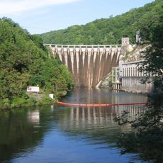
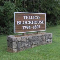
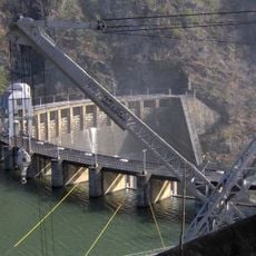
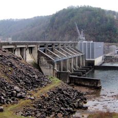
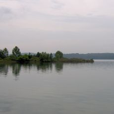
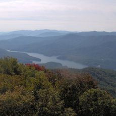
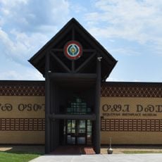
The original site is now covered by Chilhowee Lake, which was created when a dam was built in the 1950s. Visitors can still learn about the archaeology by visiting nearby museums that display finds from the excavations.

Two Cherokee legends about this place were recorded, including a story about a demon-like figure and warrior battles. These stories were collected by a researcher and keep alive the memory of what this place meant spiritually to the people who lived here.

The community of curious travelers

AroundUs brings together thousands of curated places, local tips, and hidden gems, enriched daily by 60,000 contributors worldwide.

Start exploring
Location
GPS coordinates
35.55230,-84.00740
Latest update
December 9, 2025 18:49
Around this place
Cheoah Dam
United States of America

Cheoah Dam

13.3 km
Fort Loudoun
United States of America

Fort Loudoun

18.4 km
Joyce Kilmer Memorial Forest
United States of America

Joyce Kilmer Memorial Forest

20.1 km
Chota
United States of America

Chota

11.2 km
Abrams Falls Trail
United States of America

Abrams Falls Trail

14.9 km
Gregory Bald
United States of America

Gregory Bald

13.3 km
Tellico Blockhouse
United States of America

Tellico Blockhouse

18.5 km
Joyce Kilmer-Slickrock Wilderness
United States of America

Joyce Kilmer-Slickrock Wilderness

20.1 km
Calderwood Dam
United States of America

Calderwood Dam

7.1 km
Chilhowee Dam
United States of America

Chilhowee Dam

4 km
Citico Creek Wilderness
United States of America

Citico Creek Wilderness

16.9 km
Tomotley
United States of America

Tomotley

16.3 km
Icehouse Bottom
United States of America

Icehouse Bottom

17.9 km
Calderwood
United States of America

Calderwood

6.2 km
Shuckstack
United States of America

Shuckstack

19 km
Clover Hill Mill
United States of America

Clover Hill Mill

17.3 km
Deals Gap Motorcycle Resort
United States of America

Deals Gap Motorcycle Resort

12.5 km
Tapoco Lodge Historic District
United States of America

Tapoco Lodge Historic District

13.8 km
United States of America

Fort Loudoun State Park

19.1 km
Sandy Springs Park
United States of America

Sandy Springs Park

21.1 km
Craigs Chapel AME Zion Church
United States of America

Craigs Chapel AME Zion Church

18.5 km
Sequoyah Birthplace Museum
United States of America

Sequoyah Birthplace Museum

19.1 km
John M. Rorex House
United States of America

John M. Rorex House

14.7 km
Cades Cove Missionary Baptist Church
United States of America

Cades Cove Missionary Baptist Church

17.5 km
Look Rock Observation Tower
United States of America

Look Rock Observation Tower

10.7 km
Cades Cove Methodist Church
United States of America

Cades Cove Methodist Church

18.3 km
Cades Cove Primitive Baptist Church
United States of America

Cades Cove Primitive Baptist Church

18.4 km
Cades Cove Visitor Center
United States of America

Cades Cove Visitor Center

15.3 km
Show the full map
« Chilhowee - Archaeological site in Blount and Monroe Counties, Tennessee, United States » is provided by Around Us (aroundus.com). Images and texts are derived from Wikimedia project under a Creative Commons license. You are allowed to copy, distribute, and modify copies of this page, under the conditions set by the license, as long as this note is clearly visible.

Discover hidden gems everywhere you go!

From secret cafés to breathtaking viewpoints, skip the crowded tourist spots and find places that match your style. Our app makes it easy with voice search, smart filtering, route optimization, and insider tips from travelers worldwide. Download now for the complete mobile experience.

Around Us App Screenshot

A unique approach to discovering new places

Le Figaro

All the places worth exploring

France Info

A tailor-made excursion in just a few clicks

20 Minutes

Around Us
Travel Guide & Maps
Download

Send to your phone

QR Code
1

Open the camera app on your mobile.

2

Point at the QR code with your camera. A notification will appear.

3

Tap the notification to open the link.