Enable Location

We need your location to show you interesting places around you

Discover nearby places

Find interesting locations and hidden gems around you

Precise directions

Get accurate directions and distances to places

Your location is never shared with other users. It's only used when you tap the location button.

Log in to your account

Start exploring — it's free

Trusted by 68,085 travelers worldwide

Continue with Google
Continue with Apple
or

We will send you a code to connect

By continuing, you accept our Terms and Conditions and our Privacy Policy

Check your inbox

We've sent a pincode in your inbox. Please enter the code below.

Discussion Reviews Photo
17.5k Popularity

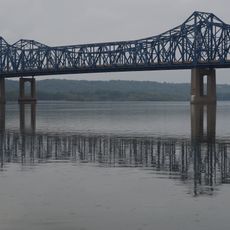
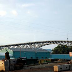
East Peoria, city on the Illinois River in Tazewell County, Illinois, USA

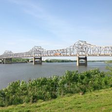
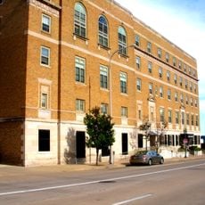
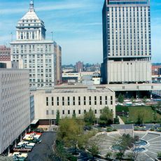
East Peoria is a city in Tazewell County, Illinois, sitting directly east of the Illinois River and facing downtown Peoria. The city mixes older residential streets with newer commercial areas, and its riverfront Levee District concentrates shops, restaurants, and hotels in one walkable zone.

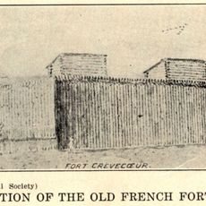
East Peoria grew around brick yards that used the local clay and shale deposits found along the river. In the early 20th century, the Caterpillar factory settled here and turned the city into a production center for tracked machinery and farm equipment.

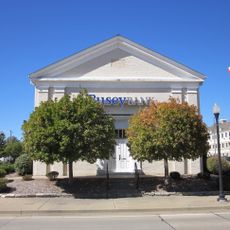
The name East Peoria simply points to where the city sits, east of the Illinois River and across from Peoria. The Levee District, once an industrial zone along the riverfront, is now a gathering spot where locals and visitors share meals, shop, and attend outdoor events.

The CityLink bus network connects East Peoria's neighborhoods and links the city to nearby towns, making it a practical option for getting around without a car. The Levee District along the river is easy to walk and works well as a starting point for exploring the area.

The Festival of Lights, held each winter, features illuminated floats and displays across the city, and its official symbol is a small wooden figure called FOLEPI. Few visitors realize that the name FOLEPI is simply an acronym formed from the first letters of the festival's full name.

The community of curious travelers

AroundUs brings together thousands of curated places, local tips, and hidden gems, enriched daily by 60,000 contributors worldwide.

Start exploring
Location
Elevation above the sea
149 m
GPS coordinates
40.66670,-89.53330
Latest update
March 3, 2026 10:14
Around this place
Peoria Civic Center
United States of America

Peoria Civic Center

5.9 km
Fort Crevecoeur
United States of America

Fort Crevecoeur

6.5 km
Peoria Zoo
United States of America

Peoria Zoo

6.4 km
Peoria Riverfront Museum
United States of America

Peoria Riverfront Museum

5.4 km
Murray Baker Bridge
United States of America

Murray Baker Bridge

4.8 km
McClugage Bridge
United States of America

McClugage Bridge

6 km
Madison Theatre
United States of America

Madison Theatre

5.8 km
Hotel Père Marquette
United States of America

Hotel Père Marquette

5.8 km
Bob Michel Bridge
United States of America

Bob Michel Bridge

5.3 km
Cedar Street Bridge
United States of America

Cedar Street Bridge

5.8 km
Scottish Rite Cathedral
United States of America

Scottish Rite Cathedral

5.9 km
Peoria City Hall
United States of America

Peoria City Hall

5.8 km
John C. Flanagan House Museum
United States of America

John C. Flanagan House Museum

6 km
Farm Creek Section
United States of America

Farm Creek Section

3.8 km
Peoria Federal Building and U.S. Courthouse
United States of America

Peoria Federal Building and U.S. Courthouse

5.8 km
Peoria Cordage Company
United States of America

Peoria Cordage Company

6.2 km
Peoria Waterworks
United States of America

Peoria Waterworks

6.7 km
Central National Bank Building
United States of America

Central National Bank Building

5.5 km
Peace and Harvest
United States of America

Peace and Harvest

5.7 km
Grand Army of the Republic Memorial Hall
United States of America

Grand Army of the Republic Memorial Hall

5.7 km
YWCA Building
United States of America

YWCA Building

5.6 km
Cumberland Presbyterian Church
United States of America

Cumberland Presbyterian Church

6 km
Downtown Peoria Historic District
United States of America

Downtown Peoria Historic District

5.6 km
The Peoria PlayHouse
United States of America

The Peoria PlayHouse

6.3 km
Marquette Apartments
United States of America

Marquette Apartments

6.1 km
Fon du Lac Farm Park
United States of America

Fon du Lac Farm Park

574 m
North Side Historic District
United States of America

North Side Historic District

5.6 km
Judge Jacob Gale House
United States of America

Judge Jacob Gale House

5.5 km
Show the full map
Reviews
Share your experience

No review yet

Discussions
Start a discussion...

No discussion yet

« East Peoria - city on the Illinois River in Tazewell County, Illinois, USA » is provided by Around Us (aroundus.com). Images and texts are derived from Wikimedia project under a Creative Commons license. You are allowed to copy, distribute, and modify copies of this page, under the conditions set by the license, as long as this note is clearly visible.

Discover hidden gems everywhere you go!

From secret cafés to breathtaking viewpoints, skip the crowded tourist spots and find places that match your style. Our app makes it easy with voice search, smart filtering, route optimization, and insider tips from travelers worldwide. Download now for the complete mobile experience.

Around Us App Screenshot

A unique approach to discovering new places

Le Figaro

All the places worth exploring

France Info

A tailor-made excursion in just a few clicks

20 Minutes

Around Us
Travel Guide & Maps
Download

Send to your phone

QR Code
1

Open the camera app on your mobile.

2

Point at the QR code with your camera. A notification will appear.

3

Tap the notification to open the link.