Enable Location

We need your location to show you interesting places around you

Discover nearby places

Find interesting locations and hidden gems around you

Precise directions

Get accurate directions and distances to places

Your location is never shared with other users. It's only used when you tap the location button.

Tazewell County

Log in to your account

Start exploring — it's free

Trusted by 62,172 travelers worldwide

Continue with Google
Continue with Apple
or

We will send you a code to connect

By continuing, you accept our Terms and Conditions and our Privacy Policy

Check your inbox

We've sent a pincode in your inbox. Please enter the code below.

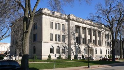
Tazewell County, County administrative division in central Illinois, US.

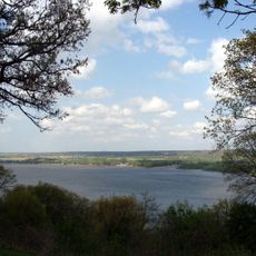
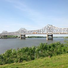
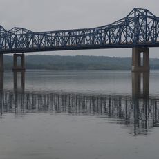
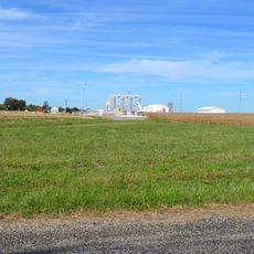
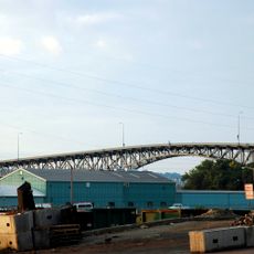
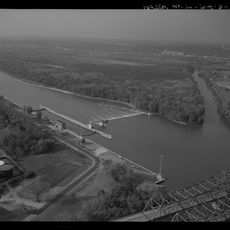
Tazewell County is an administrative division in central Illinois with a mixed landscape of farmland, small towns, and suburban areas. The terrain ranges from flat to gently rolling, with the Illinois River running through the eastern portion.

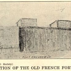
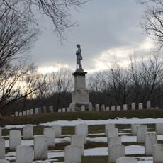
The county was established in 1827 and named after Littleton Tazewell, a prominent political figure of that era. Agricultural settlement and development became the driving force shaping the region over the following decades.

The county has a strong sense of community rooted in agricultural traditions and small-town connections. Residents gather regularly for local events and farmers' markets that reflect the region's farming heritage.

Interstate highways 74 and 155 cross through the county, providing quick access to larger cities in the region. Most attractions and services are spread out, so having a car is essential for getting around.

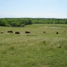
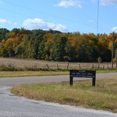
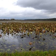
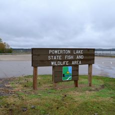
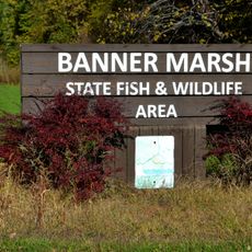
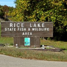
The area contains wildlife refuges with designated zones for waterfowl hunting and fish management that operate under specific conservation guidelines. These spaces represent ongoing efforts to balance recreation with environmental stewardship in the region.

The community of curious travelers

AroundUs brings together thousands of curated places, local tips, and hidden gems, enriched daily by 60,000 contributors worldwide.

Start exploring
Location
Inception
January 31, 1827
Capital city
Pekin
Shares border with
Peoria County, Woodford County, McLean County, Logan County, Mason County, Fulton County
GPS coordinates
40.51000,-89.51000
Latest update
December 7, 2025 10:06
Around this place
Peoria State Hospital
United States of America

Peoria State Hospital

19.2 km
Peoria Civic Center
United States of America

Peoria Civic Center

21.5 km
Fort Crevecoeur
United States of America

Fort Crevecoeur

17.5 km
Grandview Drive
United States of America

Grandview Drive

25.5 km
Wildlife Prairie Park
United States of America

Wildlife Prairie Park

32 km
Peoria Zoo
United States of America

Peoria Zoo

23.5 km
Peoria Riverfront Museum
United States of America

Peoria Riverfront Museum

21.1 km
Murray Baker Bridge
United States of America

Murray Baker Bridge

20.7 km
McClugage Bridge
United States of America

McClugage Bridge

23.6 km
Springdale Cemetery
United States of America

Springdale Cemetery

24.2 km
Sand Ridge State Forest
United States of America

Sand Ridge State Forest

32.1 km
Madison Theatre
United States of America

Madison Theatre

21.6 km
Hotel Père Marquette
United States of America

Hotel Père Marquette

21.6 km
Glasford crater
United States of America

Glasford crater

25.2 km
Spring Lake State Fish and Wildlife Area
United States of America

Spring Lake State Fish and Wildlife Area

28.8 km
Bob Michel Bridge
United States of America

Bob Michel Bridge

20.6 km
Powerton Lake State Fish and Wildlife Area
United States of America

Powerton Lake State Fish and Wildlife Area

17 km
Banner Marsh State Fish and Wildlife Area
United States of America

Banner Marsh State Fish and Wildlife Area

28.2 km
Cedar Street Bridge
United States of America

Cedar Street Bridge

20.2 km
Rice Lake State Fish and Wildlife Area
United States of America

Rice Lake State Fish and Wildlife Area

35.4 km
Scottish Rite Cathedral
United States of America

Scottish Rite Cathedral

22 km
Peoria City Hall
United States of America

Peoria City Hall

21.5 km
Pettingill-Morron House
United States of America

Pettingill-Morron House

22.3 km
John C. Flanagan House Museum
United States of America

John C. Flanagan House Museum

22.5 km
John T. McNaughton Bridge
United States of America

John T. McNaughton Bridge

14.6 km
George L. Luthy Memorial Botanical Garden
United States of America

George L. Luthy Memorial Botanical Garden

23.9 km
West Bluff Historic District
United States of America

West Bluff Historic District

22.2 km
Peoria Lock and Dam
United States of America

Peoria Lock and Dam

16.7 km
Show the full map
« Tazewell County - County administrative division in central Illinois, US » is provided by Around Us (aroundus.com). Images and texts are derived from Wikimedia project under a Creative Commons license. You are allowed to copy, distribute, and modify copies of this page, under the conditions set by the license, as long as this note is clearly visible.

Discover hidden gems everywhere you go!

From secret cafés to breathtaking viewpoints, skip the crowded tourist spots and find places that match your style. Our app makes it easy with voice search, smart filtering, route optimization, and insider tips from travelers worldwide. Download now for the complete mobile experience.

Around Us App Screenshot

A unique approach to discovering new places

Le Figaro

All the places worth exploring

France Info

A tailor-made excursion in just a few clicks

20 Minutes

Around Us
Travel Guide & Maps
Download

Send to your phone

QR Code
1

Open the camera app on your mobile.

2

Point at the QR code with your camera. A notification will appear.

3

Tap the notification to open the link.