Montgomery County

Log in to your account

AroundUs is a community-driven map of interesting places, built by curious explorers like you. It grows with every review, story, and photo you share.
Connect to save your favorite spots, contribute locations, and create personalized routes.
By continuing, you accept our Terms and Conditions and our Privacy Policy
Add to collection
Map
Suggest a change
Share

Montgomery County, Administrative county in Piedmont region, North Carolina, United States.

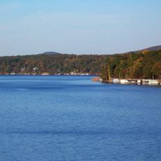
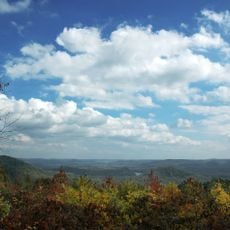
Montgomery County is a county in central North Carolina covering approximately 491 square miles of terrain. The landscape includes rolling areas, with the Uwharrie National Forest making up a substantial portion of the land.

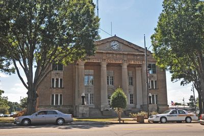
The area was established as a county in 1779 when it separated from Anson County, taking the name of Richard Montgomery, a general in the American Revolutionary War. This formation reflected the region's growing settlement and administrative organization during that period.

The community in this area has deep roots in agriculture and timber work, which continue to shape how people spend their time and what matters to them locally.

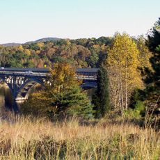
Interstate 73/74 and several highways pass through and connect this area to surrounding regions. The railroad network supports freight movement and helps connect communities within the broader region.

Near the town of Mount Gilead sits one of the country's largest lumber milling operations, a major employer that shapes local economic life. This facility represents decades of timber industry presence that continues to define the area.

Location: North Carolina

Inception: 1779

Capital city: Troy

Shares border with: Randolph County, Moore County, Richmond County, Anson County, Stanly County, Rowan County, Davidson County

Website: http://montgomery-county.com

GPS coordinates: 35.33000,-79.90000

Latest update: December 7, 2025 10:08

Around this place
Show the full map
North Carolina Zoo
United States of America

North Carolina Zoo

35.5 km
Interstate 73
United States of America

Interstate 73

29.1 km
Lake Tillery
United States of America

Lake Tillery

20.4 km
Badin Lake
United States of America

Badin Lake

20.1 km
Town Creek Indian Mound
United States of America

Town Creek Indian Mound

16.6 km
Pisgah Covered Bridge
United States of America

Pisgah Covered Bridge

23.6 km
Tuckertown Reservoir
United States of America

Tuckertown Reservoir

31.7 km
Birkhead Mountains Wilderness
United States of America

Birkhead Mountains Wilderness

30.4 km
Hardaway Site
United States of America

Hardaway Site

21.5 km
Pee Dee National Wildlife Refuge
United States of America

Pee Dee National Wildlife Refuge

30.6 km
James B. Garrison Bridge
United States of America

James B. Garrison Bridge

16.5 km
Narrows Dam and Power Plant Complex
United States of America

Narrows Dam and Power Plant Complex

20.1 km
Downtown Albemarle Historic District
United States of America

Downtown Albemarle Historic District

27.3 km
Five Points Historic District
United States of America

Five Points Historic District

26.9 km
Alfred Dockery House
United States of America

Alfred Dockery House

36.4 km
Isaiah Wilson Snugs House
United States of America

Isaiah Wilson Snugs House

27 km
Montgomery County Courthouse
United States of America

Montgomery County Courthouse

3.2 km
Thomas Marcellus Denning House
United States of America

Thomas Marcellus Denning House

27.2 km
Pee Dee Avenue Historic District
United States of America

Pee Dee Avenue Historic District

26.2 km
Randle House
United States of America

Randle House

20 km
James Bryant House
United States of America

James Bryant House

32.3 km
Liberty Hill School
United States of America

Liberty Hill School

21.6 km
Albemarle Opera House
United States of America

Albemarle Opera House

27.2 km
Mount Gilead Downtown Historic District
United States of America

Mount Gilead Downtown Historic District

15.8 km
Second Street Historic District
United States of America

Second Street Historic District

27.2 km
Town Creek Indian Mound State Historic Site
United States of America

Town Creek Indian Mound State Historic Site

16.7 km
Morrow Mountain State Park
United States of America

Morrow Mountain State Park

18.1 km
North Carolina Pottery Center
United States of America

North Carolina Pottery Center

26.2 km
Show the full map

Reviews

Visited this place? Tap the stars to rate it and share your experience / photos with the community! Try now! You can cancel it anytime.

Administrative divisions
« Montgomery County - Administrative county in Piedmont region, North Carolina, United States » is provided by Around Us (aroundus.com). Images and texts are derived from Wikimedia project under a Creative Commons license. You are allowed to copy, distribute, and modify copies of this page, under the conditions set by the license, as long as this note is clearly visible.

Discover hidden gems everywhere you go!

From secret cafés to breathtaking viewpoints, skip the crowded tourist spots and find places that match your style. Our app makes it easy with voice search, smart filtering, route optimization, and insider tips from travelers worldwide. Download now for the complete mobile experience.

Around Us App Screenshot

A unique approach to discovering new places

Le Figaro

All the places worth exploring

France Info

A tailor-made excursion in just a few clicks

20 Minutes