Enable Location

We need your location to show you interesting places around you

Discover nearby places

Find interesting locations and hidden gems around you

Precise directions

Get accurate directions and distances to places

Your location is never shared with other users. It's only used when you tap the location button.

Wood County

Log in to your account

Start exploring — it's free

Trusted by 62,937 travelers worldwide

Continue with Google
Continue with Apple
or

We will send you a code to connect

By continuing, you accept our Terms and Conditions and our Privacy Policy

Check your inbox

We've sent a pincode in your inbox. Please enter the code below.

Discussion Reviews 1 Photos
16.4k Popularity

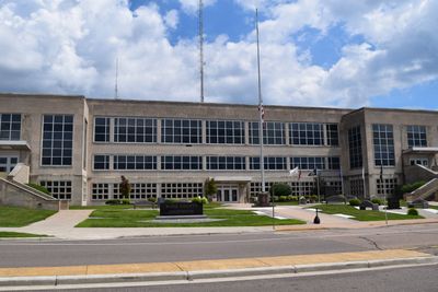
Wood County, Administrative county in central Wisconsin, United States.

Wood County is an administrative division in central Wisconsin that includes multiple towns and cities serving as regional hubs. The area encompasses both urban centers and surrounding communities that together form the county's social and economic landscape.

The county was established by the Wisconsin legislature in the mid-1800s during a period of regional growth and settlement expansion. Since then, it has served as the organizational framework for managing local affairs across central Wisconsin.

The county maintains multiple public libraries, including Marshfield Public Library and McMillian Memorial Library, providing educational resources to local communities.

Visitors can find administrative offices and services located in the county's main cities where various government services are available. Planning ahead to identify which office handles your specific need will save time when visiting.

The Wood County Sheriff's Department Investigative Division employs six full-time investigators who handle criminal cases under specialized Lieutenant supervision.

The community of curious travelers

AroundUs brings together thousands of curated places, local tips, and hidden gems, enriched daily by 60,000 contributors worldwide.

Start exploring
Location
Inception
1856
Capital city
Wisconsin Rapids
Shares border with
Marathon County, Portage County, Adams County, Juneau County, Jackson County, Clark County
GPS coordinates
44.45000,-90.04000
Latest update
December 7, 2025 19:27
Around this place
Petenwell Lake
United States of America

Petenwell Lake

35.5 km
Clark County Jail
United States of America

Clark County Jail

45.6 km
Necedah National Wildlife Refuge
United States of America

Necedah National Wildlife Refuge

38.5 km
World's Largest Round Barn
United States of America

World's Largest Round Barn

24.9 km
Fox Theater
United States of America

Fox Theater

37.2 km
Schmeeckle Reserve
United States of America

Schmeeckle Reserve

39.1 km
United States of America

Dewey Marsh, Wisconsin

46.3 km
Wisconsin Pavilion
United States of America

Wisconsin Pavilion

44.4 km
United States of America

Upham Mansion

26.4 km
Willard D. Purdy Junior High and Vocational School
United States of America

Willard D. Purdy Junior High and Vocational School

26.2 km
Buena Vista Marsh
United States of America

Buena Vista Marsh

33.7 km
Christina Kuhl House
United States of America

Christina Kuhl House

37.6 km
Neillsville Downtown Historic District
United States of America

Neillsville Downtown Historic District

45.8 km
David McMillan House
United States of America

David McMillan House

37.7 km
Temple Beth Israel
United States of America

Temple Beth Israel

37.1 km
August G. and Theresa Green House
United States of America

August G. and Theresa Green House

37.6 km
Wahle-Laird House
United States of America

Wahle-Laird House

26 km
United States of America

Columbia Park Band Shell

26.7 km
First Church of Christ, Scientist
United States of America

First Church of Christ, Scientist

45.7 km
Pleasant Hill Residential Historic District
United States of America

Pleasant Hill Residential Historic District

25.9 km
Joseph Dessert Library
United States of America

Joseph Dessert Library

46.6 km
Karl Mathie House
United States of America

Karl Mathie House

46.8 km
Decatur and Kate Dickinson House
United States of America

Decatur and Kate Dickinson House

45.6 km
Charles Foote House
United States of America

Charles Foote House

43.3 km
Forrest D. and Marian Calway House
United States of America

Forrest D. and Marian Calway House

45.4 km
William B. and Jennie Tufts House
United States of America

William B. and Jennie Tufts House

45.5 km
Jurustic Park
United States of America

Jurustic Park

33.4 km
Old Plover Methodist Church
United States of America

Old Plover Methodist Church

39.7 km
Show the full map
Reviews
Share your experience

No review yet

Discussions
Start a discussion...

No discussion yet

Administrative divisions
« Wood County - Administrative county in central Wisconsin, United States » is provided by Around Us (aroundus.com). Images and texts are derived from Wikimedia project under a Creative Commons license. You are allowed to copy, distribute, and modify copies of this page, under the conditions set by the license, as long as this note is clearly visible.

Discover hidden gems everywhere you go!

From secret cafés to breathtaking viewpoints, skip the crowded tourist spots and find places that match your style. Our app makes it easy with voice search, smart filtering, route optimization, and insider tips from travelers worldwide. Download now for the complete mobile experience.

Around Us App Screenshot

A unique approach to discovering new places

Le Figaro

All the places worth exploring

France Info

A tailor-made excursion in just a few clicks

20 Minutes

Around Us
Travel Guide & Maps
Download

Send to your phone

QR Code
1

Open the camera app on your mobile.

2

Point at the QR code with your camera. A notification will appear.

3

Tap the notification to open the link.