Enable Location

We need your location to show you interesting places around you

Discover nearby places

Find interesting locations and hidden gems around you

Precise directions

Get accurate directions and distances to places

Your location is never shared with other users. It's only used when you tap the location button.

Necedah National Wildlife Refuge

Log in to your account

Start exploring — it's free

Trusted by 65,065 travelers worldwide

Continue with Google
Continue with Apple
or

We will send you a code to connect

By continuing, you accept our Terms and Conditions and our Privacy Policy

Check your inbox

We've sent a pincode in your inbox. Please enter the code below.

Necedah National Wildlife Refuge
Discussion Reviews 1 Photos
3.7k Popularity

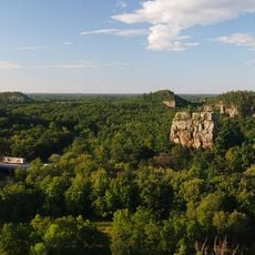
Necedah National Wildlife Refuge, Wildlife refuge in Juneau County, United States.

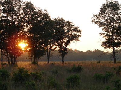
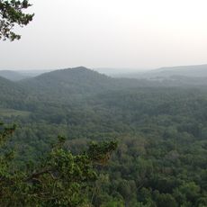
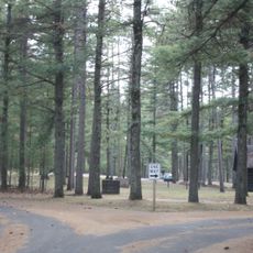
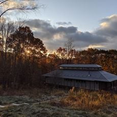
Necedah National Wildlife Refuge is a federally protected area in Juneau County, Wisconsin, made up of wetlands, oak forests, and open savanna. The refuge has several miles of trails, wildlife observation platforms, and areas set aside for seasonal hunting and photography.

The refuge was established in 1939 on land that had previously been used for farming and drainage projects. Over the following decades, it became a key site for endangered species recovery programs, especially for the whooping crane.

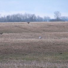
The refuge is one of the few places in Wisconsin where whooping cranes can be seen in the wild, drawing birdwatchers from across the country. In spring and fall, visitors gather at the observation areas to watch these rare birds during their stopovers.

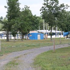
The main entrance on Headquarters Road is the best starting point for accessing the trails and observation areas. Some sections of the refuge close seasonally for hunting, so it is worth checking which areas are open before your visit.

Young whooping cranes raised at the refuge were trained to follow ultralight aircraft as a substitute for parent birds, teaching them a migration route from Wisconsin to Florida. The handlers who worked with the chicks wore crane costumes so the birds would not associate humans with their caregivers.

The community of curious travelers

AroundUs brings together thousands of curated places, local tips, and hidden gems, enriched daily by 60,000 contributors worldwide.

Start exploring
Location
Inception
1939
GPS coordinates
44.11670,-90.16670
Latest update
March 3, 2026 14:01
Around this place
Wildcat Mountain State Park
United States of America

Wildcat Mountain State Park

56.4 km
Petenwell Lake
United States of America

Petenwell Lake

15.8 km
Roche-a-Cri State Park
United States of America

Roche-a-Cri State Park

30.6 km
Buckhorn State Park
United States of America

Buckhorn State Park

23.7 km
Roche-a-Cri Petroglyphs
United States of America

Roche-a-Cri Petroglyphs

30.7 km
Black River State Forest
United States of America

Black River State Forest

45.8 km
World's Largest Round Barn
United States of America

World's Largest Round Barn

59.6 km
Wisconsin Pavilion
United States of America

Wisconsin Pavilion

58.7 km
Buena Vista Marsh
United States of America

Buena Vista Marsh

48.2 km
Benjamin Boorman House
United States of America

Benjamin Boorman House

36.2 km
Monroe County Courthouse
United States of America

Monroe County Courthouse

55.1 km
Juneau County Courthouse
United States of America

Juneau County Courthouse

36.4 km
Black River Falls Public Library
United States of America

Black River Falls Public Library

58.2 km
Sparta Free Library
United States of America

Sparta Free Library

55.1 km
Sotekizan Korinzenji
United States of America

Sotekizan Korinzenji

55.6 km
Black Hawk Powwow Grounds
United States of America

Black Hawk Powwow Grounds

51.7 km
Tomah Public Library
United States of America

Tomah Public Library

31 km
Adams County Courthouse
United States of America

Adams County Courthouse

32.5 km
William G. and Anne Williams House
United States of America

William G. and Anne Williams House

54.7 km
St. John's Episcopal Church
United States of America

St. John's Episcopal Church

54.9 km
Sparta Masonic Temple
United States of America

Sparta Masonic Temple

55.1 km
Charles Foote House
United States of America

Charles Foote House

58 km
Herman M. and Hanna Hediger House
United States of America

Herman M. and Hanna Hediger House

59.5 km
Witches Gulch
United States of America

Witches Gulch

57.4 km
Cranberry Discovery Center
United States of America

Cranberry Discovery Center

26.7 km
Mill Bluff State Park
United States of America

Mill Bluff State Park

22.4 km
FAST Fiberglass Mold Graveyard
United States of America

FAST Fiberglass Mold Graveyard

51.9 km
Wegner Grotto
United States of America

Wegner Grotto

56.4 km
Show the full map
Reviews
Share your experience

No review yet

Discussions
Start a discussion...

No discussion yet

« Necedah National Wildlife Refuge - Wildlife refuge in Juneau County, United States » is provided by Around Us (aroundus.com). Images and texts are derived from Wikimedia project under a Creative Commons license. You are allowed to copy, distribute, and modify copies of this page, under the conditions set by the license, as long as this note is clearly visible.

Discover hidden gems everywhere you go!

From secret cafés to breathtaking viewpoints, skip the crowded tourist spots and find places that match your style. Our app makes it easy with voice search, smart filtering, route optimization, and insider tips from travelers worldwide. Download now for the complete mobile experience.

Around Us App Screenshot

A unique approach to discovering new places

Le Figaro

All the places worth exploring

France Info

A tailor-made excursion in just a few clicks

20 Minutes

Around Us
Travel Guide & Maps
Download

Send to your phone

QR Code
1

Open the camera app on your mobile.

2

Point at the QR code with your camera. A notification will appear.

3

Tap the notification to open the link.