Enable Location

We need your location to show you interesting places around you

Discover nearby places

Find interesting locations and hidden gems around you

Precise directions

Get accurate directions and distances to places

Your location is never shared with other users. It's only used when you tap the location button.

Braxton County

Log in to your account

Start exploring — it's free

Trusted by 61,444 travelers worldwide

Continue with Google
Continue with Apple
or

We will send you a code to connect

By continuing, you accept our Terms and Conditions and our Privacy Policy

Check your inbox

We've sent a pincode in your inbox. Please enter the code below.

Braxton County, County in central West Virginia, United States

Description

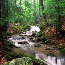
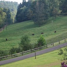
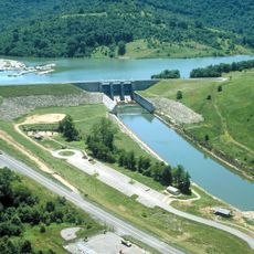
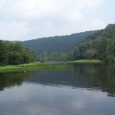
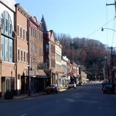
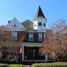
Braxton County is an administrative division in central West Virginia that spans hilly terrain covered with forests and crossed by waterways. Sutton Lake and the Elk River shape the landscape, with small towns scattered throughout the forested hills.

History

The county was established in 1836 from portions of neighboring Lewis, Kanawha, and Nicholas counties. It was named after Carter Braxton, a signer of the Declaration of Independence.

Culture

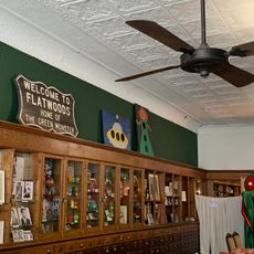
The Flatwoods Monster Museum in Sutton displays exhibits about the 1952 sighting when residents reported an unexplained creature in the area. The place has become a gathering point for visitors curious about local stories and unexplained events.

Practical

The area is connected to Charleston and Morgantown via Interstate 79, with US Route 19 providing access through different communities. Since it is a rural county, having a car helps explore the scattered towns and natural areas.

Did you know?

Five large monster chairs are placed throughout the county at locations tied to the 1952 Flatwoods Monster sighting. These colorful landmarks serve as popular photo stops for visitors interested in local folklore and paranormal history.

Location
Inception
January 15, 1836
Capital city
Sutton
Shares border with
Lewis County, Nicholas County, Clay County, Webster County, Gilmer County, Calhoun County
GPS coordinates
38.70000,-80.73000
Latest update
December 7, 2025 19:26

AroundUs brings together thousands of curated places, local tips, and hidden gems, enriched daily by 60,000 contributors worldwide. Discover all places nearby (West Virginia).

Around this place
Holly River State Park
United States of America

Holly River State Park

35.2 km
West Virginia State Wildlife Center
United States of America

West Virginia State Wildlife Center

40.2 km
Burnsville Lake
United States of America

Burnsville Lake

18.4 km
Cedar Creek State Park
United States of America

Cedar Creek State Park

23.3 km
Camp Caesar
United States of America

Camp Caesar

35.9 km
Weston Colored School
United States of America

Weston Colored School

44.3 km
Walkersville Covered Bridge
United States of America

Walkersville Covered Bridge

29.3 km
Cunningham House and Outbuildings
United States of America

Cunningham House and Outbuildings

17.9 km
Weston Downtown Historic District
United States of America

Weston Downtown Historic District

43.8 km
Morton House
United States of America

Morton House

37.5 km
Duck Run Cable Suspension Bridge
United States of America

Duck Run Cable Suspension Bridge

25.9 km
Old Clay County Courthouse
United States of America

Old Clay County Courthouse

40.7 km
William Edgar Haymond House
United States of America

William Edgar Haymond House

4.4 km
Jonathan M. Bennett House
United States of America

Jonathan M. Bennett House

43.9 km
Mollohan Mill
United States of America

Mollohan Mill

22.5 km
Little Kanawha Valley Bank
United States of America

Little Kanawha Valley Bank

27.6 km
Weston Downtown Residential Historic District
United States of America

Weston Downtown Residential Historic District

44.6 km
Burnsville Bridge
United States of America

Burnsville Bridge

18.4 km
Glenville Truss Bridge
United States of America

Glenville Truss Bridge

27.6 km
John E. Arbuckle House
United States of America

John E. Arbuckle House

27.7 km
Sutton Downtown Historic District
United States of America

Sutton Downtown Historic District

4.4 km
Gilmer County Poor Farm Infirmary
United States of America

Gilmer County Poor Farm Infirmary

29.2 km
Stouts Mill Bridge
United States of America

Stouts Mill Bridge

21.9 km
French Creek Presbyterian Church
United States of America

French Creek Presbyterian Church

42.5 km
Whiting House
United States of America

Whiting House

27.5 km
Flatwoods Monster Museum
United States of America

Flatwoods Monster Museum

4.3 km
Museum of American Glass in West Virginia
United States of America

Museum of American Glass in West Virginia

44.1 km
New Deal Resources in Holly River State Park Historic District
United States of America

New Deal Resources in Holly River State Park Historic District

32.3 km
Show the full map
« Braxton County - County in central West Virginia, United States » is provided by Around Us (aroundus.com). Images and texts are derived from Wikimedia project under a Creative Commons license. You are allowed to copy, distribute, and modify copies of this page, under the conditions set by the license, as long as this note is clearly visible.

Discover hidden gems everywhere you go!

From secret cafés to breathtaking viewpoints, skip the crowded tourist spots and find places that match your style. Our app makes it easy with voice search, smart filtering, route optimization, and insider tips from travelers worldwide. Download now for the complete mobile experience.

Around Us App Screenshot

A unique approach to discovering new places

Le Figaro

All the places worth exploring

France Info

A tailor-made excursion in just a few clicks

20 Minutes

Around Us
Travel Guide & Maps
Download

Send to your phone

QR Code
1

Open the camera app on your mobile.

2

Point at the QR code with your camera. A notification will appear.

3

Tap the notification to open the link.