Enable Location

We need your location to show you interesting places around you

Discover nearby places

Find interesting locations and hidden gems around you

Precise directions

Get accurate directions and distances to places

Your location is never shared with other users. It's only used when you tap the location button.

Camp Caesar

Log in to your account

Start exploring — it's free

Trusted by 62,519 travelers worldwide

Continue with Google
Continue with Apple
or

We will send you a code to connect

By continuing, you accept our Terms and Conditions and our Privacy Policy

Check your inbox

We've sent a pincode in your inbox. Please enter the code below.

Camp Caesar, Youth summer camp in Webster County, United States

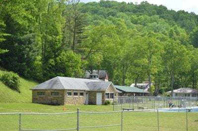
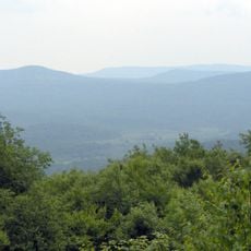
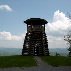
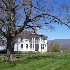
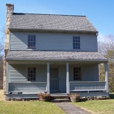
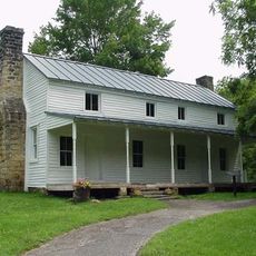
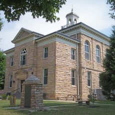
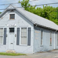
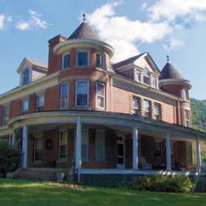
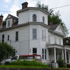
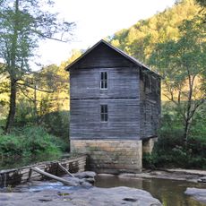
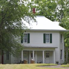
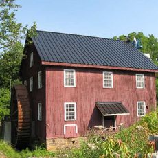
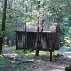
Camp Caesar is a youth facility spanning 188 acres with 41 historic buildings and structures, including an octagonal assembly hall, dining buildings, and stone cottages situated along the Gauley River. The property includes accommodation buildings, a swimming pool with poolhouse, stone pathways, and retaining walls throughout the grounds.

The camp was founded in 1922 by the Farm Bureau and county extension agent Julius A. Wolfram. During the 1940s, extensive development and improvements were made through federal Works Progress Administration projects.

The facility continues to function as a learning center where young people gain skills in conservation and outdoor recreation. Visitors can see how the buildings and grounds remain active spaces for group activities and skill-building throughout the year.

The grounds are best explored by following the network of pathways that connect the various building clusters throughout the property. Keep in mind this is an active facility, so access may be restricted depending on ongoing programs and activities.

The camp displays a rare blend of Bungalow and Craftsman architectural styles mixed with Modern Movement elements. This combination of building approaches developed across different phases of construction and modernization over the decades.

The community of curious travelers

AroundUs brings together thousands of curated places, local tips, and hidden gems, enriched daily by 60,000 contributors worldwide.

Start exploring
Location
GPS coordinates
38.40920,-80.55170
Latest update
December 14, 2025 17:03
Around this place
Summersville Lake
United States of America

Summersville Lake

36.1 km
Holly River State Park
United States of America

Holly River State Park

34.7 km
Greenbrier River Trail
United States of America

Greenbrier River Trail

45.1 km
Cranberry Wilderness
United States of America

Cranberry Wilderness

24.2 km
Droop Mountain Battlefield State Park
United States of America

Droop Mountain Battlefield State Park

41.3 km
Pearl S. Buck Birthplace
United States of America

Pearl S. Buck Birthplace

42.5 km
Carnifex Ferry Battlefield State Park
United States of America

Carnifex Ferry Battlefield State Park

40.5 km
Helvetia Village Historic District
United States of America

Helvetia Village Historic District

44.8 km
Cunningham House and Outbuildings
United States of America

Cunningham House and Outbuildings

42.7 km
Nicholas County Courthouse
United States of America

Nicholas County Courthouse

30.8 km
Pocahontas Times Print Shop
United States of America

Pocahontas Times Print Shop

45 km
Sunshine Farm and Gardens
United States of America

Sunshine Farm and Gardens

39.9 km
Morton House
United States of America

Morton House

14.5 km
Pocahontas County Opera House
United States of America

Pocahontas County Opera House

45 km
William Edgar Haymond House
United States of America

William Edgar Haymond House

31.5 km
Mollohan Mill
United States of America

Mollohan Mill

31.1 km
Frank and Anna Hunter House
United States of America

Frank and Anna Hunter House

44.6 km
Nicholas County Bank
United States of America

Nicholas County Bank

29.8 km
Sutton Downtown Historic District
United States of America

Sutton Downtown Historic District

31.5 km
Pocahontas County Courthouse and Jail
United States of America

Pocahontas County Courthouse and Jail

45.7 km
McNeel Mill
United States of America

McNeel Mill

42.8 km
United States of America

Pleasant Green Methodist Episcopal Church

43.4 km
Downtown Richwood Historic District
United States of America

Downtown Richwood Historic District

20.6 km
IOOF Lodge Building
United States of America

IOOF Lodge Building

45 km
Droop Mountain Battlefield State Park
United States of America

Droop Mountain Battlefield State Park

41.1 km
Flatwoods Monster Museum
United States of America

Flatwoods Monster Museum

31.6 km
Locust Creek Covered Bridge
United States of America

Locust Creek Covered Bridge

45.2 km
New Deal Resources in Holly River State Park Historic District
United States of America

New Deal Resources in Holly River State Park Historic District

33.1 km
Show the full map
« Camp Caesar - Youth summer camp in Webster County, United States » is provided by Around Us (aroundus.com). Images and texts are derived from Wikimedia project under a Creative Commons license. You are allowed to copy, distribute, and modify copies of this page, under the conditions set by the license, as long as this note is clearly visible.

Discover hidden gems everywhere you go!

From secret cafés to breathtaking viewpoints, skip the crowded tourist spots and find places that match your style. Our app makes it easy with voice search, smart filtering, route optimization, and insider tips from travelers worldwide. Download now for the complete mobile experience.

Around Us App Screenshot

A unique approach to discovering new places

Le Figaro

All the places worth exploring

France Info

A tailor-made excursion in just a few clicks

20 Minutes

Around Us
Travel Guide & Maps
Download

Send to your phone

QR Code
1

Open the camera app on your mobile.

2

Point at the QR code with your camera. A notification will appear.

3

Tap the notification to open the link.