Enable Location

We need your location to show you interesting places around you

Discover nearby places

Find interesting locations and hidden gems around you

Precise directions

Get accurate directions and distances to places

Your location is never shared with other users. It's only used when you tap the location button.

Summersville Lake

Log in to your account

Start exploring — it's free

Trusted by 62,519 travelers worldwide

Continue with Google
Continue with Apple
or

We will send you a code to connect

By continuing, you accept our Terms and Conditions and our Privacy Policy

Check your inbox

We've sent a pincode in your inbox. Please enter the code below.

Summersville Lake

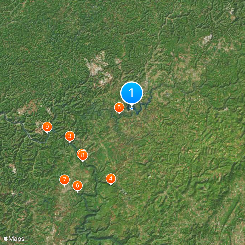
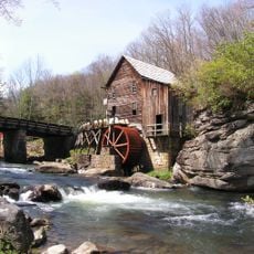
Summersville Lake, Recreational reservoir in Nicholas County, West Virginia.

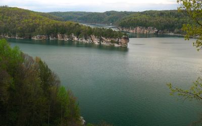
Summersville Lake is a reservoir in Nicholas County in central West Virginia that spreads across densely forested hills and covers roughly 1,093 hectares. The water reaches a maximum depth of nearly 100 meters (327 feet) and the winding shoreline runs for about 97 kilometers (60 miles) with numerous coves and rocky sections.

The dam was built in the mid-1960s by the United States Army Corps of Engineers to control flooding along the Gauley River. President Lyndon B. Johnson formally dedicated the facility in 1966 and turned the river valley into one of the largest lakes in the state.

Divers and climbers gave this body of water the nickname Little Bahamas of the East because of how clear the water runs compared to other freshwater sites. Rock faces along the shore draw climbers from neighboring states while families swim and boat near the shallower southern end.

The northern section offers access to climbing rocks, trails and campsites that see the most activity during warmer months. Water activities focus on the southern portion where boat launches and swimming areas sit closer to the main dam.

A sunken boat sits deliberately on the lakebed and serves as an artificial reef for divers who train in these inland waters. Visibility underwater can reach 15 meters (50 feet) or more on calm days, which is rare for an Appalachian reservoir.

The community of curious travelers

AroundUs brings together thousands of curated places, local tips, and hidden gems, enriched daily by 60,000 contributors worldwide.

Start exploring
Location
GPS coordinates
38.22310,-80.89060
Latest update
December 20, 2025 14:49
Around this place
New River Gorge Bridge
United States of America

New River Gorge Bridge

24 km
Hawks Nest State Park
United States of America

Hawks Nest State Park

23.6 km
Babcock State Park
United States of America

Babcock State Park

26.5 km
Carnifex Ferry Battlefield State Park
United States of America

Carnifex Ferry Battlefield State Park

4.5 km
Ace Adventure Resort
United States of America

Ace Adventure Resort

33.3 km
Oak Hill High School
United States of America

Oak Hill High School

34.3 km
Tunney Hunsaker Bridge
United States of America

Tunney Hunsaker Bridge

24 km
Glen Ferris Inn
United States of America

Glen Ferris Inn

29.5 km
Page-Vawter House
United States of America

Page-Vawter House

20.8 km
Old Main
United States of America

Old Main

7 km
Camp Washington-Carver Complex
United States of America

Camp Washington-Carver Complex

24.7 km
Altamont Hotel
United States of America

Altamont Hotel

26.5 km
Deitz Farm
United States of America

Deitz Farm

39.9 km
Nicholas County Courthouse
United States of America

Nicholas County Courthouse

5.6 km
Contentment
United States of America

Contentment

21 km
Old Clay County Courthouse
United States of America

Old Clay County Courthouse

31.3 km
E. B. Hawkins House
United States of America

E. B. Hawkins House

26.4 km
Fayetteville Historic District
United States of America

Fayetteville Historic District

26.9 km
Fayette County Courthouse
United States of America

Fayette County Courthouse

26.5 km
Nicholas County Bank
United States of America

Nicholas County Bank

7.3 km
Downtown Richwood Historic District
United States of America

Downtown Richwood Historic District

31.2 km
Dr. John Hughart House
United States of America

Dr. John Hughart House

28.1 km
Earl M. Vickers Bridge
United States of America

Earl M. Vickers Bridge

37.6 km
Glade Creek Grist Mill
United States of America

Glade Creek Grist Mill

27.6 km
Fayette Station Road
United States of America

Fayette Station Road

23.9 km
Kay Moor
United States of America

Kay Moor

24.8 km
Nuttall Coal Mine Conveyor
United States of America

Nuttall Coal Mine Conveyor

23.2 km
Thurmond Historic District
United States of America

Thurmond Historic District

33.8 km
Show the full map
« Summersville Lake - Recreational reservoir in Nicholas County, West Virginia » is provided by Around Us (aroundus.com). Images and texts are derived from Wikimedia project under a Creative Commons license. You are allowed to copy, distribute, and modify copies of this page, under the conditions set by the license, as long as this note is clearly visible.

Discover hidden gems everywhere you go!

From secret cafés to breathtaking viewpoints, skip the crowded tourist spots and find places that match your style. Our app makes it easy with voice search, smart filtering, route optimization, and insider tips from travelers worldwide. Download now for the complete mobile experience.

Around Us App Screenshot

A unique approach to discovering new places

Le Figaro

All the places worth exploring

France Info

A tailor-made excursion in just a few clicks

20 Minutes

Around Us
Travel Guide & Maps
Download

Send to your phone

QR Code
1

Open the camera app on your mobile.

2

Point at the QR code with your camera. A notification will appear.

3

Tap the notification to open the link.