Fayette Station Road

Log in to your account

AroundUs is a community-driven map of interesting places, built by curious explorers like you. It grows with every review, story, and photo you share.
Connect to save your favorite spots, contribute locations, and create personalized routes.
Continue with Google
Continue with Apple
Continue with X
Continue with Facebook
Continue with email
By continuing, you accept our Terms and Conditions and our Privacy Policy
Create an account
Add to collection
Map
Suggest a change
Share

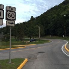
Fayette Station Road, One-way scenic route in Fayette County, United States.

Fayette Station Road is a one-way scenic route in Fayette County that descends into the New River Gorge through a series of switchbacks, revealing mountain views along its path. The route passes through terrain shaped by the gorge and connects the old mining settlements below.

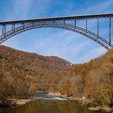
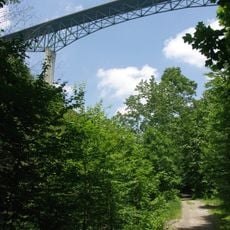
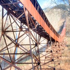
The road was the main transportation link across the New River Gorge from 1873 until the New River Gorge Bridge opened in 1977. After the bridge was completed, the road's role shifted from being a vital passage to serving local travel and recreation.

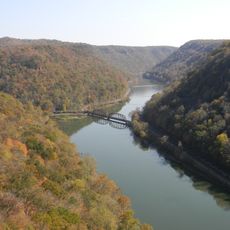
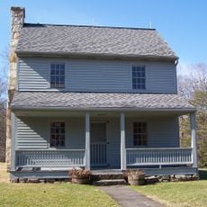
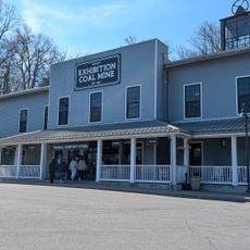
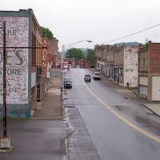
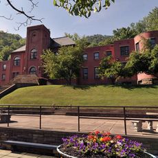
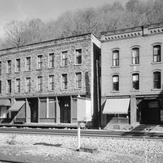
The settlements of Fayette and South Fayette along this road tell the story of West Virginia's coal mining era through the places where miners once lived and worked. Visitors traveling this route see the landscape that shaped community life during that industrial period.

The drive through this road takes about 45 minutes with several parking areas available along the way for river and gorge views. Drive slowly through the tight switchbacks and watch for other vehicles, especially during peak visiting times.

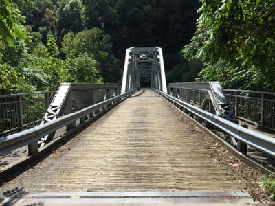
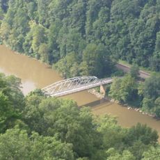
Three hiking trails start from points along this road and lead to overlooks where visitors can see both the older Fayette Station Bridge and the newer New River Gorge Bridge from different angles. These trails reveal how engineering solutions to crossing the gorge changed over time.

Location: Fayette County

Website: https://nps.gov/neri/planyourvisit/fayette-station-road.htm

GPS coordinates: 38.06746,-81.07896

Latest update: December 6, 2025 19:03

Photos
Nature areas and historic sites in West Virginia

West Virginia brings together natural landscapes and historical places. The state features waterfalls, mountain peaks, caves and old railroad lines that invite exploration. Visitors discover national forests, battlefields from America's past and mineral springs that have drawn people for...

Around this place
New River Gorge Bridge
United States of America

New River Gorge Bridge

355 m
Summersville Lake
United States of America

Summersville Lake

23.9 km
Hawks Nest State Park
United States of America

Hawks Nest State Park

7.5 km
Babcock State Park
United States of America

Babcock State Park

12.5 km
Phil G. McDonald Bridge
United States of America

Phil G. McDonald Bridge

33.5 km
Carnifex Ferry Battlefield State Park
United States of America

Carnifex Ferry Battlefield State Park

20 km
Tamarack Marketplace
United States of America

Tamarack Marketplace

32 km
Phillips-Sprague Mine
United States of America

Phillips-Sprague Mine

33.1 km
Tunney Hunsaker Bridge
United States of America

Tunney Hunsaker Bridge

337 m
Bank of Glen Jean
United States of America

Bank of Glen Jean

16.9 km
Page-Vawter House
United States of America

Page-Vawter House

8 km
Camp Washington-Carver Complex
United States of America

Camp Washington-Carver Complex

11.5 km
Beckley Courthouse Square Historic District
United States of America

Beckley Courthouse Square Historic District

33.7 km
Nicholas County Courthouse
United States of America

Nicholas County Courthouse

29.5 km
Contentment
United States of America

Contentment

7.8 km
E. B. Hawkins House
United States of America

E. B. Hawkins House

2.4 km
Fayetteville Historic District
United States of America

Fayetteville Historic District

3 km
Mount Hope Historic District
United States of America

Mount Hope Historic District

21 km
Fayette County Courthouse
United States of America

Fayette County Courthouse

2.7 km
Nicholas County Bank
United States of America

Nicholas County Bank

31 km
New River Company General Office Building
United States of America

New River Company General Office Building

20.5 km
Pratt Historic District
United States of America

Pratt Historic District

31.1 km
Dr. John Hughart House
United States of America

Dr. John Hughart House

16.4 km
Earl M. Vickers Bridge
United States of America

Earl M. Vickers Bridge

24.4 km
Glade Creek Grist Mill
United States of America

Glade Creek Grist Mill

15.2 km
Main Building
United States of America

Main Building

24.9 km
Nuttall Coal Mine Conveyor
United States of America

Nuttall Coal Mine Conveyor

3.7 km
Thurmond Historic District
United States of America

Thurmond Historic District

12.2 km
Show the full map
Reviews

Visited this place? Tap the stars to rate it and share your experience / photos with the community! Try now! You can cancel it anytime.

« Fayette Station Road - One-way scenic route in Fayette County, United States » is provided by Around Us (aroundus.com). Images and texts are derived from Wikimedia project under a Creative Commons license. You are allowed to copy, distribute, and modify copies of this page, under the conditions set by the license, as long as this note is clearly visible.

Discover hidden gems everywhere you go!

From secret cafés to breathtaking viewpoints, skip the crowded tourist spots and find places that match your style. Our app makes it easy with voice search, smart filtering, route optimization, and insider tips from travelers worldwide. Download now for the complete mobile experience.

Around Us App Screenshot

A unique approach to discovering new places

Le Figaro

All the places worth exploring

France Info

A tailor-made excursion in just a few clicks

20 Minutes