Enable Location

We need your location to show you interesting places around you

Discover nearby places

Find interesting locations and hidden gems around you

Precise directions

Get accurate directions and distances to places

Your location is never shared with other users. It's only used when you tap the location button.

Droop Mountain Battlefield State Park

Log in to your account

Start exploring — it's free

Trusted by 64,490 travelers worldwide

Continue with Google
Continue with Apple
or

We will send you a code to connect

By continuing, you accept our Terms and Conditions and our Privacy Policy

Check your inbox

We've sent a pincode in your inbox. Please enter the code below.

Discussion Reviews 1 Photos
4.1k Popularity

Droop Mountain Battlefield State Park, Civil War battlefield park in Pocahontas County, United States

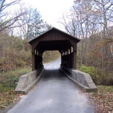
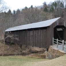
Droop Mountain Battlefield State Park is a Civil War battlefield park in Pocahontas County, West Virginia, featuring a museum, an observation tower, hiking trails, and interpretive signs that explain how troops moved during the battle. The layout lets visitors walk through the actual terrain and follow the military positions from that day.

The battle fought here on November 6, 1863 was the last major Civil War engagement in West Virginia, between Union troops under Averell and Confederate forces under Echols. The outcome shifted military control in the region and weakened Confederate presence across the state.

The museum inside a restored cabin displays firearms, uniforms, and personal letters from soldiers, giving visitors a direct connection to the people who fought here. These objects offer a tangible sense of what soldiers carried and experienced during the conflict.

The park sits about 25 miles (40 km) north of Lewisburg on US Route 219 and offers reservable picnic shelters and play areas for children alongside the hiking trails. Visitors can explore the grounds at their own pace on paths of varying length and difficulty.

Every two years in October during even-numbered years, the park holds battle reenactments where visitors can watch military demonstrations, period-style social activities, and religious services. These events recreate the daily routines and beliefs of soldiers in a way that goes beyond what a museum display can convey.

The community of curious travelers

AroundUs brings together thousands of curated places, local tips, and hidden gems, enriched daily by 60,000 contributors worldwide.

Start exploring
Inception
1928
Elevation above the sea
936 m
GPS coordinates
38.11000,-80.27222
Latest update
March 3, 2026 10:05
Around this place
The Greenbrier
United States of America

The Greenbrier

36.3 km
Project Greek Island
United States of America

Project Greek Island

36.1 km
Lost World Caverns
United States of America

Lost World Caverns

34.5 km
Greenbrier River Trail
United States of America

Greenbrier River Trail

19.9 km
Cranberry Wilderness
United States of America

Cranberry Wilderness

19.3 km
Beartown State Park
United States of America

Beartown State Park

6.4 km
Watoga State Park
United States of America

Watoga State Park

10.8 km
Pearl S. Buck Birthplace
United States of America

Pearl S. Buck Birthplace

6.8 km
Big Draft Wilderness
United States of America

Big Draft Wilderness

21.1 km
Spice Run Wilderness
United States of America

Spice Run Wilderness

8.2 km
Renick Farm
United States of America

Renick Farm

15.7 km
Herns Mill Covered Bridge
United States of America

Herns Mill Covered Bridge

37 km
Sunshine Farm and Gardens
United States of America

Sunshine Farm and Gardens

15.1 km
Wood Hall
United States of America

Wood Hall

37.1 km
Pocahontas County Opera House
United States of America

Pocahontas County Opera House

20 km
Frank and Anna Hunter House
United States of America

Frank and Anna Hunter House

19.4 km
Pocahontas County Courthouse and Jail
United States of America

Pocahontas County Courthouse and Jail

20.1 km
Edgefield
United States of America

Edgefield

14.6 km
United States of America

Pleasant Green Methodist Episcopal Church

8 km
Downtown Richwood Historic District
United States of America

Downtown Richwood Historic District

26.2 km
Gov. Samuel Price House
United States of America

Gov. Samuel Price House

37.2 km
IOOF Lodge Building
United States of America

IOOF Lodge Building

20 km
McClung's Price Place
United States of America

McClung's Price Place

27.1 km
Droop Mountain Battlefield State Park
United States of America

Droop Mountain Battlefield State Park

178 m
Greenbrier County Courthouse
United States of America

Greenbrier County Courthouse

37.4 km
Locust Creek Covered Bridge
United States of America

Locust Creek Covered Bridge

3.9 km
Lewisburg Historic District
United States of America

Lewisburg Historic District

35 km
James Withrow House
United States of America

James Withrow House

37.2 km
Show the full map
Reviews
Share your experience

No review yet

Discussions
Start a discussion...

No discussion yet

« Droop Mountain Battlefield State Park - Civil War battlefield park in Pocahontas County, United States » is provided by Around Us (aroundus.com). Images and texts are derived from Wikimedia project under a Creative Commons license. You are allowed to copy, distribute, and modify copies of this page, under the conditions set by the license, as long as this note is clearly visible.

Discover hidden gems everywhere you go!

From secret cafés to breathtaking viewpoints, skip the crowded tourist spots and find places that match your style. Our app makes it easy with voice search, smart filtering, route optimization, and insider tips from travelers worldwide. Download now for the complete mobile experience.

Around Us App Screenshot

A unique approach to discovering new places

Le Figaro

All the places worth exploring

France Info

A tailor-made excursion in just a few clicks

20 Minutes

Around Us
Travel Guide & Maps
Download

Send to your phone

QR Code
1

Open the camera app on your mobile.

2

Point at the QR code with your camera. A notification will appear.

3

Tap the notification to open the link.