Enable Location

We need your location to show you interesting places around you

Discover nearby places

Find interesting locations and hidden gems around you

Precise directions

Get accurate directions and distances to places

Your location is never shared with other users. It's only used when you tap the location button.

Watoga State Park

Log in to your account

Start exploring — it's free

Trusted by 62,532 travelers worldwide

Continue with Google
Continue with Apple
or

We will send you a code to connect

By continuing, you accept our Terms and Conditions and our Privacy Policy

Check your inbox

We've sent a pincode in your inbox. Please enter the code below.

Watoga State Park, State park in Pocahontas County, United States

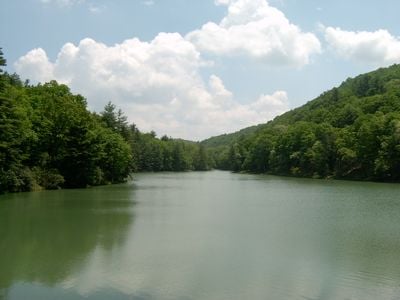
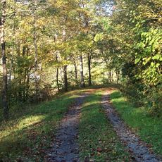
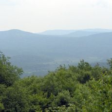
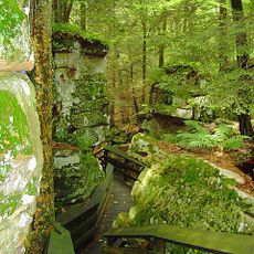
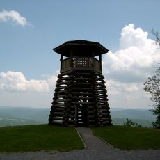
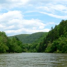
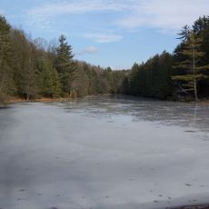
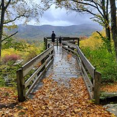
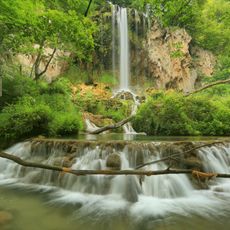
Watoga State Park is a large wooded preserve in the Appalachian Mountains with dense forest and natural ridge landscapes spread across more than 10,000 acres. The grounds include over 40 miles of hiking trails through different ecosystems and an extensive arboretum featuring rare tree species.

The preserve began in 1934 when the Civilian Conservation Corps established initial facilities on land managed as wildlife and timber reserve. This development was part of a nationwide effort to protect forest landscapes during the Great Depression.

The Fred E. Brooks Memorial Arboretum within the park spans 400 acres, named after a prominent West Virginia naturalist.

The grounds offer 34 rental cabins and two campgrounds with about 88 sites total, many equipped with electric hookups for trailers. Visitors should wear sturdy footwear and prepare for changing weather conditions in the mountains.

The grounds received certification as an official Dark Sky Park from the International Dark-Sky Association in 2021 for excellent stargazing conditions. This recognition reflects the minimal light pollution achieved by the remote mountain location.

The community of curious travelers

AroundUs brings together thousands of curated places, local tips, and hidden gems, enriched daily by 60,000 contributors worldwide.

Start exploring
Inception
1934
Elevation above the sea
866 m
GPS coordinates
38.10360,-80.14970
Latest update
December 10, 2025 20:09
Around this place
The Omni Homestead Resort
United States of America

The Omni Homestead Resort

30.5 km
Greenbrier River Trail
United States of America

Greenbrier River Trail

14 km
Cranberry Wilderness
United States of America

Cranberry Wilderness

25 km
Beartown State Park
United States of America

Beartown State Park

12.4 km
Droop Mountain Battlefield State Park
United States of America

Droop Mountain Battlefield State Park

10.8 km
Pearl S. Buck Birthplace
United States of America

Pearl S. Buck Birthplace

6.5 km
The Yard
United States of America

The Yard

30.5 km
Big Draft Wilderness
United States of America

Big Draft Wilderness

22.7 km
Spice Run Wilderness
United States of America

Spice Run Wilderness

9.9 km
Seneca State Forest
United States of America

Seneca State Forest

31.2 km
Renick Farm
United States of America

Renick Farm

22.2 km
Barton Lodge
United States of America

Barton Lodge

30.1 km
Hidden Valley
United States of America

Hidden Valley

29.3 km
Pocahontas Times Print Shop
United States of America

Pocahontas Times Print Shop

14.2 km
Sunshine Farm and Gardens
United States of America

Sunshine Farm and Gardens

25.3 km
Pocahontas County Opera House
United States of America

Pocahontas County Opera House

14.1 km
Mustoe House
United States of America

Mustoe House

30.5 km
Old Stone House
United States of America

Old Stone House

30.5 km
Frank and Anna Hunter House
United States of America

Frank and Anna Hunter House

13.7 km
Pocahontas County Courthouse and Jail
United States of America

Pocahontas County Courthouse and Jail

13.8 km
Edgefield
United States of America

Edgefield

21.7 km
United States of America

Pleasant Green Methodist Episcopal Church

5.5 km
McNeel Mill
United States of America

McNeel Mill

6.6 km
Ashwood School
United States of America

Ashwood School

30.1 km
IOOF Lodge Building
United States of America

IOOF Lodge Building

14.2 km
Droop Mountain Battlefield State Park
United States of America

Droop Mountain Battlefield State Park

10.8 km
Locust Creek Covered Bridge
United States of America

Locust Creek Covered Bridge

9.2 km
Falling Springs Falls
United States of America

Falling Springs Falls

31.7 km
Show the full map
« Watoga State Park - State park in Pocahontas County, United States » is provided by Around Us (aroundus.com). Images and texts are derived from Wikimedia project under a Creative Commons license. You are allowed to copy, distribute, and modify copies of this page, under the conditions set by the license, as long as this note is clearly visible.

Discover hidden gems everywhere you go!

From secret cafés to breathtaking viewpoints, skip the crowded tourist spots and find places that match your style. Our app makes it easy with voice search, smart filtering, route optimization, and insider tips from travelers worldwide. Download now for the complete mobile experience.

Around Us App Screenshot

A unique approach to discovering new places

Le Figaro

All the places worth exploring

France Info

A tailor-made excursion in just a few clicks

20 Minutes

Around Us
Travel Guide & Maps
Download

Send to your phone

QR Code
1

Open the camera app on your mobile.

2

Point at the QR code with your camera. A notification will appear.

3

Tap the notification to open the link.