Renick Farm

Log in to your account

AroundUs is a community-driven map of interesting places, built by curious explorers like you. It grows with every review, story, and photo you share.
Connect to save your favorite spots, contribute locations, and create personalized routes.
Continue with Google
Continue with Apple
Continue with X
Continue with Facebook
Continue with email
By continuing, you accept our Terms and Conditions and our Privacy Policy
Create an account
Add to collection
Map
Suggest a change
Share

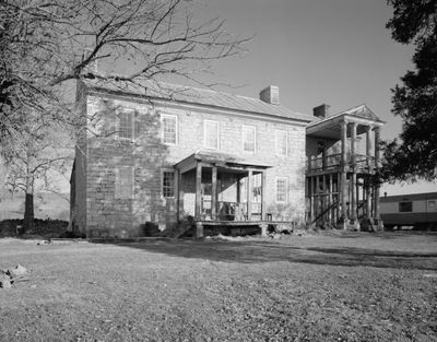
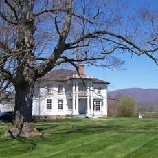
Renick Farm, Historic farm site in Renick, West Virginia, US.

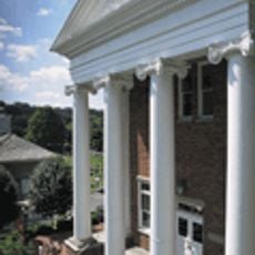
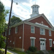
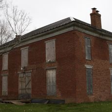
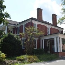
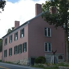
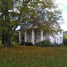
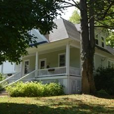
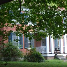
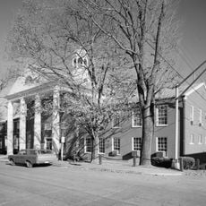
Renick Farm is a rural homestead with a two-story limestone house built in Georgian style and expanded with a Federal-style addition featuring columns and decorative railings. The property includes several historic outbuildings such as a smokehouse and barn that complete the working farm layout.

The property was built between 1787 and 1792 as a substantial farmhouse for prosperous landowners named Christopher Foglesong and Conrad Burgess. Additional structures including a smokehouse and barn were added over the following decades to support agricultural operations.

The property reflects how prosperous farming families expressed their wealth and taste through architecture during the late 1700s. The blend of Georgian and Federal styles on a rural homestead shows the influence of urban design trends reaching the countryside.

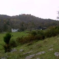
The farm sits at the intersection of WV 9 and US 219, making it easy to locate from the main roads in the area. The buildings are situated on a small parcel of land, so you can get a sense of the entire property layout from the road or nearby vantage points.

The property earned a place on the National Register of Historic Places for its architectural significance to rural West Virginia development. The detailed recording by the Historic American Buildings Survey preserved precise structural information that would otherwise be lost over time.

Location: West Virginia

Architectural style: Georgian architecture

GPS coordinates: 37.98330,-80.35110

Latest update: December 14, 2025 13:00

Photos
Around this place
The Greenbrier
United States of America

The Greenbrier

22.3 km
Project Greek Island
United States of America

Project Greek Island

22.2 km
Lost World Caverns
United States of America

Lost World Caverns

18.8 km
Beartown State Park
United States of America

Beartown State Park

10.1 km
Watoga State Park
United States of America

Watoga State Park

22.2 km
Droop Mountain Battlefield State Park
United States of America

Droop Mountain Battlefield State Park

15.7 km
Pearl S. Buck Birthplace
United States of America

Pearl S. Buck Birthplace

21.8 km
Carnegie Hall
United States of America

Carnegie Hall

22 km
Greenbrier State Forest
United States of America

Greenbrier State Forest

27.2 km
Big Draft Wilderness
United States of America

Big Draft Wilderness

10.3 km
Spice Run Wilderness
United States of America

Spice Run Wilderness

12.3 km
John Wesley Methodist Church
United States of America

John Wesley Methodist Church

22.1 km
Deitz Farm
United States of America

Deitz Farm

29.1 km
Herns Mill Covered Bridge
United States of America

Herns Mill Covered Bridge

21.6 km
Sunshine Farm and Gardens
United States of America

Sunshine Farm and Gardens

11.5 km
John A. North House
United States of America

John A. North House

21.8 km
Supreme Court Library Building
United States of America

Supreme Court Library Building

21.8 km
Edgefield
United States of America

Edgefield

1.5 km
Ronceverte Historic District
United States of America

Ronceverte Historic District

27.9 km
United States of America

Pleasant Green Methodist Episcopal Church

22.6 km
South Church Street Historic District
United States of America

South Church Street Historic District

22.4 km
Gov. Samuel Price House
United States of America

Gov. Samuel Price House

21.6 km
McClung's Price Place
United States of America

McClung's Price Place

11.5 km
Droop Mountain Battlefield State Park
United States of America

Droop Mountain Battlefield State Park

15.9 km
Greenbrier County Courthouse
United States of America

Greenbrier County Courthouse

21.7 km
Locust Creek Covered Bridge
United States of America

Locust Creek Covered Bridge

13.9 km
Lewisburg Historic District
United States of America

Lewisburg Historic District

19.3 km
Maple Street Historic District
United States of America

Maple Street Historic District

21.7 km
Show the full map
Reviews

Visited this place? Tap the stars to rate it and share your experience / photos with the community! Try now! You can cancel it anytime.

« Renick Farm - Historic farm site in Renick, West Virginia, US » is provided by Around Us (aroundus.com). Images and texts are derived from Wikimedia project under a Creative Commons license. You are allowed to copy, distribute, and modify copies of this page, under the conditions set by the license, as long as this note is clearly visible.

Discover hidden gems everywhere you go!

From secret cafés to breathtaking viewpoints, skip the crowded tourist spots and find places that match your style. Our app makes it easy with voice search, smart filtering, route optimization, and insider tips from travelers worldwide. Download now for the complete mobile experience.

Around Us App Screenshot

A unique approach to discovering new places

Le Figaro

All the places worth exploring

France Info

A tailor-made excursion in just a few clicks

20 Minutes