Enable Location

We need your location to show you interesting places around you

Discover nearby places

Find interesting locations and hidden gems around you

Precise directions

Get accurate directions and distances to places

Your location is never shared with other users. It's only used when you tap the location button.

Cranberry Wilderness

Log in to your account

Start exploring — it's free

Trusted by 62,520 travelers worldwide

Continue with Google
Continue with Apple
or

We will send you a code to connect

By continuing, you accept our Terms and Conditions and our Privacy Policy

Check your inbox

We've sent a pincode in your inbox. Please enter the code below.

Cranberry Wilderness

Cranberry Wilderness, Federal wilderness area in Pocahontas County, West Virginia

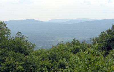
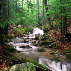
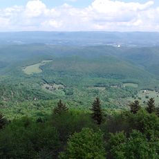
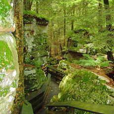
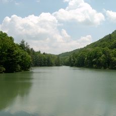
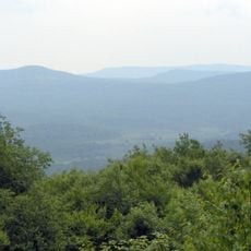
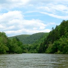
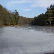
Cranberry Wilderness is a protected forest area in the Monongahela National Forest with mountains, valleys, and dense hardwood forests. The terrain includes steep slopes, stream corridors, and extensive woodland that covers the entire landscape.

The area received federal wilderness protection in 1983, and an expansion in 2009 added adjacent lands to the protected zone. These additions strengthened long-term conservation of the forest and its ecosystems.

The area serves as a natural laboratory for ecological research and provides opportunities for solitary outdoor experiences in the Appalachian mountains.

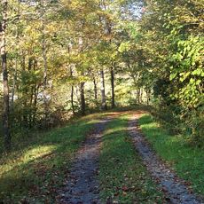
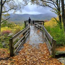
More than 70 miles of marked trails offer hiking options at various difficulty levels throughout the area. Since trails pass through different forest types and elevations, visitors should wear proper footwear and bring weather-appropriate clothing.

Black Mountain, the highest point in the area at about 4,556 feet, can experience frost during any month of the year. This unusual weather pattern is due to the exposed mountainous terrain.

The community of curious travelers

AroundUs brings together thousands of curated places, local tips, and hidden gems, enriched daily by 60,000 contributors worldwide.

Start exploring
Location
GPS coordinates
38.27670,-80.33250
Latest update
December 10, 2025 16:25
Around this place
Cass Scenic Railroad State Park
United States of America

Cass Scenic Railroad State Park

38.8 km
Holly River State Park
United States of America

Holly River State Park

43.4 km
Greenbrier River Trail
United States of America

Greenbrier River Trail

21.7 km
Bald Knob
United States of America

Bald Knob

39.9 km
Beartown State Park
United States of America

Beartown State Park

25.5 km
Watoga State Park
United States of America

Watoga State Park

25 km
Droop Mountain Battlefield State Park
United States of America

Droop Mountain Battlefield State Park

19.3 km
Pearl S. Buck Birthplace
United States of America

Pearl S. Buck Birthplace

18.7 km
Big Draft Wilderness
United States of America

Big Draft Wilderness

40.1 km
Spice Run Wilderness
United States of America

Spice Run Wilderness

27.4 km
Seneca State Forest
United States of America

Seneca State Forest

35.1 km
Renick Farm
United States of America

Renick Farm

32.7 km
Camp Caesar
United States of America

Camp Caesar

24.2 km
Pocahontas Times Print Shop
United States of America

Pocahontas Times Print Shop

21.7 km
Sunshine Farm and Gardens
United States of America

Sunshine Farm and Gardens

25.4 km
Morton House
United States of America

Morton House

23.1 km
Pocahontas County Opera House
United States of America

Pocahontas County Opera House

21.6 km
Frank and Anna Hunter House
United States of America

Frank and Anna Hunter House

21.2 km
Pocahontas County Courthouse and Jail
United States of America

Pocahontas County Courthouse and Jail

22.3 km
Edgefield
United States of America

Edgefield

31.3 km
Cass Historic District
United States of America

Cass Historic District

38.3 km
McNeel Mill
United States of America

McNeel Mill

18.7 km
United States of America

Pleasant Green Methodist Episcopal Church

19.5 km
Downtown Richwood Historic District
United States of America

Downtown Richwood Historic District

18.6 km
IOOF Lodge Building
United States of America

IOOF Lodge Building

21.6 km
McClung's Price Place
United States of America

McClung's Price Place

43.2 km
Droop Mountain Battlefield State Park
United States of America

Droop Mountain Battlefield State Park

19.1 km
Locust Creek Covered Bridge
United States of America

Locust Creek Covered Bridge

23.1 km
Show the full map
« Cranberry Wilderness - Federal wilderness area in Pocahontas County, West Virginia » is provided by Around Us (aroundus.com). Images and texts are derived from Wikimedia project under a Creative Commons license. You are allowed to copy, distribute, and modify copies of this page, under the conditions set by the license, as long as this note is clearly visible.

Discover hidden gems everywhere you go!

From secret cafés to breathtaking viewpoints, skip the crowded tourist spots and find places that match your style. Our app makes it easy with voice search, smart filtering, route optimization, and insider tips from travelers worldwide. Download now for the complete mobile experience.

Around Us App Screenshot

A unique approach to discovering new places

Le Figaro

All the places worth exploring

France Info

A tailor-made excursion in just a few clicks

20 Minutes

Around Us
Travel Guide & Maps
Download

Send to your phone

QR Code
1

Open the camera app on your mobile.

2

Point at the QR code with your camera. A notification will appear.

3

Tap the notification to open the link.