Bald Knob

Log in to your account

AroundUs is a community-driven map of interesting places, built by curious explorers like you. It grows with every review, story, and photo you share.
Connect to save your favorite spots, contribute locations, and create personalized routes.
Continue with Google
Continue with Apple
Continue with X
Continue with Facebook
Continue with email
By continuing, you accept our Terms and Conditions and our Privacy Policy
Create an account
Add to collection
Map
Suggest a change
Share

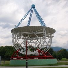
Bald Knob, Mountain summit in Pocahontas County, United States.

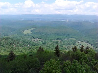
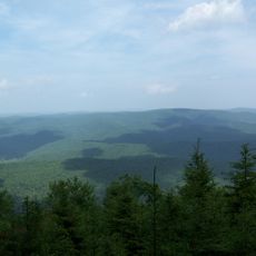
Bald Knob rises to 1,476 meters (4,844 feet) above sea level as the highest point of Back Allegheny Mountain and displays vegetation with fewer trees than the forested slopes below. The terrain offers open views across the surrounding ridges and distant valleys beyond.

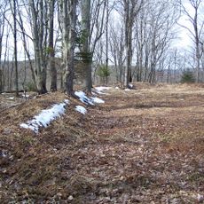
The area experienced intensive logging operations from 1900 to 1960, when spruce and hemlock trees were removed from the mountain forest. This clearing permanently changed the summit's appearance and shaped the landscape visitors see today.

The summit is part of West Virginia's natural identity and the Appalachian landscape, where visitors find rare mountain plants adapted to harsh highland conditions.

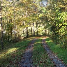
The summit is reachable via hiking trails, with some paths starting from lower elevations while others connect from the historic railroad line at the top. Most visitors should expect moderate hiking conditions and changing weather at this elevation.

The summit is the highest point reached by any standard gauge railroad system east of the Mississippi River, a rare achievement in American railroad history. The historic Cass Scenic Railroad brought visitors directly to this record.

Location: Pocahontas County

Elevation above the sea: 1,476 m

GPS coordinates: 38.44778,-79.93111

Latest update: December 10, 2025 16:24

Photos
Around this place
Green Bank Telescope
United States of America

Green Bank Telescope

8.1 km
Cass Scenic Railroad State Park
United States of America

Cass Scenic Railroad State Park

5.9 km
Durbin and Greenbrier Valley Railroad
United States of America

Durbin and Greenbrier Valley Railroad

13.8 km
Greenbrier River Trail
United States of America

Greenbrier River Trail

28.9 km
Green Bank Interferometer
United States of America

Green Bank Interferometer

8.2 km
White Top
United States of America

White Top

20.2 km
Gaudineer Scenic Area
United States of America

Gaudineer Scenic Area

21.5 km
Gaudineer Knob
United States of America

Gaudineer Knob

20.1 km
Reber Radio Telescope
United States of America

Reber Radio Telescope

10.1 km
40-foot telescope
United States of America

40-foot telescope

8.8 km
Seneca State Forest
United States of America

Seneca State Forest

13.4 km
Shavers Fork Mountain Complex
United States of America

Shavers Fork Mountain Complex

20.1 km
Monterey High School
United States of America

Monterey High School

30.3 km
Camp Bartow Historic District
United States of America

Camp Bartow Historic District

17.2 km
Pocahontas Times Print Shop
United States of America

Pocahontas Times Print Shop

28.8 km
Pocahontas County Opera House
United States of America

Pocahontas County Opera House

28.9 km
E. E. Hutton House
United States of America

E. E. Hutton House

30.1 km
Frank and Anna Hunter House
United States of America

Frank and Anna Hunter House

29.3 km
Pocahontas County Courthouse and Jail
United States of America

Pocahontas County Courthouse and Jail

29 km
Cass Historic District
United States of America

Cass Historic District

6.4 km
IOOF Lodge Building
United States of America

IOOF Lodge Building

28.8 km
Green Bank Observatory
United States of America

Green Bank Observatory

8.4 km
Green Bank Observatory Science Center
United States of America

Green Bank Observatory Science Center

10.1 km
300 foot Radio Telescope
United States of America

300 foot Radio Telescope

8.1 km
Green Bank Jansky Antenna
United States of America

Green Bank Jansky Antenna

10.2 km
Howard E. Tatel Radio Telescope
United States of America

Howard E. Tatel Radio Telescope

9.1 km
Green Bank 85-3 telescope
United States of America

Green Bank 85-3 telescope

7.9 km
Green Bank 45ft telescope
United States of America

Green Bank 45ft telescope

9.6 km
Show the full map
Reviews

Visited this place? Tap the stars to rate it and share your experience / photos with the community! Try now! You can cancel it anytime.

« Bald Knob - Mountain summit in Pocahontas County, United States » is provided by Around Us (aroundus.com). Images and texts are derived from Wikimedia project under a Creative Commons license. You are allowed to copy, distribute, and modify copies of this page, under the conditions set by the license, as long as this note is clearly visible.

Discover hidden gems everywhere you go!

From secret cafés to breathtaking viewpoints, skip the crowded tourist spots and find places that match your style. Our app makes it easy with voice search, smart filtering, route optimization, and insider tips from travelers worldwide. Download now for the complete mobile experience.

Around Us App Screenshot

A unique approach to discovering new places

Le Figaro

All the places worth exploring

France Info

A tailor-made excursion in just a few clicks

20 Minutes