Chest opened
+${chestReward.xp} XP
Explorer
NOUVEAU ×${chestReward.collectible.quantity}
tapez pour fermer
Chest locked

Open chests in the app

Around Us is built for your phone — chests unlock when you walk, explore and capture nearby places.

Enable Location

We need your location to show you interesting places around you

Discover nearby places

Find interesting locations and hidden gems around you

Precise directions

Get accurate directions and distances to places

Your location is never shared with other users. It's only used when you tap the location button.

Wounded Knee

Log in to your account

Start exploring — it's free

Trusted by 72,881 travelers worldwide

Continue with Google
Continue with Apple
or

We will send you a code to connect

By continuing, you accept our Terms and Conditions and our Privacy Policy

Check your inbox

We've sent a pincode in your inbox. Please enter the code below.

Discussion Reviews 4 Photos
53k Popularity

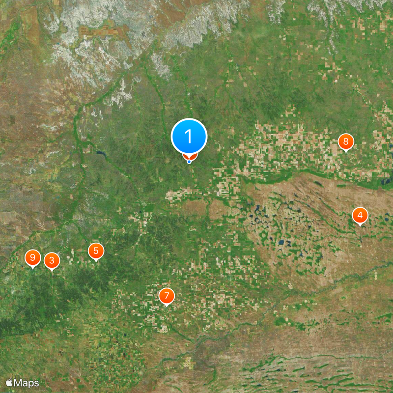
Wounded Knee, Census-designated place in Oglala Lakota County, United States.

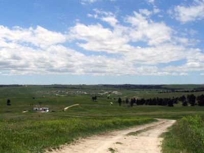
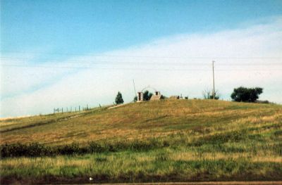
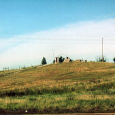
Wounded Knee is a small community located on the Pine Ridge Reservation in Oglala Lakota County, South Dakota. The settlement sits on elevated terrain and functions today as a residential area with a memorial site honoring those who died there.

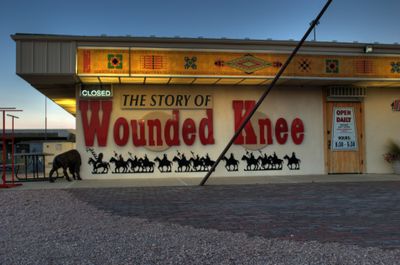
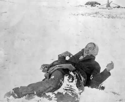
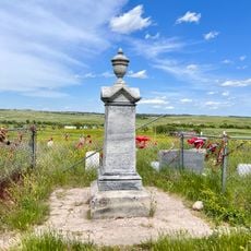
The site witnessed a deadly confrontation in 1890 between United States soldiers and Lakota people, resulting in the deaths of hundreds including women and children. This tragedy became a defining moment in Native American history and continues to shape the region's identity today.

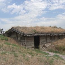
The site holds deep spiritual meaning for the Lakota people, with regular gatherings and remembrance ceremonies throughout the year. Visitors can sense how this place remains central to the community's healing and identity.

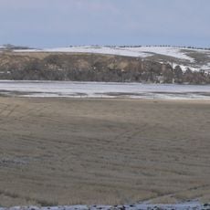
The community is accessible by car and features a memorial site that visitors can explore freely. It is helpful to contact local guides or the community in advance to learn about visiting opportunities and respectful ways to experience the site.

In 1973, members of the American Indian Movement occupied the site for 71 days to bring national attention to Native American rights and treaty violations. This occupation became one of the longest and most visible protests of the era, reshaping discussions about indigenous sovereignty.

The community of curious travelers

AroundUs brings together thousands of curated places, local tips, and hidden gems, enriched daily by 60,000 contributors worldwide.

Start exploring
Elevation above the sea
986 m
GPS coordinates
43.14389,-102.36778
Latest update
March 4, 2026 16:15
Around this place
Wounded Knee National Historic Landmark
United States of America

Wounded Knee National Historic Landmark

283 m
Bordeaux Trading Post
United States of America

Bordeaux Trading Post

57.6 km
United States of America

Bowring Ranch State Historical Park

59.9 km
Camp Sheridan
United States of America

Camp Sheridan

44.7 km
Chadron Commercial Historic District
United States of America

Chadron Commercial Historic District

62.2 km
Plains Theatre
United States of America

Plains Theatre

48 km
Inland Theater
United States of America

Inland Theater

51.5 km
Hotel Chadron
United States of America

Hotel Chadron

62.1 km
United States of America

Loosveldt Bridge

62.6 km
Sheridan County Courthouse
United States of America

Sheridan County Courthouse

48 km
Miller Hall
United States of America

Miller Hall

60.2 km
Chadron Public Library
United States of America

Chadron Public Library

62.4 km
Lee and Gottliebe Fritz House
United States of America

Lee and Gottliebe Fritz House

40.1 km
Wounded Knee cemetery
United States of America

Wounded Knee cemetery

267 m
Museum of the Fur Trade
United States of America

Museum of the Fur Trade

57.9 km
United States of America

Antelope Creek Dam 40-B

38.7 km
United States of America

Antelope Creek Dam 20-A

40.3 km
United States of America

White River Visitor Center

42.2 km
United States of America

Jones Reservoir

48.3 km
United States of America

Oglala Lake

29 km
United States of America

Antelope Creek Dam 60-A

38.1 km
United States of America

Evening Star Butte

46.5 km
United States of America

Shell Lake

36.5 km
United States of America

Cedar Bluffs

47.5 km
United States of America

Beaver Wall

39.6 km
United States of America

Gordon Country Club GC and Park

39.6 km
United States of America

AH-1 Cobra Helicopter

40.6 km
United States of America

Musfelt Reservoir

49.3 km
Show the full map
Reviews
Share your experience

No review yet

Discussions
Start a discussion...

No discussion yet

« Wounded Knee - Census-designated place in Oglala Lakota County, United States » is provided by Around Us (aroundus.com). Images and texts are derived from Wikimedia project under a Creative Commons license. You are allowed to copy, distribute, and modify copies of this page, under the conditions set by the license, as long as this note is clearly visible.

Discover hidden gems everywhere you go!

From secret cafés to breathtaking viewpoints, skip the crowded tourist spots and find places that match your style. Our app makes it easy with voice search, smart filtering, route optimization, and insider tips from travelers worldwide. Download now for the complete mobile experience.

Around Us App Screenshot

A unique approach to discovering new places

Le Figaro

All the places worth exploring

France Info

A tailor-made excursion in just a few clicks

20 Minutes

Around Us
Travel Guide & Maps
Download

Send to your phone

QR Code
1

Open the camera app on your mobile.

2

Point at the QR code with your camera. A notification will appear.

3

Tap the notification to open the link.