Oglala Lakota County

Log in to your account

AroundUs is a community-driven map of interesting places, built by curious explorers like you. It grows with every review, story, and photo you share.
Connect to save your favorite spots, contribute locations, and create personalized routes.
Continue with Google
Continue with Apple
Continue with X
Continue with Facebook
Continue with email
By continuing, you accept our Terms and Conditions and our Privacy Policy
Create an account
Add to collection
Map
Suggest a change
Share

Oglala Lakota County, Administrative county in southwestern South Dakota, US

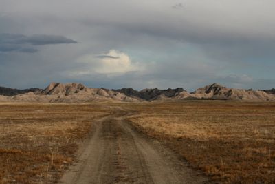
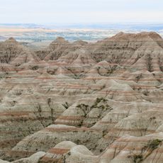
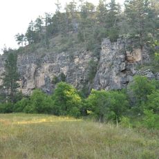
Oglala Lakota County is an administrative territory in southwestern South Dakota covering semi-arid rolling terrain with sparse vegetation and exposed earth formations. A portion of Badlands National Park within its boundaries displays dramatic ridges and eroded badlands landscape.

The territory received its current name in May 2015 when residents voted to change it from Shannon County, marking an important affirmation of Native American identity. This renaming reflected a decision rooted in the region's indigenous heritage and community self-determination.

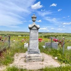
The county sits entirely within Pine Ridge Indian Reservation, where Lakota language, customs, and ceremonies continue to shape daily life and community identity today.

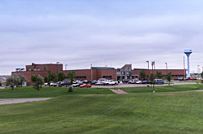
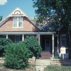
Hot Springs in neighboring Fall River County serves as the administrative center since the territory has no county seat of its own. Visitors seeking services or information should plan to travel outside the territory for administrative purposes.

This territory stands as the only dry county in South Dakota, where alcohol sales remain prohibited by law. Related tax revenues instead flow to neighboring counties, a legal arrangement that shapes commerce in the region.

Location: South Dakota

Inception: January 1875

Capital city: Hot Springs

Shares border with: Pennington County, Dawes County, Cherry County, Sheridan County, Fall River County, Custer County, Jackson County, Bennett County

Website: https://oglalalakota.sdcounties.org

GPS coordinates: 43.33000,-102.55000

Latest update: December 17, 2025 09:48

Photos
Around this place
Badlands National Park
United States of America

Badlands National Park

46.9 km
Wounded Knee National Historic Landmark
United States of America

Wounded Knee National Historic Landmark

25.7 km
Angostura Reservoir
United States of America

Angostura Reservoir

71.7 km
Camp Sheridan
United States of America

Camp Sheridan

55.5 km
Angostura Dam
United States of America

Angostura Dam

71.8 km
United States of America

Hot Springs National Cemetery

75.6 km
Governor Leslie Jensen House
United States of America

Governor Leslie Jensen House

75.3 km
United States of America

St. Martin's Catholic Church and Grotto

57.6 km
Wind Cave National Park Administrative and Utility Area Historic District
United States of America

Wind Cave National Park Administrative and Utility Area Historic District

78.8 km
United States of America

Buffalo Gap Cheyenne River Bridge

46.5 km
United States of America

Fairburn Historic Commercial District

66.4 km
Wounded Knee cemetery
United States of America

Wounded Knee cemetery

25.7 km
Beaver Creek Rockshelter
United States of America

Beaver Creek Rockshelter

79.5 km
United States of America

Norman B. Streeter Homestead

71.1 km
United States of America

White River Visitor Center

20.7 km
United States of America

Jones Reservoir

50 km
United States of America

Limestone Butte Reservoir

53.5 km
United States of America

Oglala Lake

22.4 km
United States of America

Tahc'a Okute Aglehan

39.6 km
United States of America

Evening Star Butte

56.9 km
United States of America

Cedar Bluffs

29.8 km
United States of America

Tahc'a Okute Aglehan C'ikala

39.7 km
United States of America

Beaver Wall

50.8 km
United States of America

Petroglyphs

71.3 km
United States of America

Cowboy Artwork

58.2 km
United States of America

Red Shirt Table Overlook

36.8 km
United States of America

Scenic viewpoint

75.9 km
United States of America

Scenic viewpoint

71.5 km
Show the full map
Reviews

Visited this place? Tap the stars to rate it and share your experience / photos with the community! Try now! You can cancel it anytime.

« Oglala Lakota County - Administrative county in southwestern South Dakota, US » is provided by Around Us (aroundus.com). Images and texts are derived from Wikimedia project under a Creative Commons license. You are allowed to copy, distribute, and modify copies of this page, under the conditions set by the license, as long as this note is clearly visible.

Discover hidden gems everywhere you go!

From secret cafés to breathtaking viewpoints, skip the crowded tourist spots and find places that match your style. Our app makes it easy with voice search, smart filtering, route optimization, and insider tips from travelers worldwide. Download now for the complete mobile experience.

Around Us App Screenshot

A unique approach to discovering new places

Le Figaro

All the places worth exploring

France Info

A tailor-made excursion in just a few clicks

20 Minutes