Enable Location

We need your location to show you interesting places around you

Discover nearby places

Find interesting locations and hidden gems around you

Precise directions

Get accurate directions and distances to places

Your location is never shared with other users. It's only used when you tap the location button.

Camp Sheridan

Log in to your account

Start exploring — it's free

Trusted by 62,857 travelers worldwide

Continue with Google
Continue with Apple
or

We will send you a code to connect

By continuing, you accept our Terms and Conditions and our Privacy Policy

Check your inbox

We've sent a pincode in your inbox. Please enter the code below.

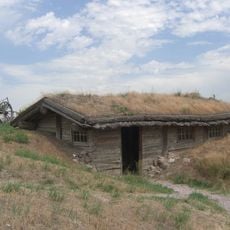
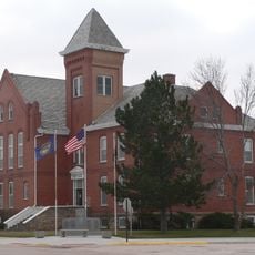
Camp Sheridan, Military outpost and Indian agency in Sheridan County, Nebraska.

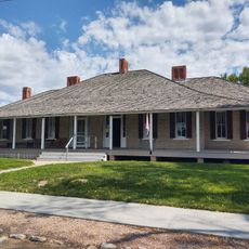
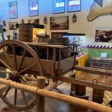
Camp Sheridan is a military outpost with over 30 frame and brick structures built in 1875 along Beaver Creek. The buildings sit about 12 miles upstream from the White River and once housed soldiers and administrative staff for the nearby Sioux agency.

The camp was established in 1874 and operated until 1880 as a guard post for the Spotted Tail Agency and the Brule Sioux settlement. These years saw rapid westward movement and changes to Native American lands across the region.

The location marks where military personnel and Brule Sioux people lived in close proximity, with Chief Spotted Tail's community depending on the agency's presence. You can sense how this mixing of two very different worlds shaped daily routines for everyone here.

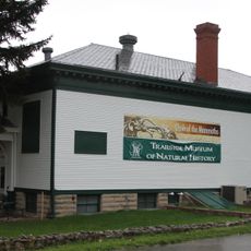
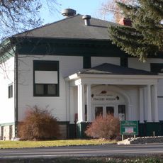
The site sits in a remote rural area, so plan ahead for your visit and check what is accessible. Local historical societies and museums in the region provide information and context about what you will see here.

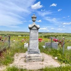
The Oglala leader Crazy Horse passed through this location in September 1877 on his final journey before his death at Fort Robinson. This passage made the camp a point in one of the most pivotal moments in Plains history.

The community of curious travelers

AroundUs brings together thousands of curated places, local tips, and hidden gems, enriched daily by 60,000 contributors worldwide.

Start exploring
Location
GPS coordinates
42.85198,-102.74421
Latest update
December 13, 2025 12:25
Around this place
Carhenge
United States of America

Carhenge

79.6 km
Fort Robinson
United States of America

Fort Robinson

62.5 km
Wounded Knee National Historic Landmark
United States of America

Wounded Knee National Historic Landmark

44.7 km
Toadstool Geologic Park
United States of America

Toadstool Geologic Park

68.5 km
Hudson-Meng Bison Kill
United States of America

Hudson-Meng Bison Kill

71.5 km
Angostura Reservoir
United States of America

Angostura Reservoir

75.5 km
Chadron State Park
United States of America

Chadron State Park

27.5 km
Pine Ridge National Recreation Area
United States of America

Pine Ridge National Recreation Area

40.1 km
Bordeaux Trading Post
United States of America

Bordeaux Trading Post

15 km
Angostura Dam
United States of America

Angostura Dam

78.4 km
Trailside Museum of Natural History at Fort Robinson State Park
United States of America

Trailside Museum of Natural History at Fort Robinson State Park

62.5 km
Mari Sandoz High Plains Heritage Center
United States of America

Mari Sandoz High Plains Heritage Center

21.4 km
Fort Robinson State Park
United States of America

Fort Robinson State Park

63.9 km
Dawes County Courthouse
United States of America

Dawes County Courthouse

47.9 km
Chadron Commercial Historic District
United States of America

Chadron Commercial Historic District

21.1 km
Plains Theatre
United States of America

Plains Theatre

27.5 km
Crites Hall
United States of America

Crites Hall

21.2 km
Sheridan County Courthouse
United States of America

Sheridan County Courthouse

27.6 km
Sparks Hall
United States of America

Sparks Hall

21.2 km
Miller Hall
United States of America

Miller Hall

21 km
Chadron Public Library
United States of America

Chadron Public Library

21 km
Edna Work Hall
United States of America

Edna Work Hall

21.3 km
Lee and Gottliebe Fritz House
United States of America

Lee and Gottliebe Fritz House

44.4 km
Fort Robinson Museum & History Center
United States of America

Fort Robinson Museum & History Center

62.5 km
Wounded Knee cemetery
United States of America

Wounded Knee cemetery

44.8 km
Museum of the Fur Trade
United States of America

Museum of the Fur Trade

15.4 km
Army Theatre
United States of America

Army Theatre

62.5 km
Warbonnet Battlefield Monument
United States of America

Warbonnet Battlefield Monument

80.7 km
Show the full map
« Camp Sheridan - Military outpost and Indian agency in Sheridan County, Nebraska » is provided by Around Us (aroundus.com). Images and texts are derived from Wikimedia project under a Creative Commons license. You are allowed to copy, distribute, and modify copies of this page, under the conditions set by the license, as long as this note is clearly visible.

Discover hidden gems everywhere you go!

From secret cafés to breathtaking viewpoints, skip the crowded tourist spots and find places that match your style. Our app makes it easy with voice search, smart filtering, route optimization, and insider tips from travelers worldwide. Download now for the complete mobile experience.

Around Us App Screenshot

A unique approach to discovering new places

Le Figaro

All the places worth exploring

France Info

A tailor-made excursion in just a few clicks

20 Minutes

Around Us
Travel Guide & Maps
Download

Send to your phone

QR Code
1

Open the camera app on your mobile.

2

Point at the QR code with your camera. A notification will appear.

3

Tap the notification to open the link.