Log in to your account

AroundUs is a community-driven map of interesting places, built by curious explorers like you. It grows with every review, story, and photo you share.
Connect to save your favorite spots, contribute locations, and create personalized routes.
Continue with Google
Continue with Apple
Continue with X
Continue with Facebook
Continue with email
By continuing, you accept our Terms and Conditions and our Privacy Policy
Create an account

Bowring Ranch State Historical Park

Add to collection
Map
Suggest a change
Share

Bowring Ranch State Historical Park, State historical park and working cattle ranch in Cherry County, United States.

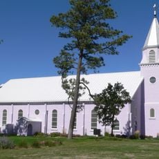
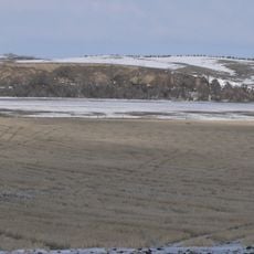
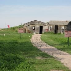
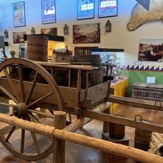
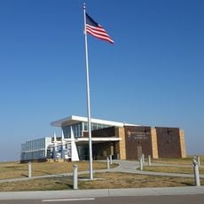
Bowring Ranch is a working cattle operation run as a state historical park in Nebraska's Sand Hills region, preserving traditional ranch structures from the early 1900s. The property includes a main house, visitor center, corrals, barns, and bunkhouses arranged across the landscape where livestock operations continue today.

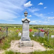
The ranch was managed by Eva Bowring after her husband Arthur's death in 1944, and she continued running it until 1985 while also serving as a United States Senator. Her leadership during this period shaped how the operation developed and adapted to changes in ranching practices.

The main house displays collections of antique china, silver, and glass that reflect daily life on a ranch in the early 1900s. These personal objects show visitors how ranch families lived and what mattered to them during that time.

Visitors need a vehicle permit to enter the property and should plan for admission fees. Guided tours are available and help explain the different buildings and how ranching work continues on the land.

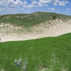
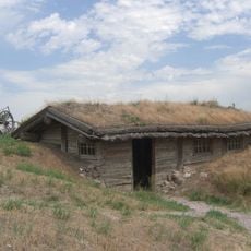
The property features a replica sod house that shows how pioneers lived in the Sand Hills region without traditional building materials. This unusual structure gives visitors insight into the extreme conditions and resourcefulness of early settlers.

Location: Cherry County

Inception: 1987

Website: https://outdoornebraska.gov/bowringranch

GPS coordinates: 42.95780,-101.67700

Latest update: December 12, 2025 14:20

Photos
Around this place
Nebraska Sand Hills Mixed Grasslands
United States of America

Nebraska Sand Hills Mixed Grasslands

101.3 km
Minuteman Missile National Historic Site
United States of America

Minuteman Missile National Historic Site

115.2 km
Wounded Knee National Historic Landmark
United States of America

Wounded Knee National Historic Landmark

59.6 km
United States of America

Spade Ranch

80.1 km
Bordeaux Trading Post
United States of America

Bordeaux Trading Post

102.8 km
Fort Niobrara National Wildlife Refuge
United States of America

Fort Niobrara National Wildlife Refuge

100.6 km
St. Francis Mission
United States of America

St. Francis Mission

69.2 km
Camp Sheridan
United States of America

Camp Sheridan

87.8 km
Lacreek National Wildlife Refuge
United States of America

Lacreek National Wildlife Refuge

17.4 km
Prairie Homestead
United States of America

Prairie Homestead

95.7 km
Bryan Bridge
United States of America

Bryan Bridge

94.7 km
Cherry County Courthouse
United States of America

Cherry County Courthouse

92.2 km
Valentine Public School
United States of America

Valentine Public School

92.6 km
Adamson Bridge
United States of America

Adamson Bridge

83.7 km
Borman Bridge
United States of America

Borman Bridge

95 km
Twin Bridge
United States of America

Twin Bridge

102.2 km
Plains Theatre
United States of America

Plains Theatre

69.3 km
Inland Theater
United States of America

Inland Theater

24.7 km
Mt. Moriah Masonic Lodge No. 155
United States of America

Mt. Moriah Masonic Lodge No. 155

98.7 km
Sheridan County Courthouse
United States of America

Sheridan County Courthouse

69.3 km
F.M. Walcott House
United States of America

F.M. Walcott House

92 km
Spotted Tail Gravesite
United States of America

Spotted Tail Gravesite

74.1 km
Lee and Gottliebe Fritz House
United States of America

Lee and Gottliebe Fritz House

46.3 km
Wounded Knee cemetery
United States of America

Wounded Knee cemetery

59.6 km
Museum of the Fur Trade
United States of America

Museum of the Fur Trade

103.1 km
Distrito electoral de Valentine (condado de Cherry, Nebraska)
United States of America

Distrito electoral de Valentine (condado de Cherry, Nebraska)

94.3 km
Ben Reifel Visitor Center
United States of America

Ben Reifel Visitor Center

90.6 km
Minuteman Missile National Historic Site Visitor Center
United States of America

Minuteman Missile National Historic Site Visitor Center

100.4 km
Show the full map
Reviews

Visited this place? Tap the stars to rate it and share your experience / photos with the community! Try now! You can cancel it anytime.

« Bowring Ranch State Historical Park - State historical park and working cattle ranch in Cherry County, United States » is provided by Around Us (aroundus.com). Images and texts are derived from Wikimedia project under a Creative Commons license. You are allowed to copy, distribute, and modify copies of this page, under the conditions set by the license, as long as this note is clearly visible.

Discover hidden gems everywhere you go!

From secret cafés to breathtaking viewpoints, skip the crowded tourist spots and find places that match your style. Our app makes it easy with voice search, smart filtering, route optimization, and insider tips from travelers worldwide. Download now for the complete mobile experience.

Around Us App Screenshot

A unique approach to discovering new places

Le Figaro

All the places worth exploring

France Info

A tailor-made excursion in just a few clicks

20 Minutes