Enable Location

We need your location to show you interesting places around you

Discover nearby places

Find interesting locations and hidden gems around you

Precise directions

Get accurate directions and distances to places

Your location is never shared with other users. It's only used when you tap the location button.

Fort Niobrara National Wildlife Refuge

Log in to your account

Start exploring — it's free

Trusted by 62,863 travelers worldwide

Continue with Google
Continue with Apple
or

We will send you a code to connect

By continuing, you accept our Terms and Conditions and our Privacy Policy

Check your inbox

We've sent a pincode in your inbox. Please enter the code below.

Fort Niobrara National Wildlife Refuge

Fort Niobrara National Wildlife Refuge, National Wildlife Refuge in northern Nebraska, United States.

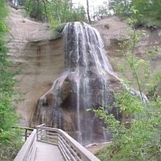
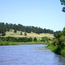
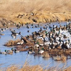
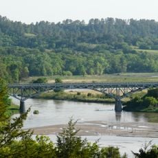
Fort Niobrara National Wildlife Refuge is a protected area in northern Nebraska covering thousands of acres with river valleys, limestone cliffs, and grassland habitats. The terrain also includes different forest types, creating spaces for many animals and plants to live.

The area first served as a U.S. Army cavalry post before being converted into a wildlife refuge in the early 1900s. This change happened to protect the region's natural resources and wildlife for the future.

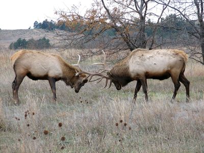
The refuge was created by conservationists who wanted to bring back bison and native animals to this region. Today the free-roaming herds represent an important effort to restore the natural prairie landscape for people to experience.

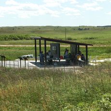
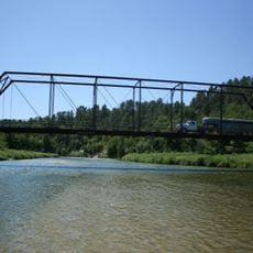
Visitors can explore the area by car, on foot, or by water using various routes and trails available. An on-site visitor center provides information to help plan your experience before heading out into the landscape.

The refuge is home to a restored bison herd that roams freely across the prairie landscape. This restoration shows how wildlife can return to places where it once lived long ago.

The community of curious travelers

AroundUs brings together thousands of curated places, local tips, and hidden gems, enriched daily by 60,000 contributors worldwide.

Start exploring
Location
GPS coordinates
42.87810,-100.44800
Latest update
December 12, 2025 14:24
Around this place
Smith Falls
United States of America

Smith Falls

10.8 km
Niobrara National Scenic River
United States of America

Niobrara National Scenic River

10.7 km
Valentine National Wildlife Refuge
United States of America

Valentine National Wildlife Refuge

44 km
St. Francis Mission
United States of America

St. Francis Mission

53.1 km
Lacreek National Wildlife Refuge
United States of America

Lacreek National Wildlife Refuge

95.9 km
Niobrara Valley Preserve
United States of America

Niobrara Valley Preserve

35.9 km
Bryan Bridge
United States of America

Bryan Bridge

8.3 km
Brewer Bridge
United States of America

Brewer Bridge

14.8 km
Carns State Aid Bridge
United States of America

Carns State Aid Bridge

80.6 km
Bell Bridge
United States of America

Bell Bridge

10.4 km
St. Augustine Church
United States of America

St. Augustine Church

85.5 km
Cherry County Courthouse
United States of America

Cherry County Courthouse

8.4 km
Valentine Public School
United States of America

Valentine Public School

8.1 km
Lewis Bridge
United States of America

Lewis Bridge

67.5 km
Adamson Bridge
United States of America

Adamson Bridge

19.9 km
St. John's Catholic Church
United States of America

St. John's Catholic Church

76.2 km
Borman Bridge
United States of America

Borman Bridge

6.6 km
Twin Bridge
United States of America

Twin Bridge

65.9 km
Tripp County Veteran's Memorial
United States of America

Tripp County Veteran's Memorial

73.4 km
Berry State Aid Bridge
United States of America

Berry State Aid Bridge

7.5 km
Herrick Elevator
United States of America

Herrick Elevator

106.6 km
Hooker County Courthouse
United States of America

Hooker County Courthouse

105.2 km
F.M. Walcott House
United States of America

F.M. Walcott House

8.7 km
Spotted Tail Gravesite
United States of America

Spotted Tail Gravesite

52.1 km
Dallas Carnegie Library
United States of America

Dallas Carnegie Library

85.6 km
Rock County Courthouse
United States of America

Rock County Courthouse

81.5 km
Manthey Barn
United States of America

Manthey Barn

65.9 km
Distrito electoral de Valentine (condado de Cherry, Nebraska)
United States of America

Distrito electoral de Valentine (condado de Cherry, Nebraska)

7 km
Show the full map
« Fort Niobrara National Wildlife Refuge - National Wildlife Refuge in northern Nebraska, United States » is provided by Around Us (aroundus.com). Images and texts are derived from Wikimedia project under a Creative Commons license. You are allowed to copy, distribute, and modify copies of this page, under the conditions set by the license, as long as this note is clearly visible.

Discover hidden gems everywhere you go!

From secret cafés to breathtaking viewpoints, skip the crowded tourist spots and find places that match your style. Our app makes it easy with voice search, smart filtering, route optimization, and insider tips from travelers worldwide. Download now for the complete mobile experience.

Around Us App Screenshot

A unique approach to discovering new places

Le Figaro

All the places worth exploring

France Info

A tailor-made excursion in just a few clicks

20 Minutes

Around Us
Travel Guide & Maps
Download

Send to your phone

QR Code
1

Open the camera app on your mobile.

2

Point at the QR code with your camera. A notification will appear.

3

Tap the notification to open the link.