Valentine National Wildlife Refuge

Log in to your account

AroundUs is a community-driven map of interesting places, built by curious explorers like you. It grows with every review, story, and photo you share.
Connect to save your favorite spots, contribute locations, and create personalized routes.
By continuing, you accept our Terms and Conditions and our Privacy Policy
Add to collection
Map
Suggest a change
Share

Valentine National Wildlife Refuge, National Wildlife Refuge in Cherry County, Nebraska, United States

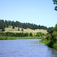
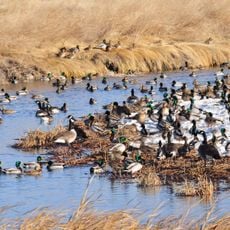
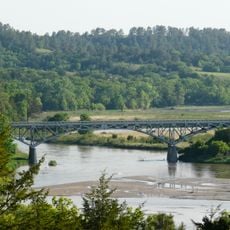
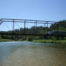
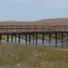
Valentine National Wildlife Refuge is a large protected area in north-central Nebraska featuring sand hills, native grasslands, lakes, and wetlands across more than 71,000 acres. The refuge provides habitat for over 260 bird species and supports diverse populations of mammals and reptiles.

The refuge was established in 1935 to protect breeding grounds for migratory birds after the landscape had been shaped by glacial activity thousands of years earlier. The sand dunes that form its foundation were created when glaciers deposited sediment across the region during ancient ice ages.

The refuge draws visitors seeking to experience native prairie and wetland ecosystems that once covered much of this region before settlement. Walking through the grasslands, visitors encounter the landscape that shaped life for countless generations across the Great Plains.

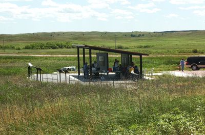
The refuge lies about 20 miles south of Valentine along US Highway 83 and welcomes visitors year-round for bird watching, fishing, hiking, and hunting. Plan for changing weather and bring appropriate gear for your chosen activity, as conditions vary significantly by season.

Within the refuge lie Research Natural Areas that protect undisturbed meadows and wetlands where over 59 mammal species and 22 reptile species live without human interference. These preserved zones allow scientists to study natural ecosystems in their original state.

Location: Nebraska

Inception: 1935

Website: https://fws.gov/refuge/valentine

GPS coordinates: 42.49360,-100.57300

Latest update: December 8, 2025 21:02

Photos
Around this place
Show the full map
Smith Falls
United States of America

Smith Falls

48.7 km
Niobrara National Scenic River
United States of America

Niobrara National Scenic River

48.2 km
Fort Niobrara National Wildlife Refuge
United States of America

Fort Niobrara National Wildlife Refuge

44 km
St. Francis Mission
United States of America

St. Francis Mission

85.2 km
Lacreek National Wildlife Refuge
United States of America

Lacreek National Wildlife Refuge

106.7 km
St. Anselm's Catholic Church, Rectory and Parish Hall
United States of America

St. Anselm's Catholic Church, Rectory and Parish Hall

113.8 km
Niobrara Valley Preserve
United States of America

Niobrara Valley Preserve

55.1 km
Bryan Bridge
United States of America

Bryan Bridge

37.9 km
Brewer Bridge
United States of America

Brewer Bridge

49.4 km
Carns State Aid Bridge
United States of America

Carns State Aid Bridge

93.4 km
Bell Bridge
United States of America

Bell Bridge

49.2 km
St. Augustine Church
United States of America

St. Augustine Church

119.4 km
Cherry County Courthouse
United States of America

Cherry County Courthouse

42.6 km
Valentine Public School
United States of America

Valentine Public School

42.5 km
Lewis Bridge
United States of America

Lewis Bridge

95 km
Adamson Bridge
United States of America

Adamson Bridge

35.8 km
St. John's Catholic Church
United States of America

St. John's Catholic Church

105.4 km
Borman Bridge
United States of America

Borman Bridge

40.1 km
Twin Bridge
United States of America

Twin Bridge

23.7 km
Tripp County Veteran's Memorial
United States of America

Tripp County Veteran's Memorial

114.3 km
Berry State Aid Bridge
United States of America

Berry State Aid Bridge

48.6 km
Hooker County Courthouse
United States of America

Hooker County Courthouse

63.5 km
F.M. Walcott House
United States of America

F.M. Walcott House

42.6 km
Spotted Tail Gravesite
United States of America

Spotted Tail Gravesite

86.3 km
Rock County Courthouse
United States of America

Rock County Courthouse

85.7 km
Manthey Barn
United States of America

Manthey Barn

102.9 km
Distrito electoral de Valentine (condado de Cherry, Nebraska)
United States of America

Distrito electoral de Valentine (condado de Cherry, Nebraska)

40.6 km
Smith Falls State Park
United States of America

Smith Falls State Park

49 km
Show the full map
Reviews

Visited this place? Tap the stars to rate it and share your experience / photos with the community! Try now! You can cancel it anytime.

« Valentine National Wildlife Refuge - National Wildlife Refuge in Cherry County, Nebraska, United States » is provided by Around Us (aroundus.com). Images and texts are derived from Wikimedia project under a Creative Commons license. You are allowed to copy, distribute, and modify copies of this page, under the conditions set by the license, as long as this note is clearly visible.

Discover hidden gems everywhere you go!

From secret cafés to breathtaking viewpoints, skip the crowded tourist spots and find places that match your style. Our app makes it easy with voice search, smart filtering, route optimization, and insider tips from travelers worldwide. Download now for the complete mobile experience.

Around Us App Screenshot

A unique approach to discovering new places

Le Figaro

All the places worth exploring

France Info

A tailor-made excursion in just a few clicks

20 Minutes