Chest opened
+${chestReward.xp} XP
Explorer
NOUVEAU ×${chestReward.collectible.quantity}
tapez pour fermer
Chest locked

Open chests in the app

Around Us is built for your phone — chests unlock when you walk, explore and capture nearby places.

Enable Location

We need your location to show you interesting places around you

Discover nearby places

Find interesting locations and hidden gems around you

Precise directions

Get accurate directions and distances to places

Your location is never shared with other users. It's only used when you tap the location button.

Log in to your account

Start exploring — it's free

Trusted by 72,894 travelers worldwide

Continue with Google
Continue with Apple
or

We will send you a code to connect

By continuing, you accept our Terms and Conditions and our Privacy Policy

Check your inbox

We've sent a pincode in your inbox. Please enter the code below.

Discussion Reviews Photo
18.8k Popularity

Port Deposit, Administrative town in Cecil County, Maryland, US

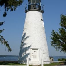
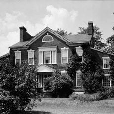
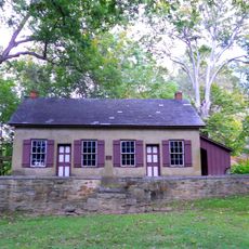
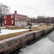
Port Deposit is a town on the eastern bank of the Susquehanna River in Maryland, where buildings were constructed from local granite quarried nearby. The streets slope downward toward the water, and older structures with their narrow windows and simple designs still define the town's appearance.

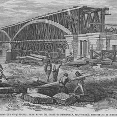
The town grew after the Susquehanna Canal opened in 1812, creating new trade routes along the river. Official incorporation came in 1824, transforming the location into a proper settlement focused on shipping and cargo transfer.

The name Port Deposit reflects its past as a stopping point where river commerce temporarily held goods before shipment onward. Walking through town today, you can still sense this trading heritage in the stone structures and how the waterfront is shaped.

The town is easily reached by car and offers parking spots along Main Street. Most shops and services are clustered on Lower Main Street and near the waterfront, making it simple to explore on foot.

The area around Port Deposit was famous for its granite quarries that supplied some of the best stone in the country. This granite was not only used locally but also shipped to larger projects in other states.

The community of curious travelers

AroundUs brings together thousands of curated places, local tips, and hidden gems, enriched daily by 60,000 contributors worldwide.

Start exploring
Location
Inception
1824
Elevation above the sea
15 m
Shares border with
Havre de Grace
GPS coordinates
39.61080,-76.10030
Latest update
December 7, 2025 10:08
Around this place
Millard E. Tydings Memorial Bridge
United States of America

Millard E. Tydings Memorial Bridge

3.3 km
Tome School
United States of America

Tome School

1.1 km
Thomas J. Hatem Memorial Bridge
United States of America

Thomas J. Hatem Memorial Bridge

5.7 km
West Nottingham Academy
United States of America

West Nottingham Academy

6.5 km
Susquehanna State Park
United States of America

Susquehanna State Park

3.7 km
Garrett Island
United States of America

Garrett Island

5.2 km
Amtrak Susquehanna River Bridge
United States of America

Amtrak Susquehanna River Bridge

6.4 km
Concord Point Light
United States of America

Concord Point Light

7.9 km
Sion Hill
United States of America

Sion Hill

5.9 km
CSX Susquehanna River Bridge
United States of America

CSX Susquehanna River Bridge

4.8 km
P.W. & B. Railroad Bridge
United States of America

P.W. & B. Railroad Bridge

6.4 km
Perry Point Mansion House and Mill
United States of America

Perry Point Mansion House and Mill

7.3 km
Port Deposit Bridge
United States of America

Port Deposit Bridge

3 km
Rodgers Tavern
United States of America

Rodgers Tavern

6.3 km
Chestnut Ridge
United States of America

Chestnut Ridge

9 km
Havre de Grace Historic District
United States of America

Havre de Grace Historic District

7.1 km
Colora Meetinghouse
United States of America

Colora Meetinghouse

7.3 km
St. Mark's Episcopal Church
United States of America

St. Mark's Episcopal Church

3.9 km
Woodlands
United States of America

Woodlands

5.8 km
Southern Terminal, Susquehanna and Tidewater Canal
United States of America

Southern Terminal, Susquehanna and Tidewater Canal

6 km
Rock Run United Methodist Church
United States of America

Rock Run United Methodist Church

8.6 km
Silver Houses Historic District
United States of America

Silver Houses Historic District

8.3 km
Paw Paw Building
United States of America

Paw Paw Building

1.6 km
Edward W. Haviland House
United States of America

Edward W. Haviland House

537 m
Winsted
United States of America

Winsted

9 km
Chesapeake House
United States of America

Chesapeake House

7.8 km
Havre De Grace Decoy Museum
United States of America

Havre De Grace Decoy Museum

8 km
Maritime Museum
United States of America

Maritime Museum

7.9 km
Show the full map
Reviews
Share your experience

No review yet

Discussions
Start a discussion...

No discussion yet

« Port Deposit - Administrative town in Cecil County, Maryland, US » is provided by Around Us (aroundus.com). Images and texts are derived from Wikimedia project under a Creative Commons license. You are allowed to copy, distribute, and modify copies of this page, under the conditions set by the license, as long as this note is clearly visible.

Discover hidden gems everywhere you go!

From secret cafés to breathtaking viewpoints, skip the crowded tourist spots and find places that match your style. Our app makes it easy with voice search, smart filtering, route optimization, and insider tips from travelers worldwide. Download now for the complete mobile experience.

Around Us App Screenshot

A unique approach to discovering new places

Le Figaro

All the places worth exploring

France Info

A tailor-made excursion in just a few clicks

20 Minutes

Around Us
Travel Guide & Maps
Download

Send to your phone

QR Code
1

Open the camera app on your mobile.

2

Point at the QR code with your camera. A notification will appear.

3

Tap the notification to open the link.