Chest opened
+${chestReward.xp} XP
Explorer
NOUVEAU ×${chestReward.collectible.quantity}
tapez pour fermer
Chest locked

Open chests in the app

Around Us is built for your phone — chests unlock when you walk, explore and capture nearby places.

Enable Location

We need your location to show you interesting places around you

Discover nearby places

Find interesting locations and hidden gems around you

Precise directions

Get accurate directions and distances to places

Your location is never shared with other users. It's only used when you tap the location button.

Log in to your account

Start exploring — it's free

Trusted by 72,931 travelers worldwide

Continue with Google
Continue with Apple
or

We will send you a code to connect

By continuing, you accept our Terms and Conditions and our Privacy Policy

Check your inbox

We've sent a pincode in your inbox. Please enter the code below.

Discussion Reviews Photo
48.3k Popularity

Indiana Territory, Former territorial region in Midwest, United States

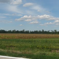
The Indiana Territory was a former administrative region in the Midwest that stretched between the Ohio River and the Great Lakes. It was divided into counties and contained settlements, farmland, and areas still inhabited by Native American nations.

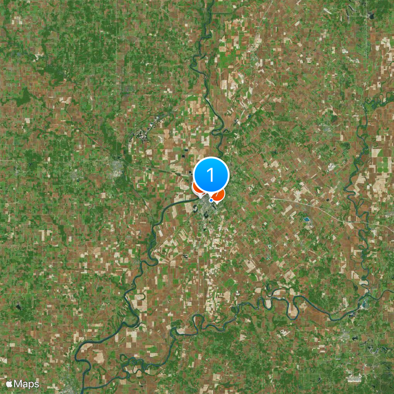
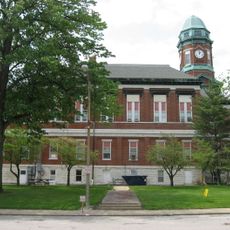
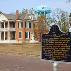
The territory was created in 1800 when President John Adams established it and appointed William Henry Harrison as its first governor, with Vincennes serving as the seat of government. It existed until 1816, when statehood followed and it became the foundation for several new states.

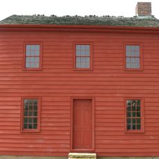
The region attracted settlers from different backgrounds: New England migrants moved in from the north, while people from Kentucky and Tennessee arrived from the south. These groups encountered existing Native American communities and created a place of mixed traditions.

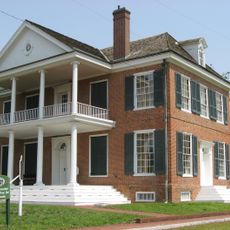
Visitors can find information at Vincennes, where remains of the historical administrative center are located. Although the territory no longer exists, historical museums and monuments help explain its past.

The population grew from about 2,600 to nearly 64,000 people in just 16 years, making it ready for statehood. This rapid expansion shows how quickly the American Midwest developed during this era.

The community of curious travelers

AroundUs brings together thousands of curated places, local tips, and hidden gems, enriched daily by 60,000 contributors worldwide.

Start exploring
Location
Inception
1800
GPS coordinates
38.67420,-87.51610
Latest update
March 8, 2026 06:27
Around this place
Grouseland
United States of America

Grouseland

1.5 km
George Rogers Clark National Historical Park
United States of America

George Rogers Clark National Historical Park

1.8 km
Forts of Vincennes
United States of America

Forts of Vincennes

1.8 km
St. Francis Xavier Cathedral and Library
United States of America

St. Francis Xavier Cathedral and Library

1.7 km
Lincoln Memorial Bridge
United States of America

Lincoln Memorial Bridge

1.9 km
Pyramid Mound
United States of America

Pyramid Mound

957 m
Indiana Territorial Capitol
United States of America

Indiana Territorial Capitol

1.4 km
United States of America

Red Skelton Memorial Bridge

3.7 km
Shadowwood
United States of America

Shadowwood

9 km
Vincennes Fortnightly Club
United States of America

Vincennes Fortnightly Club

971 m
Bridge at Thirteenth Street
United States of America

Bridge at Thirteenth Street

15 km
Swan Island Site
United States of America

Swan Island Site

20 km
Old State Bank
United States of America

Old State Bank

1.5 km
Lawrence County Courthouse
United States of America

Lawrence County Courthouse

15.7 km
Hack and Simon Office Building
United States of America

Hack and Simon Office Building

1.2 km
County Bridge No. 45
United States of America

County Bridge No. 45

21.2 km
Indiana Military Museum
United States of America

Indiana Military Museum

1.9 km
Alfred Simonson House
United States of America

Alfred Simonson House

27.8 km
Andrew Nicholson Farmstead
United States of America

Andrew Nicholson Farmstead

17.3 km
The Red Skelton Museum of American Comedy
United States of America

The Red Skelton Museum of American Comedy

1.7 km
Harrison Mansion
United States of America

Harrison Mansion

1.5 km
United States of America

Lincoln Trail State Memorial

2.2 km
United States of America

Avalon Theatre

15.7 km
United States of America

Capitol Theater

21.9 km
United States of America

Showplace 3

1.2 km
United States of America

The Bluffs

26.8 km
United States of America

Otter Pond

4.2 km
United States of America

Lucky Point

18.6 km
Show the full map
Reviews
Share your experience

No review yet

Discussions
Start a discussion...

No discussion yet

« Indiana Territory - Former territorial region in Midwest, United States » is provided by Around Us (aroundus.com). Images and texts are derived from Wikimedia project under a Creative Commons license. You are allowed to copy, distribute, and modify copies of this page, under the conditions set by the license, as long as this note is clearly visible.

Discover hidden gems everywhere you go!

From secret cafés to breathtaking viewpoints, skip the crowded tourist spots and find places that match your style. Our app makes it easy with voice search, smart filtering, route optimization, and insider tips from travelers worldwide. Download now for the complete mobile experience.

Around Us App Screenshot

A unique approach to discovering new places

Le Figaro

All the places worth exploring

France Info

A tailor-made excursion in just a few clicks

20 Minutes

Around Us
Travel Guide & Maps
Download

Send to your phone

QR Code
1

Open the camera app on your mobile.

2

Point at the QR code with your camera. A notification will appear.

3

Tap the notification to open the link.