Chest opened
+${chestReward.xp} XP
Explorer
NOUVEAU ×${chestReward.collectible.quantity}
tapez pour fermer
Chest locked

Open chests in the app

Around Us is built for your phone — chests unlock when you walk, explore and capture nearby places.

Enable Location

We need your location to show you interesting places around you

Discover nearby places

Find interesting locations and hidden gems around you

Precise directions

Get accurate directions and distances to places

Your location is never shared with other users. It's only used when you tap the location button.

Randallstown

Log in to your account

Start exploring — it's free

Trusted by 72,888 travelers worldwide

Continue with Google
Continue with Apple
or

We will send you a code to connect

By continuing, you accept our Terms and Conditions and our Privacy Policy

Check your inbox

We've sent a pincode in your inbox. Please enter the code below.

Discussion Reviews 1 Photos
17.4k Popularity

Randallstown, Census-designated place in Baltimore County, Maryland, United States

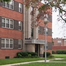
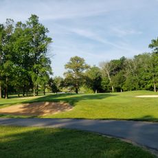
Randallstown is a residential community in the Baltimore metropolitan area with multiple parks and community facilities throughout the region. The place covers a substantial area and offers various amenities for daily life and recreation.

The settlement started in 1824 when brothers Thomas and Christopher Randall opened a tavern at a major road crossing. The place grew as a stop for travelers and later developed into a residential community.

The population of 33,655 residents represents a transformation from the 1990s, with African American residents now forming the majority demographic group.

Bus routes connect the area to surrounding neighborhoods and make it easy to move around the community and beyond. Main roads run through the region and simplify navigation whether you are traveling by car.

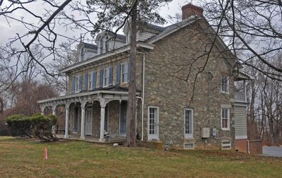
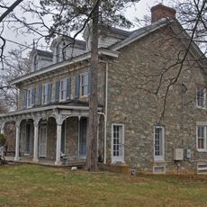
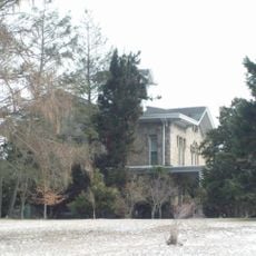
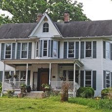
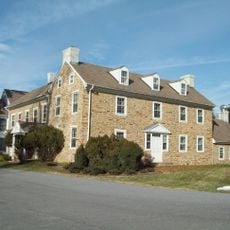
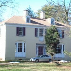
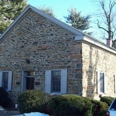
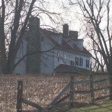
The Choate House is a historic structure recognized on the National Register of Historic Places that reflects local building traditions. Visitors can explore this well-maintained property and learn about the architectural heritage of the area.

The community of curious travelers

AroundUs brings together thousands of curated places, local tips, and hidden gems, enriched daily by 60,000 contributors worldwide.

Start exploring
Location
Inception
1824
Elevation above the sea
176 m
Shares border with
Ellicott City
GPS coordinates
39.37530,-76.79670
Latest update
December 7, 2025 19:24
Around this place
Sudbrook Park
United States of America

Sudbrook Park

5.8 km
Daniels Mill
United States of America

Daniels Mill

6.6 km
Fort Garrison
United States of America

Fort Garrison

8.1 km
Green Spring Valley Historic District
United States of America

Green Spring Valley Historic District

8.5 km
Choate House
United States of America

Choate House

1.5 km
Linwood Childrens Center
United States of America

Linwood Childrens Center

5.7 km
Caves Valley Historic District
United States of America

Caves Valley Historic District

8.5 km
Elmonte
United States of America

Elmonte

7.9 km
Granite Historic District
United States of America

Granite Historic District

5.6 km
The Meadows
United States of America

The Meadows

2.9 km
Wester Ogle
United States of America

Wester Ogle

4.4 km
Mettam Memorial Baptist Church
United States of America

Mettam Memorial Baptist Church

6.7 km
Samester Parkway Apartments
United States of America

Samester Parkway Apartments

7.8 km
Dumbarton Historic District
United States of America

Dumbarton Historic District

7.4 km
Branton Manor
United States of America

Branton Manor

8.8 km
Plinlimmon Farm
United States of America

Plinlimmon Farm

2 km
Diamond Ridge Golf Couse
United States of America

Diamond Ridge Golf Couse

5.6 km
Soldiers Delight Natural Environment Area
United States of America

Soldiers Delight Natural Environment Area

5.3 km
Linnwood
United States of America

Linnwood

7.6 km
Lower Elysville Bridge (1853)
United States of America

Lower Elysville Bridge (1853)

6.9 km
Lower Elysville Bridge (1868)
United States of America

Lower Elysville Bridge (1868)

6.9 km
Lower Elysville Bridge (1838)
United States of America

Lower Elysville Bridge (1838)

6.9 km
United States of America

Work of art, sculpture

4.4 km
United States of America

Sculpture, Work of art

7.7 km
United States of America

Work of art, sculpture

6 km
United States of America

Work of art, sculpture

5.9 km
United States of America

Work of art, sculpture

6 km
United States of America

Work of art, sculpture

7.5 km
Show the full map
Reviews
Share your experience

No review yet

Discussions
Start a discussion...

No discussion yet

« Randallstown - Census-designated place in Baltimore County, Maryland, United States » is provided by Around Us (aroundus.com). Images and texts are derived from Wikimedia project under a Creative Commons license. You are allowed to copy, distribute, and modify copies of this page, under the conditions set by the license, as long as this note is clearly visible.

Discover hidden gems everywhere you go!

From secret cafés to breathtaking viewpoints, skip the crowded tourist spots and find places that match your style. Our app makes it easy with voice search, smart filtering, route optimization, and insider tips from travelers worldwide. Download now for the complete mobile experience.

Around Us App Screenshot

A unique approach to discovering new places

Le Figaro

All the places worth exploring

France Info

A tailor-made excursion in just a few clicks

20 Minutes

Around Us
Travel Guide & Maps
Download

Send to your phone

QR Code
1

Open the camera app on your mobile.

2

Point at the QR code with your camera. A notification will appear.

3

Tap the notification to open the link.