Chest opened
+${chestReward.xp} XP
Explorer
NOUVEAU ×${chestReward.collectible.quantity}
tapez pour fermer
Chest locked

Open chests in the app

Around Us is built for your phone — chests unlock when you walk, explore and capture nearby places.

Enable Location

We need your location to show you interesting places around you

Discover nearby places

Find interesting locations and hidden gems around you

Precise directions

Get accurate directions and distances to places

Your location is never shared with other users. It's only used when you tap the location button.

Mount Airy

Log in to your account

Start exploring — it's free

Trusted by 72,875 travelers worldwide

Continue with Google
Continue with Apple
or

We will send you a code to connect

By continuing, you accept our Terms and Conditions and our Privacy Policy

Check your inbox

We've sent a pincode in your inbox. Please enter the code below.

Discussion Reviews 1 Photos
25k Popularity

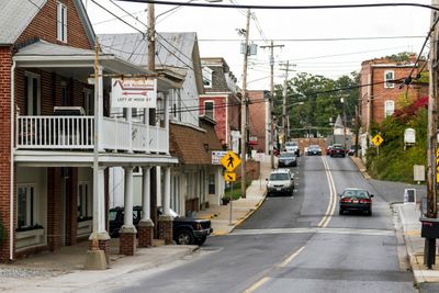
Mount Airy, Railroad town in Mount Airy, Maryland.

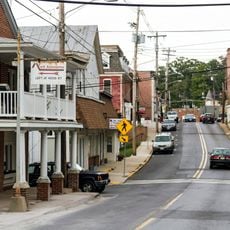
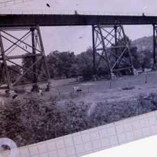
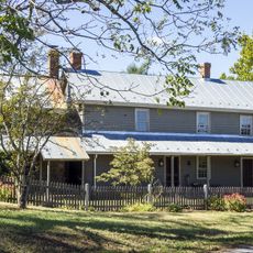
Mount Airy is a town spanning Carroll and Frederick Counties in Maryland, located along the Baltimore and Ohio Railroad route. The settlement sits at an elevation of about 238 meters on Parr's Ridge, where a major railroad tunnel built in 1895 passes beneath the ridge.

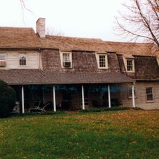
The settlement emerged in the 1830s with houses and stores along Parr's Ridge, named after an Irish railroad worker troubled by the harsh winds. The location became an important point along this early rail route.

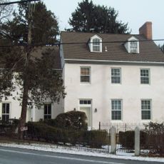
Pine Grove Chapel, constructed in 1846 as Ridge Presbyterian Church, served both religious services and education needs through its basement school for twenty years.

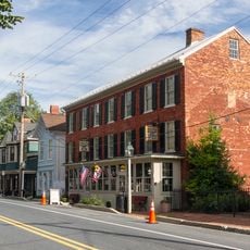
The tunnel area beneath Parr's Ridge is a notable sight, but access is limited since the railroad remains active. Visitors can explore the town and observe historic buildings to understand the early settlement pattern along this rail route.

During the Civil War, residents held southern sympathies while Maryland remained with the Union, leading to deployment of a New Jersey regiment nearby. Pine Grove Chapel became a focal point during this divided period and remains a symbol of those conflicting loyalties.

The community of curious travelers

AroundUs brings together thousands of curated places, local tips, and hidden gems, enriched daily by 60,000 contributors worldwide.

Start exploring
Location
Location
Inception
1830
Elevation above the sea
238 m
GPS coordinates
39.37470,-77.15560
Latest update
December 20, 2025 11:51
Around this place
Adventure Park USA
United States of America

Adventure Park USA

10.6 km
United States of America

Piney Run Park

14.8 km
Oakdale Manor
United States of America

Oakdale Manor

11.5 km
Mount Airy Historic District
United States of America

Mount Airy Historic District

69 m
Roberts Inn
United States of America

Roberts Inn

13 km
United States of America

Введенский монастырь (Вашингтон)

12.7 km
Little Pipe Creek bridge and viaduct
United States of America

Little Pipe Creek bridge and viaduct

9.1 km
United States of America

William and Catherine Biggs Farm

11.7 km
Abraham Jones House
United States of America

Abraham Jones House

14.3 km
Cherry Grove
United States of America

Cherry Grove

10.4 km
United States of America

Henry Nelson House

13.1 km
Hobson's Choice
United States of America

Hobson's Choice

9.3 km
Thomas Maynard House
United States of America

Thomas Maynard House

12.4 km
Drummine Farm
United States of America

Drummine Farm

9.7 km
United States of America

Pearre-Metcalfe House

12.1 km
McMurray-Frizzell-Aldridge Farm
United States of America

McMurray-Frizzell-Aldridge Farm

13.9 km
The Original Playhouse Children's Museum
United States of America

The Original Playhouse Children's Museum

9.9 km
New Market Historic District
United States of America

New Market Historic District

9.9 km
Old National Pike Milestones
United States of America

Old National Pike Milestones

10.8 km
United States of America

New Market Historic District

10 km
United States of America

Mt. Airy Theatre

130 m
United States of America

Rattlewood Golf Course

4.9 km
United States of America

Whiskey Creek Golf Course

12.3 km
United States of America

The Links at Challedon

5.4 km
United States of America

Hope Valley Golf Course

5.5 km
United States of America

West Winds Golf Club

11.8 km
United States of America

Tilt-a-Whirl

10.6 km
United States of America

Scrambler

10.6 km
Show the full map
Reviews
Share your experience

No review yet

Discussions
Start a discussion...

No discussion yet

« Mount Airy - Railroad town in Mount Airy, Maryland » is provided by Around Us (aroundus.com). Images and texts are derived from Wikimedia project under a Creative Commons license. You are allowed to copy, distribute, and modify copies of this page, under the conditions set by the license, as long as this note is clearly visible.

Discover hidden gems everywhere you go!

From secret cafés to breathtaking viewpoints, skip the crowded tourist spots and find places that match your style. Our app makes it easy with voice search, smart filtering, route optimization, and insider tips from travelers worldwide. Download now for the complete mobile experience.

Around Us App Screenshot

A unique approach to discovering new places

Le Figaro

All the places worth exploring

France Info

A tailor-made excursion in just a few clicks

20 Minutes

Around Us
Travel Guide & Maps
Download

Send to your phone

QR Code
1

Open the camera app on your mobile.

2

Point at the QR code with your camera. A notification will appear.

3

Tap the notification to open the link.