Chest opened
+${chestReward.xp} XP
Explorer
NOUVEAU ×${chestReward.collectible.quantity}
tapez pour fermer
Chest locked

Open chests in the app

Around Us is built for your phone — chests unlock when you walk, explore and capture nearby places.

Enable Location

We need your location to show you interesting places around you

Discover nearby places

Find interesting locations and hidden gems around you

Precise directions

Get accurate directions and distances to places

Your location is never shared with other users. It's only used when you tap the location button.

Blackstone River

Log in to your account

Start exploring — it's free

Trusted by 72,886 travelers worldwide

Continue with Google
Continue with Apple
or

We will send you a code to connect

By continuing, you accept our Terms and Conditions and our Privacy Policy

Check your inbox

We've sent a pincode in your inbox. Please enter the code below.

Blackstone River
Discussion Reviews 1 Photos
16.8k Popularity

Blackstone River, River system in Worcester region, Massachusetts, United States

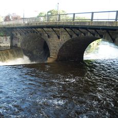
The Blackstone River is a river system flowing from Worcester, Massachusetts down to Pawtucket Falls in Rhode Island. The waterway moves through a landscape with several tributaries and natural variations in elevation along its path.

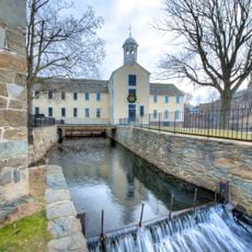
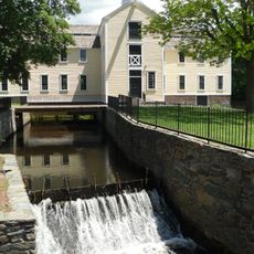
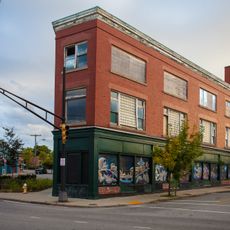
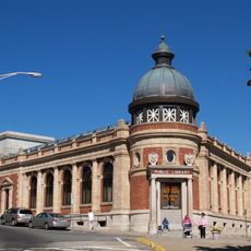
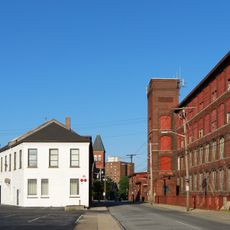
In the 1790s, Samuel Slater built one of America's first water-powered cotton mills at Pawtucket Falls. This launched industrial development along the river, which became a major center of early manufacturing.

The river is named after William Blackstone, an early European settler of the area. Indigenous people originally called this waterway Kittacuck, meaning great tidal river.

The river has several entry points along its banks for fishing, canoeing, and kayaking activities. Visitors should check local conditions and access regulations before heading out on the water.

The river's sediment holds remains from hundreds of mills that operated along its banks during the industrial era. This vanished manufacturing landscape lies hidden beneath the water's surface.

The community of curious travelers

AroundUs brings together thousands of curated places, local tips, and hidden gems, enriched daily by 60,000 contributors worldwide.

Start exploring
Location
GPS coordinates
41.87649,-71.38339
Latest update
December 7, 2025 19:26
Around this place
Blackstone River Valley National Historical Park
United States of America

Blackstone River Valley National Historical Park

138 m
Slater Mill Historic Site
United States of America

Slater Mill Historic Site

135 m
Sandra Feinstein-Gamm Theatre
United States of America

Sandra Feinstein-Gamm Theatre

494 m
United States of America

Pawtucket Falls

113 m
Pawtucket City Hall
United States of America

Pawtucket City Hall

307 m
Collyer Monument
United States of America

Collyer Monument

757 m
Pawtucket River Bridge
United States of America

Pawtucket River Bridge

358 m
Division Street Bridge
United States of America

Division Street Bridge

493 m
Charles Payne House
United States of America

Charles Payne House

873 m
Trinity Church
United States of America

Trinity Church

359 m
John E. Adams House
United States of America

John E. Adams House

892 m
St. Mary's Church of the Immaculate Conception Complex
United States of America

St. Mary's Church of the Immaculate Conception Complex

722 m
Quality Hill Historic District
United States of America

Quality Hill Historic District

616 m
Liberty Arming the Patriot
United States of America

Liberty Arming the Patriot

302 m
Gately Building
United States of America

Gately Building

375 m
Fifth Ward Wardroom
United States of America

Fifth Ward Wardroom

864 m
Main Street Bridge
United States of America

Main Street Bridge

43 m
Potter-Collyer House
United States of America

Potter-Collyer House

632 m
Pawtucket Post Office
United States of America

Pawtucket Post Office

223 m
Pitcher-Goff House
United States of America

Pitcher-Goff House

263 m
Church Hill Industrial District
United States of America

Church Hill Industrial District

500 m
Pawtucket Elks Lodge Building
United States of America

Pawtucket Elks Lodge Building

399 m
Childs-Brown House
United States of America

Childs-Brown House

701 m
Lorenzo Crandall House
United States of America

Lorenzo Crandall House

551 m
South Street Historic District
United States of America

South Street Historic District

532 m
Church Hill Grammar School
United States of America

Church Hill Grammar School

416 m
Nathaniel Montgomery House
United States of America

Nathaniel Montgomery House

496 m
Exchange Street Historic District
United States of America

Exchange Street Historic District

426 m
Show the full map
Reviews
Share your experience

No review yet

Discussions
Start a discussion...

No discussion yet

« Blackstone River - River system in Worcester region, Massachusetts, United States » is provided by Around Us (aroundus.com). Images and texts are derived from Wikimedia project under a Creative Commons license. You are allowed to copy, distribute, and modify copies of this page, under the conditions set by the license, as long as this note is clearly visible.

Discover hidden gems everywhere you go!

From secret cafés to breathtaking viewpoints, skip the crowded tourist spots and find places that match your style. Our app makes it easy with voice search, smart filtering, route optimization, and insider tips from travelers worldwide. Download now for the complete mobile experience.

Around Us App Screenshot

A unique approach to discovering new places

Le Figaro

All the places worth exploring

France Info

A tailor-made excursion in just a few clicks

20 Minutes

Around Us
Travel Guide & Maps
Download

Send to your phone

QR Code
1

Open the camera app on your mobile.

2

Point at the QR code with your camera. A notification will appear.

3

Tap the notification to open the link.