Elkins

Log in to your account

AroundUs is a community-driven map of interesting places, built by curious explorers like you. It grows with every review, story, and photo you share.
Connect to save your favorite spots, contribute locations, and create personalized routes.
By continuing, you accept our Terms and Conditions and our Privacy Policy
Add to collection
Map
Suggest a change
Share

Elkins, County seat in Randolph County, West Virginia.

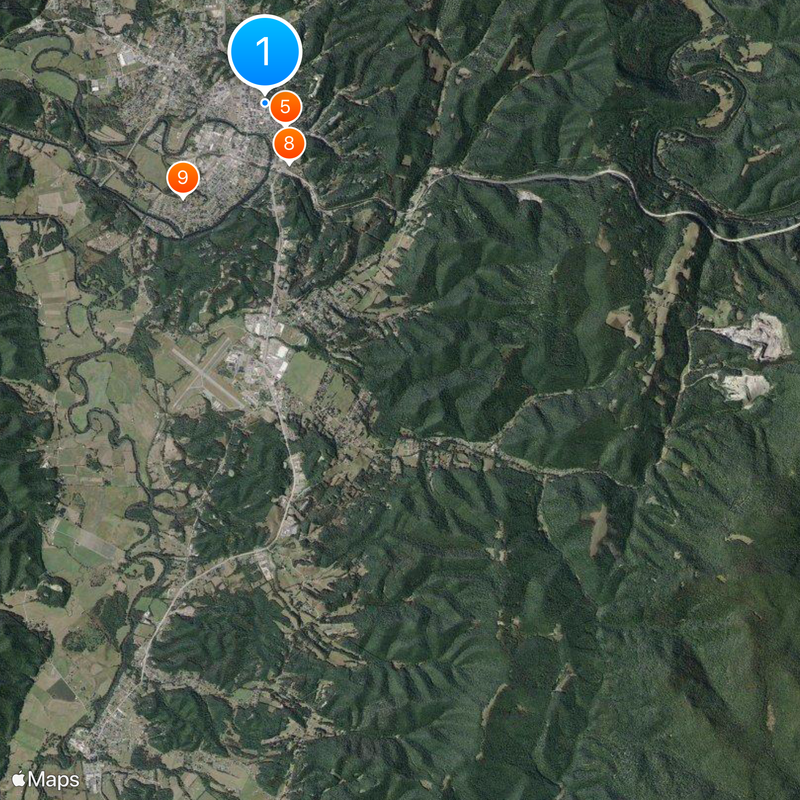
Elkins sits at 587 meters elevation along the Tygart Valley River in Randolph County, where US highways 33, 219, and 250 intersect. The town serves as the county's administrative center and regional transportation hub.

The settlement was originally called Leadsville and incorporated as a town in 1890, named after Senator Stephen Benton Elkins who championed railroad development. That railroad infrastructure helped the young town grow and thrive economically.

Davis and Elkins College shapes local education and community life, while the Mountain State Forest Festival brings traditional autumn celebrations each October. These events reflect how residents connect with the area's forest heritage and mountain traditions.

The city has Elkins-Randolph County Airport with two runways each 1,370 meters long for regional flights. Its location where three major highways meet makes it easy to reach by car.

The town became county seat in 1899 by winning a series of referendums against Beverly without any violent conflict. This peaceful transfer of administrative power was noteworthy in the region at that time.

Location: Randolph County

Elevation above the sea: 587 m

Address: Elkins, WV 26241, USA

Website: http://cityofelkinswv.com

GPS coordinates: 38.92593,-79.84666

Latest update: December 6, 2025 22:03

Photos
Around this place
Show the full map
Monongahela National Forest
United States of America

Monongahela National Forest

378 m
Audra State Park
United States of America

Audra State Park

22.8 km
Otter Creek Wilderness
United States of America

Otter Creek Wilderness

20.5 km
Bickle Knob
United States of America

Bickle Knob

10 km
Shavers Mountain
United States of America

Shavers Mountain

22.6 km
Graceland
United States of America

Graceland

599 m
Fernow Experimental Forest
United States of America

Fernow Experimental Forest

19.8 km
Laurel Fork North Wilderness
United States of America

Laurel Fork North Wilderness

24 km
Halliehurst mansion
United States of America

Halliehurst mansion

545 m
Tygart Valley Homesteads Historic District
United States of America

Tygart Valley Homesteads Historic District

17.4 km
Randolph County Courthouse and Jail
United States of America

Randolph County Courthouse and Jail

465 m
Davis and Elkins Historic District
United States of America

Davis and Elkins Historic District

548 m
Albert and Liberal Arts Halls
United States of America

Albert and Liberal Arts Halls

489 m
Gov. H. Guy Kump House
United States of America

Gov. H. Guy Kump House

974 m
Scott Hill
United States of America

Scott Hill

1.9 km
Warfield-Dye Residence
United States of America

Warfield-Dye Residence

301 m
First Ward School
United States of America

First Ward School

884 m
Bernard E. Wilmoth House
United States of America

Bernard E. Wilmoth House

14 km
Downtown Elkins Historic District
United States of America

Downtown Elkins Historic District

278 m
Wees Historic District
United States of America

Wees Historic District

400 m
Beverly Historic District
United States of America

Beverly Historic District

9.7 km
Pinecrest
United States of America

Pinecrest

826 m
Taylor-Condry House
United States of America

Taylor-Condry House

2 km
Butcher Hill Historic District
United States of America

Butcher Hill Historic District

9.4 km
Elkins Milling Company
United States of America

Elkins Milling Company

518 m
Blackman-Bosworth Store
United States of America

Blackman-Bosworth Store

9.8 km
Dr. John C. Irons House
United States of America

Dr. John C. Irons House

352 m
Beverly Heritage Center
United States of America

Beverly Heritage Center

9.8 km
Show the full map
Reviews

Visited this place? Tap the stars to rate it and share your experience / photos with the community! Try now! You can cancel it anytime.

« Elkins - County seat in Randolph County, West Virginia » is provided by Around Us (aroundus.com). Images and texts are derived from Wikimedia project under a Creative Commons license. You are allowed to copy, distribute, and modify copies of this page, under the conditions set by the license, as long as this note is clearly visible.

Discover hidden gems everywhere you go!

From secret cafés to breathtaking viewpoints, skip the crowded tourist spots and find places that match your style. Our app makes it easy with voice search, smart filtering, route optimization, and insider tips from travelers worldwide. Download now for the complete mobile experience.

Around Us App Screenshot

A unique approach to discovering new places

Le Figaro

All the places worth exploring

France Info

A tailor-made excursion in just a few clicks

20 Minutes