Enable Location

We need your location to show you interesting places around you

Discover nearby places

Find interesting locations and hidden gems around you

Precise directions

Get accurate directions and distances to places

Your location is never shared with other users. It's only used when you tap the location button.

Randolph County

Log in to your account

Start exploring — it's free

Trusted by 61,338 travelers worldwide

Continue with Google
Continue with Apple
or

We will send you a code to connect

By continuing, you accept our Terms and Conditions and our Privacy Policy

Check your inbox

We've sent a pincode in your inbox. Please enter the code below.

Randolph County, Administrative county in West Virginia, United States

Description

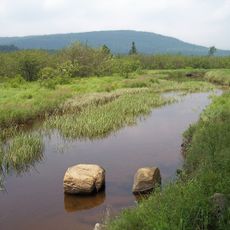
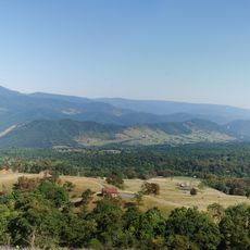
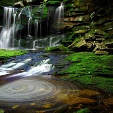
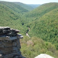
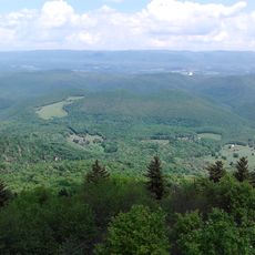
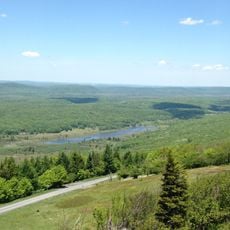
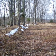
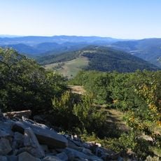
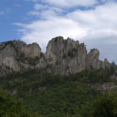
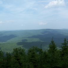
Randolph County is an administrative county in West Virginia with mountain terrain, river valleys, and diverse forests covering the landscape. The region's geography is shaped by major waterways and rolling hills throughout.

History

The county was established in 1786 when it separated from Harrison County and was named after Edmund Jennings Randolph, a Continental Congress delegate. Randolph was instrumental in drafting the U.S. Constitution.

Culture

The county operates through three magisterial districts - Tygart, Cheat, and Elkins - each represented by commissioners who meet regularly to manage local affairs.

Practical

The county is best explored by car, with roads connecting communities and natural attractions throughout the region. Plan for travel time between locations, as distances can be substantial across the area.

Did you know?

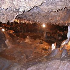
The territory contains several caves including Bowden Cave and Sinks of Gandy, which feature underground water systems and passages. These limestone formations attract visitors interested in exploring subterranean landscapes.

Location
Inception
October 16, 1786
Capital city
Elkins
Elevation above the sea
692 m
Shares border with
Tucker County, Pendleton County, Pocahontas County, Webster County, Upshur County, Barbour County, Grant County
GPS coordinates
38.78000,-79.87000
Latest update
December 7, 2025 10:08

AroundUs brings together thousands of curated places, local tips, and hidden gems, enriched daily by 60,000 contributors worldwide. Discover all places nearby (West Virginia).

Around this place
Green Bank Telescope
United States of America

Green Bank Telescope

38.7 km
Dolly Sods Wilderness
United States of America

Dolly Sods Wilderness

49.7 km
Spruce Knob
United States of America

Spruce Knob

30.6 km
Monongahela National Forest
United States of America

Monongahela National Forest

16.7 km
Cass Scenic Railroad State Park
United States of America

Cass Scenic Railroad State Park

42.8 km
Blackwater Falls
United States of America

Blackwater Falls

48.9 km
Canaan Valley Resort State Park
United States of America

Canaan Valley Resort State Park

44.3 km
Germany Valley
United States of America

Germany Valley

41.7 km
Durbin and Greenbrier Valley Railroad
United States of America

Durbin and Greenbrier Valley Railroad

26.4 km
Elakala Falls
United States of America

Elakala Falls

48.6 km
Blackwater Canyon
United States of America

Blackwater Canyon

44.9 km
Bald Knob
United States of America

Bald Knob

37.4 km
Seneca Caverns
United States of America

Seneca Caverns

41.8 km
Green Bank Interferometer
United States of America

Green Bank Interferometer

38.7 km
Audra State Park
United States of America

Audra State Park

33.6 km
Canaan Valley National Wildlife Refuge
United States of America

Canaan Valley National Wildlife Refuge

55.4 km
White Top
United States of America

White Top

17.3 km
Roaring Plains West Wilderness
United States of America

Roaring Plains West Wilderness

41.8 km
Otter Creek Wilderness
United States of America

Otter Creek Wilderness

33.8 km
Bickle Knob
United States of America

Bickle Knob

21 km
Gaudineer Scenic Area
United States of America

Gaudineer Scenic Area

17.1 km
Spruce Knob-Seneca Rocks National Recreation Area
United States of America

Spruce Knob-Seneca Rocks National Recreation Area

44 km
Olson Observation Tower
United States of America

Olson Observation Tower

43.1 km
Gaudineer Knob
United States of America

Gaudineer Knob

18.5 km
Shavers Mountain
United States of America

Shavers Mountain

33.5 km
Graceland
United States of America

Graceland

16.9 km
Reber Radio Telescope
United States of America

Reber Radio Telescope

39.2 km
40-foot telescope
United States of America

40-foot telescope

38.3 km
Show the full map
« Randolph County - Administrative county in West Virginia, United States » is provided by Around Us (aroundus.com). Images and texts are derived from Wikimedia project under a Creative Commons license. You are allowed to copy, distribute, and modify copies of this page, under the conditions set by the license, as long as this note is clearly visible.

Discover hidden gems everywhere you go!

From secret cafés to breathtaking viewpoints, skip the crowded tourist spots and find places that match your style. Our app makes it easy with voice search, smart filtering, route optimization, and insider tips from travelers worldwide. Download now for the complete mobile experience.

Around Us App Screenshot

A unique approach to discovering new places

Le Figaro

All the places worth exploring

France Info

A tailor-made excursion in just a few clicks

20 Minutes

Around Us
Travel Guide & Maps
Download

Send to your phone

QR Code
1

Open the camera app on your mobile.

2

Point at the QR code with your camera. A notification will appear.

3

Tap the notification to open the link.