Enable Location

We need your location to show you interesting places around you

Discover nearby places

Find interesting locations and hidden gems around you

Precise directions

Get accurate directions and distances to places

Your location is never shared with other users. It's only used when you tap the location button.

Elakala Falls

Log in to your account

Start exploring — it's free

Trusted by 64,488 travelers worldwide

Continue with Google
Continue with Apple
or

We will send you a code to connect

By continuing, you accept our Terms and Conditions and our Privacy Policy

Check your inbox

We've sent a pincode in your inbox. Please enter the code below.

Elakala Falls
Discussion Reviews 1 Photos
6.1k Popularity

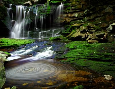
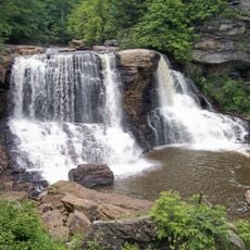
Elakala Falls, Four-tier waterfall system in Blackwater Falls State Park, West Virginia, US

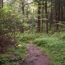
Elakala Falls is a four-tier waterfall system in Blackwater Falls State Park, West Virginia, where water flows down through a narrow forested gorge carved in sandstone. Each tier drops over rocky ledges into a small pool before continuing to the next level below.

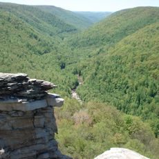
The stream cut through layers of soft sandstone over a long period, gradually shaping the steps and pools visible today. When Blackwater Falls State Park was established in the 1930s, the gorge came under protection and trails were laid out to give visitors access to each tier.

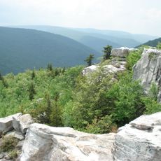
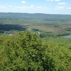
The name Elakala comes from a Native American word, and it appears on trail signs and park maps throughout the area. The gorge tends to draw visitors who prefer walking quietly through a forested ravine rather than staying near the main park facilities.

The first tier is only a few minutes' walk from the trailhead parking area on a mostly flat path, making it easy for most visitors. Reaching the lower tiers means descending on narrower, rockier trails, so sturdy footwear is a good idea.

The water runs a reddish-brown color from natural tannins released by hemlock and spruce needles decaying in the forest around the stream. The coloring deepens after rain, when the current is stronger and the hue becomes noticeably darker.

The community of curious travelers

AroundUs brings together thousands of curated places, local tips, and hidden gems, enriched daily by 60,000 contributors worldwide.

Start exploring
GPS coordinates
39.10723,-79.49918
Latest update
March 3, 2026 10:09
Around this place
Dolly Sods Wilderness
United States of America

Dolly Sods Wilderness

16.8 km
Canaan Valley
United States of America

Canaan Valley

10.7 km
Hoye-Crest
United States of America

Hoye-Crest

14.6 km
Blackwater Falls
United States of America

Blackwater Falls

324 m
Fairfax Stone State Park
United States of America

Fairfax Stone State Park

9.8 km
Canaan Valley Resort State Park
United States of America

Canaan Valley Resort State Park

9.7 km
Smoke Hole Caverns
United States of America

Smoke Hole Caverns

24.2 km
Blackwater Canyon
United States of America

Blackwater Canyon

4.3 km
Cathedral State Park
United States of America

Cathedral State Park

24.7 km
Bear Rocks Preserve
United States of America

Bear Rocks Preserve

17.8 km
Canaan Valley National Wildlife Refuge
United States of America

Canaan Valley National Wildlife Refuge

11 km
Roaring Plains West Wilderness
United States of America

Roaring Plains West Wilderness

19.7 km
Otter Creek Wilderness
United States of America

Otter Creek Wilderness

15.7 km
Bickle Knob
United States of America

Bickle Knob

27.8 km
Olson Observation Tower
United States of America

Olson Observation Tower

9 km
Shavers Mountain
United States of America

Shavers Mountain

15.2 km
Fernow Experimental Forest
United States of America

Fernow Experimental Forest

17.3 km
Tucker County Courthouse and Jail
United States of America

Tucker County Courthouse and Jail

15.7 km
Herman August Meyer House
United States of America

Herman August Meyer House

4 km
Day-Vandevander Mill
United States of America

Day-Vandevander Mill

19.6 km
Brookside Historic District
United States of America

Brookside Historic District

24.5 km
Cottrill Opera House
United States of America

Cottrill Opera House

4.8 km
Bayard Bridge
United States of America

Bayard Bridge

21.7 km
Gaymont
United States of America

Gaymont

24.5 km
United States of America

Gormania Presbyterian Church

24.5 km
Thomas Commercial Historic District
United States of America

Thomas Commercial Historic District

4.7 km
Tucker County Bank Building
United States of America

Tucker County Bank Building

15.9 km
Fairfax Stone Historical Monument
United States of America

Fairfax Stone Historical Monument

9.8 km
Show the full map
Reviews
Share your experience

No review yet

Discussions
Start a discussion...

No discussion yet

« Elakala Falls - Four-tier waterfall system in Blackwater Falls State Park, West Virginia, US » is provided by Around Us (aroundus.com). Images and texts are derived from Wikimedia project under a Creative Commons license. You are allowed to copy, distribute, and modify copies of this page, under the conditions set by the license, as long as this note is clearly visible.

Discover hidden gems everywhere you go!

From secret cafés to breathtaking viewpoints, skip the crowded tourist spots and find places that match your style. Our app makes it easy with voice search, smart filtering, route optimization, and insider tips from travelers worldwide. Download now for the complete mobile experience.

Around Us App Screenshot

A unique approach to discovering new places

Le Figaro

All the places worth exploring

France Info

A tailor-made excursion in just a few clicks

20 Minutes

Around Us
Travel Guide & Maps
Download

Send to your phone

QR Code
1

Open the camera app on your mobile.

2

Point at the QR code with your camera. A notification will appear.

3

Tap the notification to open the link.