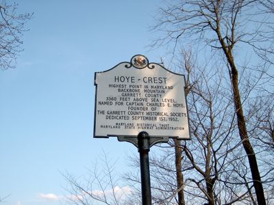
Hoye-Crest, Mountain summit in Garrett County, Maryland, United States.
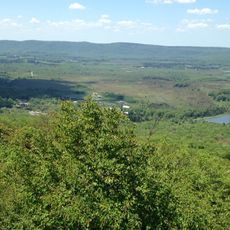
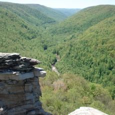
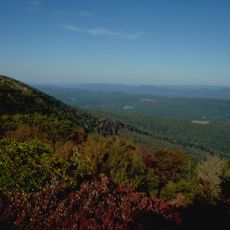
Hoye-Crest is the highest point in Maryland, rising to 1,020 meters (3,360 feet) elevation on Backbone Mountain. The summit provides expansive views across the North Branch Potomac River valley and marks the state border with West Virginia.
The peak was named in 1952 to honor Charles E. Hoye, founder of the Garrett County Historical Society, recognizing his contributions to local historical preservation. This naming established the mountain as an official geographical reference point for the state.
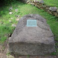
The Maryland Historical Society placed a commemorative marker at the peak, establishing its status as a significant geographical reference point for the state.
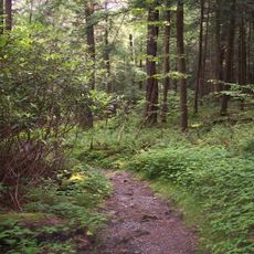
Access to the summit is via a marked trail beginning near Silver Lake on US Route 219, with red HP markings painted on trees to guide hikers. Wear sturdy footwear and stay on the marked path, as clear navigation helps ensure a safe and straightforward climb.
The summit features concrete boundary markers and maintained benches positioned exactly where Maryland and West Virginia meet. These physical markers transform the peak into an actual state border landmark rather than simply a hiking destination.
Location: Garrett County
Elevation above the sea: 1,020 m
Part of: Backbone Mountain
GPS coordinates: 39.23753,-79.48537
Latest update: December 7, 2025 19:22
Canaan Valley
15.4 km
Blackwater Falls
14.3 km
Fairfax Stone State Park
4.7 km
Canaan Valley Resort State Park
23.9 km
Elakala Falls
14.6 km
Blackwater Canyon
16.6 km
Cathedral State Park
10.9 km
Bear Rocks Preserve
24.4 km
Canaan Valley National Wildlife Refuge
18.7 km
Olson Observation Tower
17.8 km
Tucker County Courthouse and Jail
23 km
James S. Lakin House
23.5 km
Pennington Cottage
24.2 km
Herman August Meyer House
12.1 km
Oakland Historic District
20.4 km
Terra Alta Bank
23.6 km
Mountain Lake Park Historic District
19.9 km
Garrett County Courthouse
20.1 km
Creedmore
20.1 km
Brookside Historic District
10.7 km
Cottrill Opera House
9.8 km
Bayard Bridge
10.8 km
Gaymont
10.7 kmGormania Presbyterian Church
13.5 km
Thomas Commercial Historic District
9.8 km
Tucker County Bank Building
22.8 km
Downtown Rowlesburg Historic District
20.1 km
Fairfax Stone Historical Monument
4.7 kmVisited this place? Tap the stars to rate it and share your experience / photos with the community! Try now! You can cancel it anytime.
Discover hidden gems everywhere you go!
From secret cafés to breathtaking viewpoints, skip the crowded tourist spots and find places that match your style. Our app makes it easy with voice search, smart filtering, route optimization, and insider tips from travelers worldwide. Download now for the complete mobile experience.
A unique approach to discovering new places❞
— Le Figaro
All the places worth exploring❞
— France Info
A tailor-made excursion in just a few clicks❞
— 20 Minutes