Enable Location

We need your location to show you interesting places around you

Discover nearby places

Find interesting locations and hidden gems around you

Precise directions

Get accurate directions and distances to places

Your location is never shared with other users. It's only used when you tap the location button.

Otter Creek Wilderness

Log in to your account

Start exploring — it's free

Trusted by 62,520 travelers worldwide

Continue with Google
Continue with Apple
or

We will send you a code to connect

By continuing, you accept our Terms and Conditions and our Privacy Policy

Check your inbox

We've sent a pincode in your inbox. Please enter the code below.

Otter Creek Wilderness

Otter Creek Wilderness, National wilderness area in Randolph and Tucker Counties, United States.

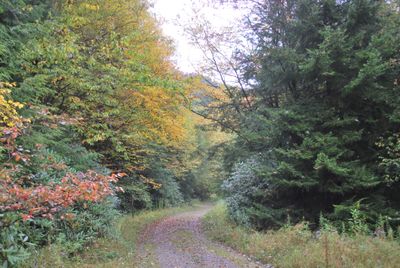
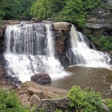
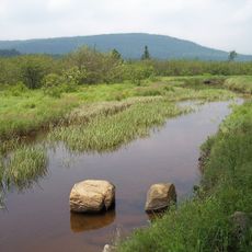
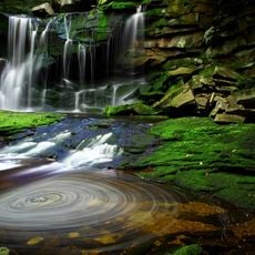
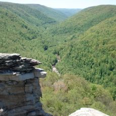
Otter Creek Wilderness is a protected mountain area with thick hardwood forests and streams running throughout more than 20,000 acres. The terrain sits between two major ridges and offers over 40 miles of trails that mostly follow old railroad grades.

The land was purchased by forest management in the early 1900s and later officially designated as a protected wilderness. This change ended commercial logging and allowed the forest to recover naturally.

The old-growth forest on Shavers Mountain shows what the landscape looked like before significant logging, with spruce and hemlock trees that have stood here for generations. For many people in West Virginia, this natural forest represents an important part of local heritage.

The trails are straightforward to follow, but you need to be careful when crossing streams, especially during rain or snowmelt. Wearing proper footwear and being ready for sudden water levels is important.

The area sits in a natural valley between two mountains, which creates a special microclimate zone. This geographic shape supports rich plant life and different forest zones at varying elevations.

The community of curious travelers

AroundUs brings together thousands of curated places, local tips, and hidden gems, enriched daily by 60,000 contributors worldwide.

Start exploring
Location
Location
Inception
January 3, 1975
GPS coordinates
39.03280,-79.65360
Latest update
December 12, 2025 09:04
Around this place
Monongahela National Forest
United States of America

Monongahela National Forest

20.4 km
Blackwater Falls
United States of America

Blackwater Falls

16 km
Canaan Valley Resort State Park
United States of America

Canaan Valley Resort State Park

16.3 km
Elakala Falls
United States of America

Elakala Falls

15.7 km
Blackwater Canyon
United States of America

Blackwater Canyon

11.6 km
Bickle Knob
United States of America

Bickle Knob

12.9 km
Olson Observation Tower
United States of America

Olson Observation Tower

9.3 km
Shavers Mountain
United States of America

Shavers Mountain

6.1 km
Graceland
United States of America

Graceland

20.4 km
Fernow Experimental Forest
United States of America

Fernow Experimental Forest

3.8 km
Halliehurst mansion
United States of America

Halliehurst mansion

20.2 km
Randolph County Courthouse and Jail
United States of America

Randolph County Courthouse and Jail

20.5 km
Tucker County Courthouse and Jail
United States of America

Tucker County Courthouse and Jail

7.5 km
Davis and Elkins Historic District
United States of America

Davis and Elkins Historic District

20.2 km
Herman August Meyer House
United States of America

Herman August Meyer House

19.7 km
Albert and Liberal Arts Halls
United States of America

Albert and Liberal Arts Halls

20.2 km
Gov. H. Guy Kump House
United States of America

Gov. H. Guy Kump House

20.8 km
St. George Academy
United States of America

St. George Academy

15.1 km
Warfield-Dye Residence
United States of America

Warfield-Dye Residence

20.2 km
Day-Vandevander Mill
United States of America

Day-Vandevander Mill

16 km
Riverside School
United States of America

Riverside School

20.7 km
Cottrill Opera House
United States of America

Cottrill Opera House

18.8 km
Downtown Elkins Historic District
United States of America

Downtown Elkins Historic District

20.8 km
Thomas Commercial Historic District
United States of America

Thomas Commercial Historic District

18.7 km
Wees Historic District
United States of America

Wees Historic District

20.1 km
Tucker County Bank Building
United States of America

Tucker County Bank Building

8.1 km
Pinecrest
United States of America

Pinecrest

20.6 km
Elkins Milling Company
United States of America

Elkins Milling Company

21 km
Show the full map
« Otter Creek Wilderness - National wilderness area in Randolph and Tucker Counties, United States » is provided by Around Us (aroundus.com). Images and texts are derived from Wikimedia project under a Creative Commons license. You are allowed to copy, distribute, and modify copies of this page, under the conditions set by the license, as long as this note is clearly visible.

Discover hidden gems everywhere you go!

From secret cafés to breathtaking viewpoints, skip the crowded tourist spots and find places that match your style. Our app makes it easy with voice search, smart filtering, route optimization, and insider tips from travelers worldwide. Download now for the complete mobile experience.

Around Us App Screenshot

A unique approach to discovering new places

Le Figaro

All the places worth exploring

France Info

A tailor-made excursion in just a few clicks

20 Minutes

Around Us
Travel Guide & Maps
Download

Send to your phone

QR Code
1

Open the camera app on your mobile.

2

Point at the QR code with your camera. A notification will appear.

3

Tap the notification to open the link.