Shavers Mountain, Mountain ridge in Randolph County, United States.
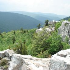
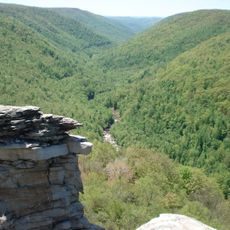
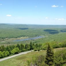
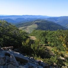
Shavers Mountain is a ridge running through eastern West Virginia with elevations exceeding 4,000 feet and slopes covered in thick forest. The terrain consists of forested ridgeline with varied woodland ecosystems along its length.
The ridge was named after Peter Shaver, an early settler who died in conflicts with Native Americans. Ellis Wyatt constructed one of the first dwellings in the area in 1848.
The ridge serves as a place where local communities practice traditional activities like hiking and hunting. People maintain these customs as part of their everyday connection to the mountain and forest.
The area is accessible via established trails and entry points throughout the Monongahela National Forest. Visitors should prepare for hilly terrain and changing weather conditions.
The Gaudineer Scenic Area at the summit preserves about 50 acres of old-growth red spruce forest in its natural state. This forest shows what the Appalachian woodlands looked like before settlement.
Location: West Virginia
Location: Randolph County
Elevation above the sea: 1,177 m
GPS coordinates: 38.99608,-79.60164
Latest update: December 12, 2025 17:48
Dolly Sods Wilderness
20.2 km
Monongahela National Forest
22.6 km
Blackwater Falls
15.5 km
Canaan Valley Resort State Park
12.1 km
Elakala Falls
15.2 km
Blackwater Canyon
12.1 km
Canaan Valley National Wildlife Refuge
22.6 km
Roaring Plains West Wilderness
16 km
Otter Creek Wilderness
6.1 km
Bickle Knob
13.2 km
Olson Observation Tower
12.3 km
Graceland
22.6 km
Fernow Experimental Forest
9.8 km
Halliehurst mansion
22.5 km
Randolph County Courthouse and Jail
22.4 km
Tucker County Courthouse and Jail
13.1 km
Davis and Elkins Historic District
22.5 km
Herman August Meyer House
19.1 km
Albert and Liberal Arts Halls
22.4 km
Gov. H. Guy Kump House
22.6 km
Warfield-Dye Residence
22.4 km
St. George Academy
20.4 km
Day-Vandevander Mill
9.9 km
Riverside School
22.8 km
Cottrill Opera House
19.4 km
Downtown Elkins Historic District
22.9 km
Thomas Commercial Historic District
19.3 km
Wees Historic District
22.2 kmVisited this place? Tap the stars to rate it and share your experience / photos with the community! Try now! You can cancel it anytime.
Discover hidden gems everywhere you go!
From secret cafés to breathtaking viewpoints, skip the crowded tourist spots and find places that match your style. Our app makes it easy with voice search, smart filtering, route optimization, and insider tips from travelers worldwide. Download now for the complete mobile experience.
A unique approach to discovering new places❞
— Le Figaro
All the places worth exploring❞
— France Info
A tailor-made excursion in just a few clicks❞
— 20 Minutes