Maunabo

Log in to your account

AroundUs is a community-driven map of interesting places, built by curious explorers like you. It grows with every review, story, and photo you share.
Connect to save your favorite spots, contribute locations, and create personalized routes.
Continue with Google
Continue with Apple
Continue with X
Continue with Facebook
Continue with email
By continuing, you accept our Terms and Conditions and our Privacy Policy
Create an account
Add to collection
Map
Suggest a change
Share

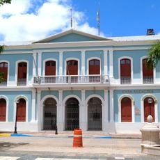
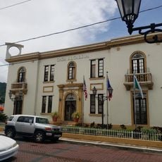
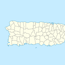
Maunabo, Administrative division in southeastern Puerto Rico, United States

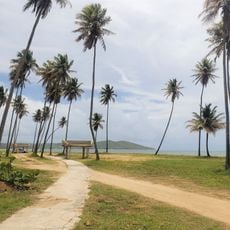
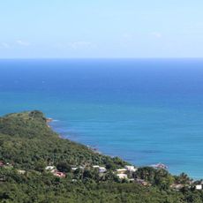
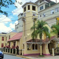
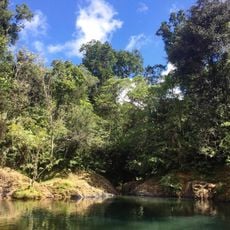
Maunabo is a municipality in southeastern Puerto Rico that extends across coastal areas and mountainous regions, with the Caribbean Sea bordering its south and east. The terrain shifts between flat coastal plains and higher hills inland.

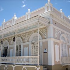
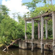
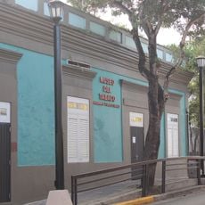
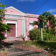
The municipality was founded in 1799 and grew from a small settlement into a sugar production center, driven by French-established plantations. This agricultural base shaped the region's economic development for generations.

The municipality keeps Puerto Rican traditions alive through celebrations like the San Pedro feast and the September Crab Festival. These events show how the community maintains its identity in daily life.

Visitors should prepare for subtropical weather, as the Caribbean location means warm temperatures year-round. The best time to explore is during the drier months, when rain is less frequent.

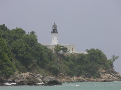
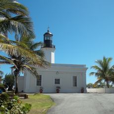
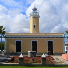
The Punta Tuna Lighthouse stands on the southeastern coast as an important nautical landmark that has long guided ships in Caribbean waters. This structure is a notable photo spot and draws visitors interested in exploring the region's maritime history.

GPS coordinates: 18.00734,-65.89955

Latest update: December 7, 2025 20:45

Photos
Around this place
Dead Dog Beach
United States of America

Dead Dog Beach

8.2 km
United States of America

Carite State Forest

19.5 km
Casa Cautiño
United States of America

Casa Cautiño

22.8 km
United States of America

Humacao Nature Reserve

22.8 km
Punta Tuna Light
United States of America

Punta Tuna Light

2.6 km
Reserva Natural de Humacao
United States of America

Reserva Natural de Humacao

23.4 km
Casa Roig Museum
United States of America

Casa Roig Museum

17.5 km
Arenas Bridge
United States of America

Arenas Bridge

28.9 km
United States of America

La Robleda Natural Protected Area

27.8 km
Bridge No. 122
United States of America

Bridge No. 122

27.3 km
Punta de las Figuras Light
United States of America

Punta de las Figuras Light

16.7 km
William Miranda Marín Botanical and Cultural Garden
United States of America

William Miranda Marín Botanical and Cultural Garden

29 km
Cayey Bridge
United States of America

Cayey Bridge

22.8 km
Punta Yeguas
United States of America

Punta Yeguas

6.7 km
José Ignacio Quintón Center for Creole Music
United States of America

José Ignacio Quintón Center for Creole Music

29 km
La Liendre Bridge
United States of America

La Liendre Bridge

28.4 km
Caguas Museum of Art
United States of America

Caguas Museum of Art

29.2 km
Aguayo Aldea Vocational High School
United States of America

Aguayo Aldea Vocational High School

28.6 km
Caguas Museum of Folk Arts
United States of America

Caguas Museum of Folk Arts

29.1 km
Caguas Museum of History
United States of America

Caguas Museum of History

29.1 km
Caguas Museum of Tobacco
United States of America

Caguas Museum of Tobacco

29.1 km
Eleuterio Derkes Grammar School
United States of America

Eleuterio Derkes Grammar School

22.6 km
Charco Azul
Puerto Rico

Charco Azul

16.9 km
La Casa del Cuento y de la Historia Cayeyana Ramón "Moncho" Gómez
United States of America

La Casa del Cuento y de la Historia Cayeyana Ramón "Moncho" Gómez

30.4 km
La Casa de la Navidad
Puerto Rico

La Casa de la Navidad

28.5 km
Casa y Museo del Poeta Luis Palés Matos
Puerto Rico

Casa y Museo del Poeta Luis Palés Matos

22.7 km
Maunabo City Hall
United States of America

Maunabo City Hall

49 m
Lago Patillas
United States of America

Lago Patillas

13.1 km
Show the full map
Reviews

Visited this place? Tap the stars to rate it and share your experience / photos with the community! Try now! You can cancel it anytime.

« Maunabo - Administrative division in southeastern Puerto Rico, United States » is provided by Around Us (aroundus.com). Images and texts are derived from Wikimedia project under a Creative Commons license. You are allowed to copy, distribute, and modify copies of this page, under the conditions set by the license, as long as this note is clearly visible.

Discover hidden gems everywhere you go!

From secret cafés to breathtaking viewpoints, skip the crowded tourist spots and find places that match your style. Our app makes it easy with voice search, smart filtering, route optimization, and insider tips from travelers worldwide. Download now for the complete mobile experience.

Around Us App Screenshot

A unique approach to discovering new places

Le Figaro

All the places worth exploring

France Info

A tailor-made excursion in just a few clicks

20 Minutes