Chest opened
+${chestReward.xp} XP
Explorer
NOUVEAU ×${chestReward.collectible.quantity}
tapez pour fermer
Chest locked

Open chests in the app

Around Us is built for your phone — chests unlock when you walk, explore and capture nearby places.

Enable Location

We need your location to show you interesting places around you

Discover nearby places

Find interesting locations and hidden gems around you

Precise directions

Get accurate directions and distances to places

Your location is never shared with other users. It's only used when you tap the location button.

Log in to your account

Start exploring — it's free

Trusted by 72,932 travelers worldwide

Continue with Google
Continue with Apple
or

We will send you a code to connect

By continuing, you accept our Terms and Conditions and our Privacy Policy

Check your inbox

We've sent a pincode in your inbox. Please enter the code below.

Discussion Reviews Photo
13.7k Popularity

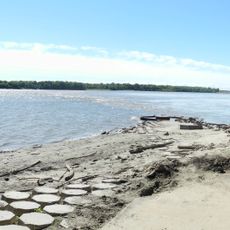
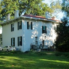
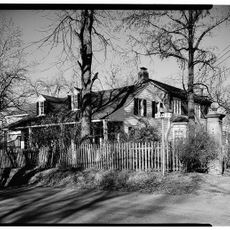
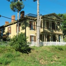
Spanish Lake, Census-designated place in St. Louis County, United States.

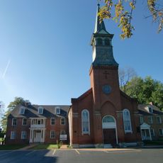
Spanish Lake is a census-designated place in northeastern St. Louis County with significant educational and federal facilities. The community is home to schools and the National Archives facility, which preserves historical records for researchers.

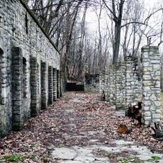
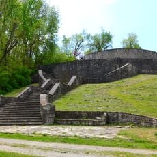
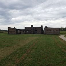
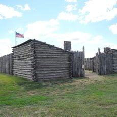
The area's name comes from Spanish military forces who established a fortified outpost in 1768, beginning European settlement there. Fort Bellefontaine, built in 1806, became the primary military installation west of the Mississippi River before being relocated in 1827.

The National Archives facility in Spanish Lake maintains extensive collections of historical records, serving researchers and genealogists from across the United States.

The area is crossed by major highways that provide good accessibility for visitors. Schools and public facilities are spread throughout and easy to reach by vehicle.

Fort Bellefontaine, established in 1806 within Spanish Lake, functioned as the primary military installation west of the Mississippi River until its relocation in 1827.

The community of curious travelers

AroundUs brings together thousands of curated places, local tips, and hidden gems, enriched daily by 60,000 contributors worldwide.

Start exploring
Location
Elevation above the sea
165 m
GPS coordinates
38.78583,-90.21278
Latest update
December 7, 2025 20:25
Around this place
Chain of Rocks Bridge
United States of America

Chain of Rocks Bridge

4.2 km
Cementland
United States of America

Cementland

5.8 km
Chain of Rocks Lock
United States of America

Chain of Rocks Lock

9.6 km
New Chain of Rocks Bridge
United States of America

New Chain of Rocks Bridge

4.1 km
Wainwright Tomb
United States of America

Wainwright Tomb

10.8 km
Melvin Price Locks and Dam
United States of America

Melvin Price Locks and Dam

10.6 km
Jones-Confluence Point State Park
United States of America

Jones-Confluence Point State Park

8.8 km
Fort Belle Fontaine
United States of America

Fort Belle Fontaine

4.6 km
Columbia Bottom Conservation Area
United States of America

Columbia Bottom Conservation Area

5.9 km
Norwood Hills Country Club
United States of America

Norwood Hills Country Club

9.4 km
Old St. Ferdinand Shrine
United States of America

Old St. Ferdinand Shrine

10.6 km
Confluence Tower
United States of America

Confluence Tower

10.1 km
Fort Belle Fontaine County Park
United States of America

Fort Belle Fontaine County Park

4.4 km
Ferguson Municipal Public Library
United States of America

Ferguson Municipal Public Library

9.2 km
Lewis Bridge
United States of America

Lewis Bridge

6.7 km
Bellefontaine Bridge
United States of America

Bellefontaine Bridge

6.7 km
Wildwood House
United States of America

Wildwood House

8.2 km
Casa Alvarez
United States of America

Casa Alvarez

10.2 km
John B. Myers House and Barn
United States of America

John B. Myers House and Barn

10.9 km
Colonel George H. Blasé Park
United States of America

Colonel George H. Blasé Park

5 km
Gen. Daniel Bissell House
United States of America

Gen. Daniel Bissell House

3.5 km
Archambault House
United States of America

Archambault House

9.8 km
Barton House
United States of America

Barton House

9.9 km
Hanson House
United States of America

Hanson House

9.9 km
Lewis & Clark Interpretive Center
United States of America

Lewis & Clark Interpretive Center

9.8 km
Chain of Rocks Water Purification Plant
United States of America

Chain of Rocks Water Purification Plant

4.1 km
James J Eagan Center
United States of America

James J Eagan Center

7.5 km
Lewis and Clark State Historic Site
United States of America

Lewis and Clark State Historic Site

9.8 km
Show the full map
Reviews
Share your experience

No review yet

Discussions
Start a discussion...

No discussion yet

« Spanish Lake - Census-designated place in St. Louis County, United States » is provided by Around Us (aroundus.com). Images and texts are derived from Wikimedia project under a Creative Commons license. You are allowed to copy, distribute, and modify copies of this page, under the conditions set by the license, as long as this note is clearly visible.

Discover hidden gems everywhere you go!

From secret cafés to breathtaking viewpoints, skip the crowded tourist spots and find places that match your style. Our app makes it easy with voice search, smart filtering, route optimization, and insider tips from travelers worldwide. Download now for the complete mobile experience.

Around Us App Screenshot

A unique approach to discovering new places

Le Figaro

All the places worth exploring

France Info

A tailor-made excursion in just a few clicks

20 Minutes

Around Us
Travel Guide & Maps
Download

Send to your phone

QR Code
1

Open the camera app on your mobile.

2

Point at the QR code with your camera. A notification will appear.

3

Tap the notification to open the link.