Coshocton

Log in to your account

AroundUs is a community-driven map of interesting places, built by curious explorers like you. It grows with every review, story, and photo you share.
Connect to save your favorite spots, contribute locations, and create personalized routes.
Continue with Google
Continue with Apple
Continue with X
Continue with Facebook
Continue with email
By continuing, you accept our Terms and Conditions and our Privacy Policy
Create an account
Add to collection
Map
Suggest a change
Share

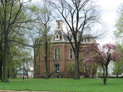
Coshocton, County seat in Southeast Ohio, United States

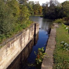
Coshocton sits where the Walhonding and Tuscarawas Rivers meet and flow together to form the Muskingum River at an elevation of 235 meters (771 feet). The city's geography centers on these waterways, which shaped its location and early growth.

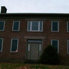
The area began as a Lenape village in the 1770s before developing into an established town in 1802. It received its current name in 1811 when designated as the county seat.

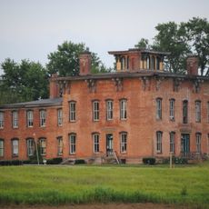
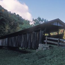
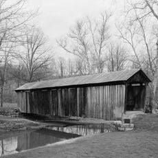
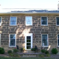
Roscoe Village within the city preserves structures from the era when the Ohio and Erie Canal shaped the region's growth. Walking through, you see period buildings and working craftspeople that reveal how water transport connected communities.

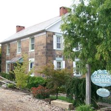
The town provides easy access to riverbanks and Roscoe Village, which you can explore on foot at your own pace. Hotels, restaurants, and shops cluster in the downtown area, making navigation straightforward without a car.

The town is credited with founding the specialty advertising industry and houses the nation's largest maker of American flags. These two industries reveal an unexpected commercial side to the region's story beyond river trade and canals.

Location: Coshocton County

Inception: 1802

Elevation above the sea: 235 m

Part of: Southeast Ohio

Website: http://coshoctoncityhall.com

GPS coordinates: 40.26780,-81.85670

Latest update: December 20, 2025 14:02

Photos
Around this place
Prospect Place
United States of America

Prospect Place

19.8 km
Age of Steam Roundhouse
United States of America

Age of Steam Roundhouse

28.5 km
Roscoe Village
United States of America

Roscoe Village

1.9 km
United States of America

Johnson-Humrickhouse Museum

2 km
Helmick Covered Bridge
United States of America

Helmick Covered Bridge

15.7 km
United States of America

Welling Site

19.3 km
Adams-Gray House
United States of America

Adams-Gray House

14.4 km
S Bridge II
United States of America

S Bridge II

32 km
Coshocton County Courthouse
United States of America

Coshocton County Courthouse

1.1 km
Booth Homestead
United States of America

Booth Homestead

24.7 km
Salt Creek Covered Bridge
United States of America

Salt Creek Covered Bridge

30 km
United States of America

George W. Adams House

20.3 km
Muskingum River Navigation Historic District
United States of America

Muskingum River Navigation Historic District

2.5 km
Ralph Hardesty Stone House
United States of America

Ralph Hardesty Stone House

31.9 km
Samuel Harper Stone House
United States of America

Samuel Harper Stone House

28.6 km
United States of America

James Hunter Stone House

22.5 km
Longaberger Homestead
United States of America

Longaberger Homestead

20.8 km
United States of America

Woodbury Wildlife Area

15.1 km
Indian Camp Covered Bridge
United States of America

Indian Camp Covered Bridge

24.7 km
Dresden Suspension Bridge
United States of America

Dresden Suspension Bridge

20.4 km
United States of America

Muskingum College Campus Historic District

31.9 km
United States of America

Hickory Flats Golf Course

9.2 km
United States of America

Green Valley Golf Course

31.7 km
United States of America

Vista Golf Course

30.1 km
United States of America

Wildfire Golf Club

27.9 km
United States of America

World's Largest Basket

20.8 km

Coshocton Airport Amphitheater Stage

4.5 km
United States of America

Waterfall

6.8 km
Show the full map
Reviews

Visited this place? Tap the stars to rate it and share your experience / photos with the community! Try now! You can cancel it anytime.

« Coshocton - County seat in Southeast Ohio, United States » is provided by Around Us (aroundus.com). Images and texts are derived from Wikimedia project under a Creative Commons license. You are allowed to copy, distribute, and modify copies of this page, under the conditions set by the license, as long as this note is clearly visible.

Discover hidden gems everywhere you go!

From secret cafés to breathtaking viewpoints, skip the crowded tourist spots and find places that match your style. Our app makes it easy with voice search, smart filtering, route optimization, and insider tips from travelers worldwide. Download now for the complete mobile experience.

Around Us App Screenshot

A unique approach to discovering new places

Le Figaro

All the places worth exploring

France Info

A tailor-made excursion in just a few clicks

20 Minutes