Enable Location

We need your location to show you interesting places around you

Discover nearby places

Find interesting locations and hidden gems around you

Precise directions

Get accurate directions and distances to places

Your location is never shared with other users. It's only used when you tap the location button.

Salem

Log in to your account

Start exploring — it's free

Trusted by 62,823 travelers worldwide

Continue with Google
Continue with Apple
or

We will send you a code to connect

By continuing, you accept our Terms and Conditions and our Privacy Policy

Check your inbox

We've sent a pincode in your inbox. Please enter the code below.

Salem, County seat in Salem County, New Jersey, US

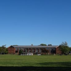
Salem is the county seat of Salem County and sits along the Delaware River on New Jersey's western edge. The city has a flat landscape and serves as the local government hub for the surrounding area.

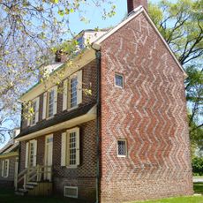
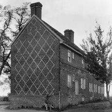
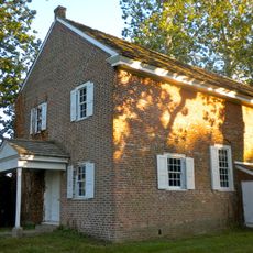
John Fenwick laid out the original settlement plan in 1675, establishing the town's foundational layout. The community gradually gained local control, eventually earning the right to appoint its own officials in the following decades.

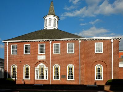
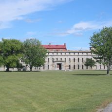
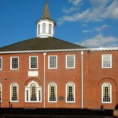
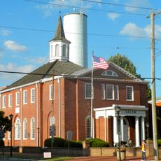
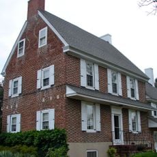
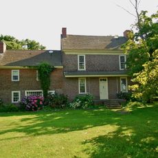
The Old Salem County Courthouse, built in 1735 from local bricks, continues to operate and shapes the character of the town center. Visitors can see how the structure reflects the building practices and craftsmanship of that colonial period.

The city offices are located in a central building with ample parking available behind it for visitors. Side entrances ensure accessibility, making it easy to find local services and navigate the town.

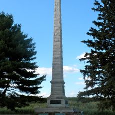
During the American Revolution, a 1778 raid led to significant trials at the courthouse involving residents accused of supporting British forces. These trials marked a dramatic moment in the town's story during the war.

The community of curious travelers

AroundUs brings together thousands of curated places, local tips, and hidden gems, enriched daily by 60,000 contributors worldwide.

Start exploring
Location
Inception
October 1675
Elevation above the sea
3 m
Shares border with
Pennsville Township, Mannington Township, Quinton Township, Lower Alloways Creek Township, Elsinboro Township
GPS coordinates
39.56820,-75.47250
Latest update
December 19, 2025 22:57
Around this place
Fort Delaware
United States of America

Fort Delaware

8.9 km
Fort Mott State Park
United States of America

Fort Mott State Park

7.9 km
Finn's Point National Cemetery
United States of America

Finn's Point National Cemetery

8 km
Hancock House
United States of America

Hancock House

6.8 km
Fort Delaware State Park
United States of America

Fort Delaware State Park

9 km
Fort DuPont
United States of America

Fort DuPont

9.5 km
Fort DuPont State Park
United States of America

Fort DuPont State Park

9.5 km
Reedy Point Bridge
United States of America

Reedy Point Bridge

9.5 km
United States of America

Killcohook National Wildlife Refuge

9.5 km
Supawna Meadows National Wildlife Refuge
United States of America

Supawna Meadows National Wildlife Refuge

7.9 km
Old Salem County Courthouse
United States of America

Old Salem County Courthouse

752 m
Finns Point Range Light
United States of America

Finns Point Range Light

7.6 km
Abel and Mary Nicholson House
United States of America

Abel and Mary Nicholson House

5.6 km
Alloways Creek Friends Meetinghouse
United States of America

Alloways Creek Friends Meetinghouse

7.4 km
Market Street Historic District
United States of America

Market Street Historic District

851 m
Finn's Point Rear Range Light
United States of America

Finn's Point Rear Range Light

7.6 km
Baker Shoal Range Rear Light
United States of America

Baker Shoal Range Rear Light

8.9 km
Broadway Historic District
United States of America

Broadway Historic District

460 m
Benjamin Holmes House
United States of America

Benjamin Holmes House

4.3 km
Richard Brick House
United States of America

Richard Brick House

9.2 km
Sarah and Samuel Nicholson House
United States of America

Sarah and Samuel Nicholson House

3.3 km
Hedge-Carpenter-Thompson Historic District
United States of America

Hedge-Carpenter-Thompson Historic District

393 m
Joseph Ware House
United States of America

Joseph Ware House

7 km
United States of America

Alloway Lake Dam

9.5 km
United States of America

Dreamland Theatre

578 m
United States of America

Market Street Historic District

838 m
United States of America

Marshalltown Historic District

7.9 km
United States of America

Fort Elfsborg

5.1 km
Show the full map
« Salem - County seat in Salem County, New Jersey, US » is provided by Around Us (aroundus.com). Images and texts are derived from Wikimedia project under a Creative Commons license. You are allowed to copy, distribute, and modify copies of this page, under the conditions set by the license, as long as this note is clearly visible.

Discover hidden gems everywhere you go!

From secret cafés to breathtaking viewpoints, skip the crowded tourist spots and find places that match your style. Our app makes it easy with voice search, smart filtering, route optimization, and insider tips from travelers worldwide. Download now for the complete mobile experience.

Around Us App Screenshot

A unique approach to discovering new places

Le Figaro

All the places worth exploring

France Info

A tailor-made excursion in just a few clicks

20 Minutes

Around Us
Travel Guide & Maps
Download

Send to your phone

QR Code
1

Open the camera app on your mobile.

2

Point at the QR code with your camera. A notification will appear.

3

Tap the notification to open the link.