Enable Location

We need your location to show you interesting places around you

Discover nearby places

Find interesting locations and hidden gems around you

Precise directions

Get accurate directions and distances to places

Your location is never shared with other users. It's only used when you tap the location button.

Frackville

Log in to your account

Start exploring — it's free

Trusted by 68,218 travelers worldwide

Continue with Google
Continue with Apple
or

We will send you a code to connect

By continuing, you accept our Terms and Conditions and our Privacy Policy

Check your inbox

We've sent a pincode in your inbox. Please enter the code below.

Discussion Reviews 1 Photos
15.5k Popularity

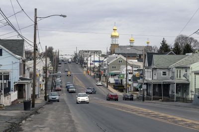
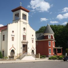
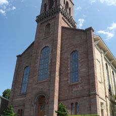
Frackville, Administrative borough in Schuylkill County, Pennsylvania, United States.

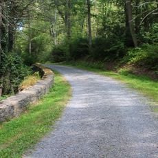
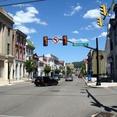
Frackville is an administrative borough in Schuylkill County, Pennsylvania, situated on the north slope of Broad Mountain. Located at the intersection of Interstate 81 and State Route 61, the borough sits at approximately 1,470 feet elevation.

The borough formed in 1876 from the merger of two villages, Frackville and Mountain City, taking its name from early settler Daniel Frack. This consolidation reflected the region's growth during the coal-mining era.

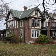
The Dutch Kitchen diner serves as a gathering place where residents maintain connections to their Pennsylvania German and coal-mining heritage. Locals gather here to preserve ties to their community's past.

Interstate 81 offers direct access to Philadelphia about 102 miles southeast and Scranton about 60 miles northeast. Local police from Borough Hall can assist with information and directions around the area.

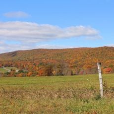
The Mahanoy Plane was a remarkable inclined railway that operated until 1931, moving approximately 50,000 tons of coal daily up the steep grade of Broad Mountain north of here. This engineering achievement shows the scale of infrastructure needed to extract and transport coal from the region.

The community of curious travelers

AroundUs brings together thousands of curated places, local tips, and hidden gems, enriched daily by 60,000 contributors worldwide.

Start exploring
GPS coordinates
40.78398,-76.23022
Latest update
December 7, 2025 19:30
Around this place
Locust Lake State Park
United States of America

Locust Lake State Park

7.5 km
Tuscarora State Park
United States of America

Tuscarora State Park

17.4 km
Assumption of the Blessed Virgin Mary Ukrainian Catholic Church
United States of America

Assumption of the Blessed Virgin Mary Ukrainian Catholic Church

9.9 km
Weiser State Forest
United States of America

Weiser State Forest

17.4 km
Frank D. Yuengling Mansion
United States of America

Frank D. Yuengling Mansion

11.9 km
Buck Mountain
United States of America

Buck Mountain

18.7 km
John O'Hara House
United States of America

John O'Hara House

11.6 km
Mary Queen of Peace Catholic Church Pottsville, Pennsylvania
United States of America

Mary Queen of Peace Catholic Church Pottsville, Pennsylvania

10.4 km
St. John the Baptist Church
United States of America

St. John the Baptist Church

11.8 km
Burd Patterson House
United States of America

Burd Patterson House

11.7 km
Wagner Covered Bridge No. 19
United States of America

Wagner Covered Bridge No. 19

17.1 km
Pottsville Downtown Historic District
United States of America

Pottsville Downtown Historic District

11.6 km
Tamaqua Historic District
United States of America

Tamaqua Historic District

23 km
St. Paul's Union Church and Cemetery
United States of America

St. Paul's Union Church and Cemetery

8.5 km
Lake Glory
United States of America

Lake Glory

23.5 km
Davis Covered Bridge
United States of America

Davis Covered Bridge

22.6 km
Kreigbaum Covered Bridge
United States of America

Kreigbaum Covered Bridge

24.5 km
Mountain Grove Campground
United States of America

Mountain Grove Campground

22.1 km
Johnson Covered Bridge No. 28
United States of America

Johnson Covered Bridge No. 28

23.8 km
Furnace Covered Bridge No. 11
United States of America

Furnace Covered Bridge No. 11

23.7 km
Anthracite Bank Building
United States of America

Anthracite Bank Building

21.7 km
George Ormrod House
United States of America

George Ormrod House

21.7 km
New Ringgold Gristmill
United States of America

New Ringgold Gristmill

21.5 km
Snyder Covered Bridge No. 17
United States of America

Snyder Covered Bridge No. 17

19 km
Pioneer Tunnel Coal Mine
United States of America

Pioneer Tunnel Coal Mine

10.3 km
Big Mine Run Geyser
United States of America

Big Mine Run Geyser

7.5 km
Pioneer Tunnel Coal Mine & Steam Train
United States of America

Pioneer Tunnel Coal Mine & Steam Train

10.3 km
Eagle Rock Ski Resort
United States of America

Eagle Rock Ski Resort

19 km
Show the full map
Reviews
Share your experience

No review yet

Discussions
Start a discussion...

No discussion yet

« Frackville - Administrative borough in Schuylkill County, Pennsylvania, United States » is provided by Around Us (aroundus.com). Images and texts are derived from Wikimedia project under a Creative Commons license. You are allowed to copy, distribute, and modify copies of this page, under the conditions set by the license, as long as this note is clearly visible.

Discover hidden gems everywhere you go!

From secret cafés to breathtaking viewpoints, skip the crowded tourist spots and find places that match your style. Our app makes it easy with voice search, smart filtering, route optimization, and insider tips from travelers worldwide. Download now for the complete mobile experience.

Around Us App Screenshot

A unique approach to discovering new places

Le Figaro

All the places worth exploring

France Info

A tailor-made excursion in just a few clicks

20 Minutes

Around Us
Travel Guide & Maps
Download

Send to your phone

QR Code
1

Open the camera app on your mobile.

2

Point at the QR code with your camera. A notification will appear.

3

Tap the notification to open the link.