Chest opened
+${chestReward.xp} XP
Explorer
NOUVEAU ×${chestReward.collectible.quantity}
tapez pour fermer
Chest locked

Open chests in the app

Around Us is built for your phone — chests unlock when you walk, explore and capture nearby places.

Enable Location

We need your location to show you interesting places around you

Discover nearby places

Find interesting locations and hidden gems around you

Precise directions

Get accurate directions and distances to places

Your location is never shared with other users. It's only used when you tap the location button.

Monocacy River

Log in to your account

Start exploring — it's free

Trusted by 72,891 travelers worldwide

Continue with Google
Continue with Apple
or

We will send you a code to connect

By continuing, you accept our Terms and Conditions and our Privacy Policy

Check your inbox

We've sent a pincode in your inbox. Please enter the code below.

Monocacy River
Discussion Reviews 1 Photos
9.6k Popularity

Monocacy River, River system in Maryland, United States

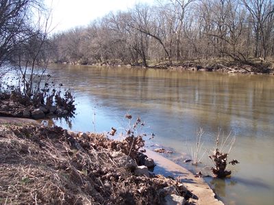
Monocacy River is a river in Maryland, formed where Marsh Creek and Rock Creek meet near the Pennsylvania border. From there it flows south through farmland and wooded stretches before reaching the Potomac River.

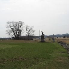
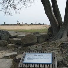
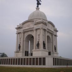
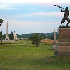
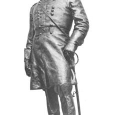
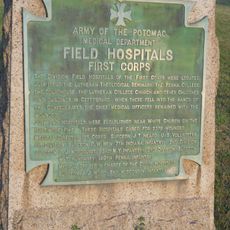
Long before European settlers arrived, indigenous peoples used the river as a travel and trade route through the region. In the summer of 1864, a Civil War battle was fought on its banks, where Union forces slowed a Confederate advance toward Washington.

The name Monocacy comes from a Shawnee word that refers to the many bends of the river. Walking along the banks, visitors can see exactly why: the river curves repeatedly through the Maryland countryside in wide, unhurried loops.

The river has several launch points for canoes and kayaks, making it possible to paddle different sections depending on the time of year. Water levels change with the seasons, so checking conditions before heading out is a good habit.

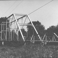
At one point, the river does not pass under the Chesapeake and Ohio Canal but rather through an aqueduct that carries the canal's water above the river. This allowed canal boats to cross the river without leaving the water, which was a practical solution at the time.

The community of curious travelers

AroundUs brings together thousands of curated places, local tips, and hidden gems, enriched daily by 60,000 contributors worldwide.

Start exploring
Location
GPS coordinates
39.71972,-77.21750
Latest update
March 3, 2026 10:12
Around this place
High-water mark of the Confederacy
United States of America

High-water mark of the Confederacy

10.4 km
Eisenhower National Historic Site
United States of America

Eisenhower National Historic Site

9.1 km
The Angle
United States of America

The Angle

10.6 km
Sachs Covered Bridge
United States of America

Sachs Covered Bridge

10 km
Gettysburg National Military Park Museum and Visitor Center
United States of America

Gettysburg National Military Park Museum and Visitor Center

10.3 km
National Shrine of St. Elizabeth Ann Seton
United States of America

National Shrine of St. Elizabeth Ann Seton

10 km
The Pennsylvania State Memorial
United States of America

The Pennsylvania State Memorial

9.9 km
Gettysburg National Tower
United States of America

Gettysburg National Tower

10.7 km
St. Joseph's College and Mother Seton Shrine
United States of America

St. Joseph's College and Mother Seton Shrine

9.4 km
Gettysburg Battlefield Historic District
United States of America

Gettysburg Battlefield Historic District

10.8 km
National Fallen Firefighters Memorial
United States of America

National Fallen Firefighters Memorial

9.7 km
72nd Pennsylvania Infantry Monument
United States of America

72nd Pennsylvania Infantry Monument

10.5 km
Terra Rubra
United States of America

Terra Rubra

10.9 km
High Water Mark of the Rebellion Monument
United States of America

High Water Mark of the Rebellion Monument

10.4 km
Virginia Monument
United States of America

Virginia Monument

10.9 km
Gettysburg National Museum
United States of America

Gettysburg National Museum

11 km
Alabama State Monument
United States of America

Alabama State Monument

8.1 km
Bullfrog Road Bridge
United States of America

Bullfrog Road Bridge

3.3 km
Antrim
United States of America

Antrim

8.2 km
Taneytown Historic District
United States of America

Taneytown Historic District

7.8 km
Winfield Scott Hancock
United States of America

Winfield Scott Hancock

9.9 km
Emmitsburg Historic District
United States of America

Emmitsburg Historic District

9.6 km
Winemiller Family Farm
United States of America

Winemiller Family Farm

10.1 km
Fourpoints Bridge
United States of America

Fourpoints Bridge

9 km
Bridge in Cumberland Township
United States of America

Bridge in Cumberland Township

7.1 km
Rock Creek-White Run Union Hospital Complex
United States of America

Rock Creek-White Run Union Hospital Complex

7.8 km
Spangler-Benner Farm
United States of America

Spangler-Benner Farm

2.8 km
St. Euphemia's School and Sisters' House
United States of America

St. Euphemia's School and Sisters' House

9.4 km
Show the full map
Reviews
Share your experience

No review yet

Discussions
Start a discussion...

No discussion yet

« Monocacy River - River system in Maryland, United States » is provided by Around Us (aroundus.com). Images and texts are derived from Wikimedia project under a Creative Commons license. You are allowed to copy, distribute, and modify copies of this page, under the conditions set by the license, as long as this note is clearly visible.

Discover hidden gems everywhere you go!

From secret cafés to breathtaking viewpoints, skip the crowded tourist spots and find places that match your style. Our app makes it easy with voice search, smart filtering, route optimization, and insider tips from travelers worldwide. Download now for the complete mobile experience.

Around Us App Screenshot

A unique approach to discovering new places

Le Figaro

All the places worth exploring

France Info

A tailor-made excursion in just a few clicks

20 Minutes

Around Us
Travel Guide & Maps
Download

Send to your phone

QR Code
1

Open the camera app on your mobile.

2

Point at the QR code with your camera. A notification will appear.

3

Tap the notification to open the link.