Enable Location

We need your location to show you interesting places around you

Discover nearby places

Find interesting locations and hidden gems around you

Precise directions

Get accurate directions and distances to places

Your location is never shared with other users. It's only used when you tap the location button.

Fort Crown Point

Log in to your account

Join the adventure

Create your free account and start exploring (like 60k+ others)

We will send you a code to connect

or
Continue with Google
Continue with Apple
By continuing, you accept our Terms and Conditions and our Privacy Policy

Check your inbox

We've sent a pincode in your inbox. Please enter the code below.

Fort Crown Point, Military fortress in Crown Point, United States.

Description

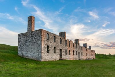
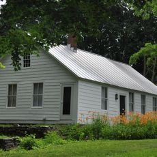
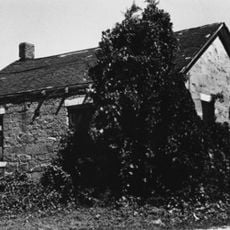
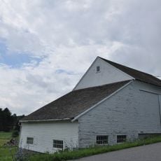
Fort Crown Point is a military fortress on a peninsula at Lake Champlain with substantial earthen ramparts and two surviving barracks buildings from the colonial era. The ruins reveal the remains of a complex defensive layout with multiple bastions and interconnected fortification lines.

History

The British built Fort Crown Point in 1759 during the French and Indian War as the largest earthen fortress in North America. After initial use, the site was eventually abandoned but its substantial fortifications remained partially intact through the following centuries.

Culture

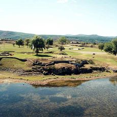
The fort complex displays remains from French and British periods, reflecting how different powers shaped the Champlain Valley over time. Walking through the site, you notice how each occupation left its own mark on the fortifications and layout.

Practical

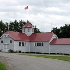
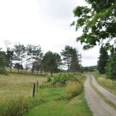
The site is best explored on foot, with ruins spread across the grounds and clearly marked paths for visitors to follow. The museum provides helpful context about the fortification before you walk through the outdoor areas.

Did you know?

The fortress was originally connected by a road network spanning several miles, linking multiple defensive structures across the peninsula. This expansive layout made it one of the most extensive fortified systems of its era.

Location
GPS coordinates
44.02917,-73.43111
Latest update
December 7, 2025 20:22

AroundUs brings together thousands of curated places, local tips, and hidden gems, enriched daily by 60,000 contributors worldwide. Discover all places nearby (Crown Point).

Around this place
Lake Champlain Bridge
United States of America

Lake Champlain Bridge

727 m
Lake Champlain Bridge
United States of America

Lake Champlain Bridge

727 m
Snake Mountain
United States of America

Snake Mountain

12.6 km
Fort Saint-Frédéric
United States of America

Fort Saint-Frédéric

0 m
Crown Point Light
United States of America

Crown Point Light

769 m
Ironville Historic District
United States of America

Ironville Historic District

14.6 km
Grand Isle State Park
United States of America

Grand Isle State Park

18.3 km
Barber's Point Light
United States of America

Barber's Point Light

14.1 km
Essex County Fairgrounds
United States of America

Essex County Fairgrounds

17.6 km
John Strong Mansion Museum
United States of America

John Strong Mansion Museum

3.2 km
Addison Baptist Church
United States of America

Addison Baptist Church

12.2 km
Shoreham Congregational Church
United States of America

Shoreham Congregational Church

18.3 km
Wesleyan Methodist Church
United States of America

Wesleyan Methodist Church

17.7 km
Sherman Free Library
United States of America

Sherman Free Library

3.1 km
Moriah Town Office Building
United States of America

Moriah Town Office Building

3.3 km
Witherbee Memorial Hall
United States of America

Witherbee Memorial Hall

10.2 km
Camp Dudley Road Historic District
United States of America

Camp Dudley Road Historic District

14 km
Lake View Grange No. 970
United States of America

Lake View Grange No. 970

17.4 km
Paris and Anna Fletcher House
United States of America

Paris and Anna Fletcher House

10.6 km
District Six Schoolhouse
United States of America

District Six Schoolhouse

15.3 km
Central Powerhouse
United States of America

Central Powerhouse

10.8 km
Cotton Free Library
United States of America

Cotton Free Library

17.7 km
House at 215 School Street
United States of America

House at 215 School Street

17.8 km
District School No. 1
United States of America

District School No. 1

12.1 km
Witherell Farm
United States of America

Witherell Farm

17.6 km
John Hamilton Farmstead
United States of America

John Hamilton Farmstead

13.2 km
Mount Moriah Presbyterian Church
United States of America

Mount Moriah Presbyterian Church

3.2 km
Port Henry Village Beach
United States of America

Port Henry Village Beach

3 km
Show the full map
« Fort Crown Point - Military fortress in Crown Point, United States » is provided by Around Us (aroundus.com). Images and texts are derived from Wikimedia project under a Creative Commons license. You are allowed to copy, distribute, and modify copies of this page, under the conditions set by the license, as long as this note is clearly visible.

Discover hidden gems everywhere you go!

From secret cafés to breathtaking viewpoints, skip the crowded tourist spots and find places that match your style. Our app makes it easy with voice search, smart filtering, route optimization, and insider tips from travelers worldwide. Download now for the complete mobile experience.

Around Us App Screenshot

A unique approach to discovering new places

Le Figaro

All the places worth exploring

France Info

A tailor-made excursion in just a few clicks

20 Minutes

Around Us
Travel Guide & Maps
Download

Send to your phone

QR Code
1

Open the camera app on your mobile.

2

Point at the QR code with your camera. A notification will appear.

3

Tap the notification to open the link.