Chest opened
+${chestReward.xp} XP
Explorer
NOUVEAU ×${chestReward.collectible.quantity}
tapez pour fermer
Chest locked

Open chests in the app

Around Us is built for your phone — chests unlock when you walk, explore and capture nearby places.

Enable Location

We need your location to show you interesting places around you

Discover nearby places

Find interesting locations and hidden gems around you

Precise directions

Get accurate directions and distances to places

Your location is never shared with other users. It's only used when you tap the location button.

New Utrecht

Log in to your account

Start exploring — it's free

Trusted by 72,886 travelers worldwide

Continue with Google
Continue with Apple
or

We will send you a code to connect

By continuing, you accept our Terms and Conditions and our Privacy Policy

Check your inbox

We've sent a pincode in your inbox. Please enter the code below.

New Utrecht
Discussion Reviews 1 Photos
14.2k Popularity

New Utrecht, Dutch colonial settlement in Brooklyn, United States.

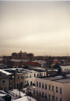
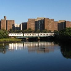
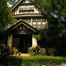
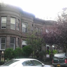
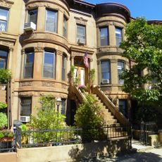
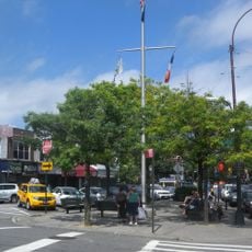
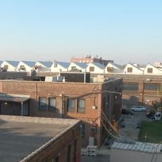
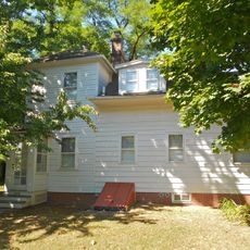
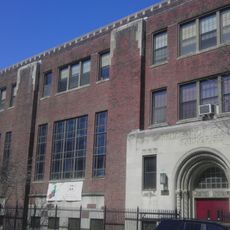
New Utrecht is a neighborhood in western Brooklyn with residential streets and commercial areas centered on New Utrecht Avenue and 86th Street. The area features a mix of housing styles from different periods, reflecting its gradual transformation from a rural settlement to a developed neighborhood.

The settlement was founded in 1652 when Cornelius Van Werckhoven purchased land from the Canarsie and Nyack peoples. Over time, it grew from an isolated farming community into a residential neighborhood tied to Brooklyn's urban expansion in the 1800s and 1900s.

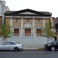
The neighborhood's street names and local institutions reflect its Dutch roots, shaping how residents connect to their community's heritage.

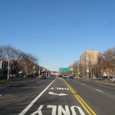
The neighborhood is accessible via the New Utrecht Avenue subway station, which connects to Manhattan and other Brooklyn areas. Streets are laid out in a regular grid pattern, making navigation straightforward for visitors on foot.

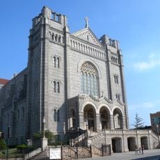
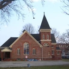
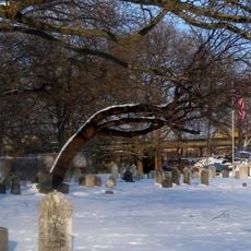
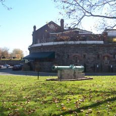
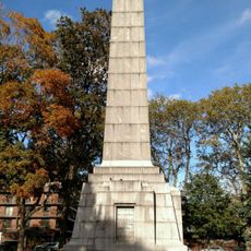
The Liberty Pole at the Reformed Church marks where residents replaced British flags with American flags during the Revolutionary War. This modest monument marks a moment when the neighborhood directly participated in the nation's independence struggle.

The community of curious travelers

AroundUs brings together thousands of curated places, local tips, and hidden gems, enriched daily by 60,000 contributors worldwide.

Start exploring
Location
Inception
1652
GPS coordinates
40.61000,-74.00333
Latest update
March 5, 2026 21:06
Around this place
Verrazzano-Narrows Bridge
United States of America

Verrazzano-Narrows Bridge

3.6 km
Ocean Parkway
United States of America

Ocean Parkway

3 km
Fort Lafayette
United States of America

Fort Lafayette

3 km
Coney Island Creek
United States of America

Coney Island Creek

3.6 km
Angel Guardian Home
United States of America

Angel Guardian Home

2 km
Bishop Kearney High School
United States of America

Bishop Kearney High School

2.2 km
Basilica of Our Lady of Perpetual Help
United States of America

Basilica of Our Lady of Perpetual Help

3.5 km
Saitta House
United States of America

Saitta House

1.4 km
Basilica of Regina Pacis
United States of America

Basilica of Regina Pacis

1.9 km
Temple Beth El of Borough Park
United States of America

Temple Beth El of Borough Park

2.9 km
New Utrecht Reformed Church
United States of America

New Utrecht Reformed Church

286 m
Harbor Defense Museum
United States of America

Harbor Defense Museum

2.4 km
Magen David Synagogue
United States of America

Magen David Synagogue

1.5 km
Living Torah Museum
United States of America

Living Torah Museum

3.4 km
Gravesend Cemetery
United States of America

Gravesend Cemetery

3 km
John J. Carty Park
United States of America

John J. Carty Park

2.3 km
Houses at 216–264 Ovington Ave.
United States of America

Houses at 216–264 Ovington Ave.

3.5 km
B'nai Yosef Synagogue
United States of America

B'nai Yosef Synagogue

3 km
Jewish Center of Kings Highway
United States of America

Jewish Center of Kings Highway

3.6 km
Senator Street Historic District
United States of America

Senator Street Historic District

3.5 km
United States of America

Kollel Gur Aryeh

3.5 km
Coney Island Fire Station Pumping Station
United States of America

Coney Island Fire Station Pumping Station

3.6 km
Casemate Fort, Whiting Quadrangle
United States of America

Casemate Fort, Whiting Quadrangle

2.5 km
Sgt. Joyce Kilmer Triangle
United States of America

Sgt. Joyce Kilmer Triangle

3.6 km
Coney Island Yard Electric Motor Repair Shop
United States of America

Coney Island Yard Electric Motor Repair Shop

3.3 km
Hubbard House
United States of America

Hubbard House

2.8 km
Holy Angels Catholic Academy
United States of America

Holy Angels Catholic Academy

3.1 km
Dover Patrol Monument
United States of America

Dover Patrol Monument

2.6 km
Show the full map
Reviews
Share your experience

No review yet

Discussions
Start a discussion...

No discussion yet

« New Utrecht - Dutch colonial settlement in Brooklyn, United States » is provided by Around Us (aroundus.com). Images and texts are derived from Wikimedia project under a Creative Commons license. You are allowed to copy, distribute, and modify copies of this page, under the conditions set by the license, as long as this note is clearly visible.

Discover hidden gems everywhere you go!

From secret cafés to breathtaking viewpoints, skip the crowded tourist spots and find places that match your style. Our app makes it easy with voice search, smart filtering, route optimization, and insider tips from travelers worldwide. Download now for the complete mobile experience.

Around Us App Screenshot

A unique approach to discovering new places

Le Figaro

All the places worth exploring

France Info

A tailor-made excursion in just a few clicks

20 Minutes

Around Us
Travel Guide & Maps
Download

Send to your phone

QR Code
1

Open the camera app on your mobile.

2

Point at the QR code with your camera. A notification will appear.

3

Tap the notification to open the link.