Chest opened
+${chestReward.xp} XP
Explorer
NOUVEAU ×${chestReward.collectible.quantity}
tapez pour fermer
Chest locked

Open chests in the app

Around Us is built for your phone — chests unlock when you walk, explore and capture nearby places.

Enable Location

We need your location to show you interesting places around you

Discover nearby places

Find interesting locations and hidden gems around you

Precise directions

Get accurate directions and distances to places

Your location is never shared with other users. It's only used when you tap the location button.

South Boston

Log in to your account

Start exploring — it's free

Trusted by 72,924 travelers worldwide

Continue with Google
Continue with Apple
or

We will send you a code to connect

By continuing, you accept our Terms and Conditions and our Privacy Policy

Check your inbox

We've sent a pincode in your inbox. Please enter the code below.

South Boston
Discussion Reviews 2 Photos
3k Popularity

South Boston, Residential neighborhood in Boston, US

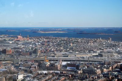
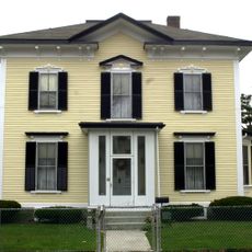
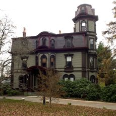
South Boston stretches along the waterfront with brownstone buildings, modern developments, and industrial spaces that blend into the Seaport District. The area shows how different architectural styles exist side by side, creating a neighborhood that combines older homes with newer commercial buildings.

The neighborhood played a key role during the American Revolution when rebel cannons positioned here forced British troops to evacuate Boston in 1776. This military action proved decisive in the city's fight for independence.

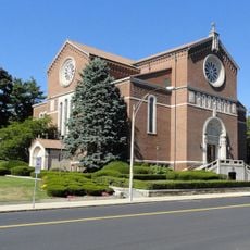
The annual Saint Patrick's Day parade draws thousands through the streets, reflecting the strong Irish-American heritage rooted in the community. This celebration shapes the neighborhood's identity and shows how much these traditions matter to people who live here.

The neighborhood connects to downtown Boston through multiple MBTA bus routes and Red Line subway stations at Broadway and Andrew. These transit options make it straightforward to travel between here and other parts of the city.

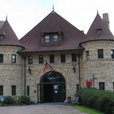
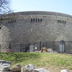
Castle Island features Fort Independence, a five-sided fortress that visitors can walk around while watching planes descend toward nearby Logan Airport. This mix of history and modern air traffic creates an unexpected experience that catches many people off guard.

The community of curious travelers

AroundUs brings together thousands of curated places, local tips, and hidden gems, enriched daily by 60,000 contributors worldwide.

Start exploring
Location
Inception
1776
Shares border with
Dorchester
GPS coordinates
42.28582,-71.12909
Latest update
December 12, 2025 12:03
Around this place
Arnold Arboretum
United States of America

Arnold Arboretum

1.4 km
Forest Hills Cemetery
United States of America

Forest Hills Cemetery

2.2 km
Franklin Park
United States of America

Franklin Park

3.3 km
Larz Anderson Park
United States of America

Larz Anderson Park

3 km
Larz Anderson Auto Museum
United States of America

Larz Anderson Auto Museum

2.8 km
Ellen Swallow Richards House
United States of America

Ellen Swallow Richards House

3 km
George Wright Golf Course
United States of America

George Wright Golf Course

2 km
Death and the Sculptor
United States of America

Death and the Sculptor

2.2 km
Adams-Nervine Asylum
United States of America

Adams-Nervine Asylum

2 km
Holy Name Church
United States of America

Holy Name Church

1.5 km
John Harris House and Farm
United States of America

John Harris House and Farm

2.2 km
Bellevue Standpipe
United States of America

Bellevue Standpipe

1.7 km
Mount Hope Cemetery
United States of America

Mount Hope Cemetery

2.2 km
Veterans of Foreign Wars Parkway
United States of America

Veterans of Foreign Wars Parkway

2.4 km
Firemen's Memorial
United States of America

Firemen's Memorial

1.8 km
Annunciation Melkite Catholic Cathedral
United States of America

Annunciation Melkite Catholic Cathedral

1.4 km
Walnut Hills Cemetery
United States of America

Walnut Hills Cemetery

2.4 km
West Roxbury Parkway
United States of America

West Roxbury Parkway

2.7 km
Loring-Greenough House
United States of America

Loring-Greenough House

2.9 km
Stony Brook Reservation Parkways
United States of America

Stony Brook Reservation Parkways

2.5 km
Westerly Burial Ground
United States of America

Westerly Burial Ground

2.5 km
Theodore Parker Unitarian Universalist Church
United States of America

Theodore Parker Unitarian Universalist Church

2.1 km
Putterham School
United States of America

Putterham School

3 km
Eliot Hall
United States of America

Eliot Hall

2.9 km
Roslindale Baptist Church
United States of America

Roslindale Baptist Church

104 m
Monument Square Historic District
United States of America

Monument Square Historic District

2.8 km
Isaac Child House
United States of America

Isaac Child House

3 km
Jamaica Plain Branch Library
United States of America

Jamaica Plain Branch Library

2.8 km
Show the full map
Reviews
Share your experience

No review yet

Discussions
Start a discussion...

No discussion yet

« South Boston - Residential neighborhood in Boston, US » is provided by Around Us (aroundus.com). Images and texts are derived from Wikimedia project under a Creative Commons license. You are allowed to copy, distribute, and modify copies of this page, under the conditions set by the license, as long as this note is clearly visible.

Discover hidden gems everywhere you go!

From secret cafés to breathtaking viewpoints, skip the crowded tourist spots and find places that match your style. Our app makes it easy with voice search, smart filtering, route optimization, and insider tips from travelers worldwide. Download now for the complete mobile experience.

Around Us App Screenshot

A unique approach to discovering new places

Le Figaro

All the places worth exploring

France Info

A tailor-made excursion in just a few clicks

20 Minutes

Around Us
Travel Guide & Maps
Download

Send to your phone

QR Code
1

Open the camera app on your mobile.

2

Point at the QR code with your camera. A notification will appear.

3

Tap the notification to open the link.