Enable Location

We need your location to show you interesting places around you

Discover nearby places

Find interesting locations and hidden gems around you

Precise directions

Get accurate directions and distances to places

Your location is never shared with other users. It's only used when you tap the location button.

Stony Brook Reservation Parkways

Log in to your account

Start exploring — it's free

Trusted by 61,848 travelers worldwide

Continue with Google
Continue with Apple
or

We will send you a code to connect

By continuing, you accept our Terms and Conditions and our Privacy Policy

Check your inbox

We've sent a pincode in your inbox. Please enter the code below.

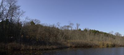
Stony Brook Reservation Parkways, Historic parkway system in Boston and Dedham, United States.

Description

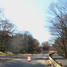
Stony Brook Reservation Parkways consist of four connected roads including Dedham Parkway and Enneking Parkway that link different sections of the green space. The system provides access to hiking paths, athletic fields, and recreational areas throughout the reservation.

History

Construction of these parkways began in 1894 and continued until 1956 as a major regional project of the Metropolitan District Commission for Greater Boston. The system earned recognition on the National Register of Historic Places in 2006 for its significance as an early planning effort.

Culture

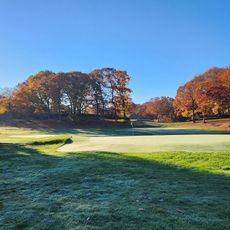
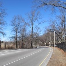
The parkways reflect early twentieth-century ideals about connecting open spaces with transportation, shaping how people moved and spent leisure time across the Boston area. Today, the curved paths and tree-lined corridors still influence how visitors experience the landscape.

Practical

The parkways are maintained for walkers and cyclists, with separate areas designated for different activities. Spring and fall offer the most comfortable conditions for exploring the full network of paths.

Did you know?

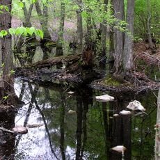
West Boundary Road was completed in 1928 but has partially transformed into a hiking trail due to housing developments along its original route. This change reveals how land use in the region shifted over the decades.

Location
Location
GPS coordinates
42.26625,-71.14389
Latest update
December 14, 2025 14:26

AroundUs brings together thousands of curated places, local tips, and hidden gems, enriched daily by 60,000 contributors worldwide. Discover all places nearby (Boston).

Around this place
Museum of Bad Art
United States of America

Museum of Bad Art

9.1 km
Fairbanks House
United States of America

Fairbanks House

3.2 km
West Roxbury
United States of America

West Roxbury

1.5 km
Endicott Estate
United States of America

Endicott Estate

3.2 km
George Wright Golf Course
United States of America

George Wright Golf Course

936 m
Stony Brook Reservation
United States of America

Stony Brook Reservation

1.5 km
United States of America

Millennium Park

3.6 km
Holy Name Church
United States of America

Holy Name Church

2.4 km
Upper Charles River Reservation
United States of America

Upper Charles River Reservation

2.6 km
Bellevue Standpipe
United States of America

Bellevue Standpipe

1 km
Veterans of Foreign Wars Parkway
United States of America

Veterans of Foreign Wars Parkway

2.5 km
Annunciation Melkite Catholic Cathedral
United States of America

Annunciation Melkite Catholic Cathedral

3.6 km
Norfolk County Courthouse
United States of America

Norfolk County Courthouse

3.3 km
Truman Parkway
United States of America

Truman Parkway

2.8 km
Westerly Burial Ground
United States of America

Westerly Burial Ground

2.1 km
United States of America

Dedham Public Library

3.4 km
Ames Schoolhouse
United States of America

Ames Schoolhouse

3.5 km
United States of America

Norfolk House

3.4 km
Dedham Village Historic District
United States of America

Dedham Village Historic District

3.6 km
Theodore Parker Unitarian Universalist Church
United States of America

Theodore Parker Unitarian Universalist Church

2.4 km
First Congregational Church of Hyde Park
United States of America

First Congregational Church of Hyde Park

2.2 km
First Church of Christ, Scientist
United States of America

First Church of Christ, Scientist

3.2 km
St. Mary's School and Asylum
United States of America

St. Mary's School and Asylum

3.4 km
City of Boston Archives
United States of America

City of Boston Archives

3.3 km
19 Court Street
United States of America

19 Court Street

3.4 km
Roslindale Baptist Church
United States of America

Roslindale Baptist Church

2.5 km
Dedham Public Library
United States of America

Dedham Public Library

3.3 km
West Roxbury Branch Library
United States of America

West Roxbury Branch Library

2.2 km
Show the full map
« Stony Brook Reservation Parkways - Historic parkway system in Boston and Dedham, United States » is provided by Around Us (aroundus.com). Images and texts are derived from Wikimedia project under a Creative Commons license. You are allowed to copy, distribute, and modify copies of this page, under the conditions set by the license, as long as this note is clearly visible.

Discover hidden gems everywhere you go!

From secret cafés to breathtaking viewpoints, skip the crowded tourist spots and find places that match your style. Our app makes it easy with voice search, smart filtering, route optimization, and insider tips from travelers worldwide. Download now for the complete mobile experience.

Around Us App Screenshot

A unique approach to discovering new places

Le Figaro

All the places worth exploring

France Info

A tailor-made excursion in just a few clicks

20 Minutes

Around Us
Travel Guide & Maps
Download

Send to your phone

QR Code
1

Open the camera app on your mobile.

2

Point at the QR code with your camera. A notification will appear.

3

Tap the notification to open the link.